

- Usage in publication:
-
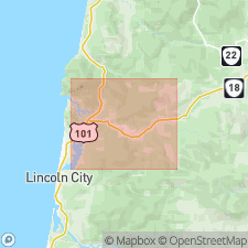
- Salmon River Formation*
- Modifications:
-
- Named
- Biostratigraphic dating
- Reference
- Dominant lithology:
-
- Sandstone
- Siltstone
- Basalt
- AAPG geologic province:
-
- Oregon-Washington Coast Ranges province
Summary:
Named for Salmon River. Type section designated as exposures in riverbed and banks of Salmon River extending upstream from a point 0.8 km southeast of Otis, (SE/4 SW/4 sec.29) to Rose Lodge (SW/4 SE/4 sec.26), T6S R10W Hebo quad, Lincoln Co, northwest OR. Rocks originally included in Siletz River Volcanics by Snavely and Baldwin (1948). Reference sections designated at outcrops in riverbed of Neskowin Creek (NE/4 NE/4 sec.24 T6S R10W) and along Little Nestucca River eastward from point (SW/4 SW/4 sec.24 T5S R10W), both in Hebo quad. Composed of basaltic sandstone and siltstone that contain minor interbeds of conglomerate and basalt flows, breccia, and tuff. Type section is 463 m thick; attains maximum of 600 m thickness. Interpreted to represent aprons of clastic debris eroded from and deposited adjacent to oceanic islands or seamounts formed by extrusion of Siletz River Volcanics. Unconformably overlies Siletz River Volcanics. Unconformably underlies, in most places, Yamhill Formation; however in westernmost exposures along Salmon River underlies informally designated basaltic siltstone and sandstone of Otis. Assigned early Eocene (DISCOASTER LODOENSIS Zone) age based on biostratigraphic dating of planktonic coccoliths (Bukry and Snavely, 1988)
Source: GNU records (USGS DDS-6; Menlo GNULEX).
For more information, please contact Nancy Stamm, Geologic Names Committee Secretary.
Asterisk (*) indicates published by U.S. Geological Survey authors.
"No current usage" (†) implies that a name has been abandoned or has fallen into disuse. Former usage and, if known, replacement name given in parentheses ( ).
Slash (/) indicates name conflicts with nomenclatural guidelines (CSN, 1933; ACSN, 1961, 1970; NACSN, 1983, 2005, 2021). May be explained within brackets ([ ]).