

- Usage in publication:
-
- Salitral shale tongue*
- Modifications:
-
- First used
- Dominant lithology:
-
- Shale
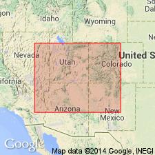
- AAPG geologic province:
-
- San Juan basin
Summary:
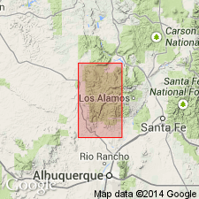
Intent to name, source of geographic name, type locality, not stated. First published use as a tongue of Chinle formation. Consists of variegated shale with limestone concretions. Overlies Agua Zarca sandstone member (new) of Chinle. Underlies Poleo sandstone lentil (new) of Chinle. Cannot be recognized south of latitude of Los Pinos Arroyo. About 100+ ft thick on cross sections. Geologic map covers parts of Sandoval and Rio Arriba Cos, NM, San Juan basin. Salitral Creek [source of name] occurs west of Coyote, Rio Arriba Co. Of Late Triassic age.
Source: GNU records (USGS DDS-6; Denver GNULEX).
- Usage in publication:
-
- Salitral Shale Tongue*
- Modifications:
-
- Overview
- Dominant lithology:
-
- Claystone
- Siltstone
- Sandstone
- AAPG geologic province:
-
- San Juan basin
Summary:
States that Salitral was named by Wood and Northrop (1946) for exposures 3 mi west of Coyote and 75 mi north of Albuquerque [on Salitral Creek], Rio Arriba Co, NM, San Juan basin [though Wood and Northrop did not say this]. Gives a more detailed lithologic description than was given in Wood and Northrop, so description included here. Tongue is composed predominantly of grayish-red, pale-reddish-brown, pale purple, and light-greenish-gray bentonitic structureless silty claystone and siltstone. Locally contains lenses of very fine to coarse grained sandstone. Is a slope former. Ranges from 0 to 100 ft thick. Lower contact placed at top of Agua Zarca Sandstone Member at a change from sandstone and conglomerate (below) to claystone and siltstone of the Salitral. Upper contact placed at change from fine textured Salitral to coarse textured Poleo Sandstone Lentil. Late Triassic age. Areal extent (map) limited to a small area west of Abiquiu west to Gallina and south to Senorito Canyon, Rio Arriba and Sandoval Cos, NM, San Juan basin. Nomenclature charts. Measured sections.
Source: GNU records (USGS DDS-6; Denver GNULEX).
For more information, please contact Nancy Stamm, Geologic Names Committee Secretary.
Asterisk (*) indicates published by U.S. Geological Survey authors.
"No current usage" (†) implies that a name has been abandoned or has fallen into disuse. Former usage and, if known, replacement name given in parentheses ( ).
Slash (/) indicates name conflicts with nomenclatural guidelines (CSN, 1933; ACSN, 1961, 1970; NACSN, 1983, 2005, 2021). May be explained within brackets ([ ]).