The National Geologic Map Database is migrating to a new infrastructure. We apologize for any service disruptions during this process.
|
|---|


- Usage in publication:
-
- Rubio Peak formation
- Modifications:
-
- First used
- Dominant lithology:
-
- Gravel
- Tuff
- Basalt
- AAPG geologic province:
-
- Basin-and-Range province
Summary:
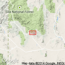
First use of name; shown on chart only. Intent to name not stated and no type locality designated. Area of report is the Santa Rita quadrangle, Grant Co, NM in Basin-and-Range province. Underlies Lucky Bill formation (first used) of Miocene? age; unconformably overlies the lower Tertiary Wimsattville formation (first used). Consists of gravels and pumiceous tuffs; well-sorted and stratified in places; is 0-600 ft thick. Is of Miocene? age.
Source: GNU records (USGS DDS-6; Denver GNULEX).
- Usage in publication:
-
- Rubio Peak formation
- Modifications:
-
- Overview
- AAPG geologic province:
-
- Basin-and-Range province
- Orogrande basin
Summary:
Author points out that Rubio Peak formation was originally named in an unpublished manuscript by W. E. Elston (1953) from a prominent butte at secs 9, 10, 15 and 16, T19S, R10W in Dwyer quadrangle, Grant Co, NM in Basin-and-Range province. In Lake Valley quadrangle (Grant, Luna, and Sierra Cos in Basin-and-Range province and Orogrande basin) rocks of Rubio Peak formation are the most voluminous volcanic rocks. They range in composition from fairly silicic amphibole latites to pyroxene andesites; their color ranges from pinkish gray through various shades of red, lavender, purple, brown, and black. Phenocrysts may be large or small, and the rocks may be glassy or almost entirely crystalline. Microscopically, however, rocks are much more uniform. No sections measured because not all flows are exposed, and they are numerous and of limited extent. Thickness in Lake Valley quadrangle estimated at about 2,500 ft. Top of formation marked by a prominent unconformity. Unconformably overlies Macho pyroxene andesites; unconformably underlies Sugarlump tuffs--may be in fault contact with Sugarlump. Is of late Tertiary age.
Source: GNU records (USGS DDS-6; Denver GNULEX).
- Usage in publication:
-
- Rubio Peak formation*
- Modifications:
-
- Areal extent
- AAPG geologic province:
-
- Pedregosa basin
- Basin-and-Range province
- Orogrande basin
Summary:
Rubio Peak Formation (as used by Hernon and others, 1953) and generally equivalent beds mapped in southwestern NM in the following localities:
1) Peloncillo Mountains (Hidalgo Co, in Pedregosa basin).
2) Northwest of Aden; south of Hatch; east side of Magdalena Peak; and Robledo Mountain (Dona Ana Co, in Orogrande basin).
3) Northeast part of Black Range; Lake Valley area; west of Monticello; and southern end of San Mateo Mountains (Sierra Co, in Orogrande basin).
4) The Dwyer area; and southwest of Gila (Grant Co, in Basin-and-Range province).
5) East of Horse Springs (Catron Co, in Basin-and-Range province).
Geologic map. Shown as of Tertiary age. As mapped includes some beds of Late Cretaceous age.
Source: GNU records (USGS DDS-6; Denver GNULEX).
- Usage in publication:
-
- Rubio Peak Formation*
- Modifications:
-
- Overview
- AAPG geologic province:
-
- Basin-and-Range province
Summary:
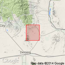
Consists of andesite and latite flows, conglomerate, welded ash flows, volcanic conglomerate, and tuffaceous sandstone. No section typical because of lenticularity of flows and other units. Deposited on an irregular surface so thickness varies. Estimated to be up to 5,000 ft thick in Dwyer quad, Grant and Sierra Cos, NM. Is younger than rhyodacite porphyry plug and dikes on Bull Hill. Disconformably overlain by Sugarlump Tuffs. Assigned a Miocene? age. A major disconformity separates Rubio Peak and unnamed intrusive rocks of early Tertiary age. Floral assemblages of late Miocene age or early Pliocene age collected from lake beds believed to be correlative with Rubio Peak. Mapped in the southern part of the quad, Grant Co, NM in the Basin-and-Range province where two map units distinguished--1) conglomerate and gravels, 2) rhyodacite-quartz latite flows.
Source: GNU records (USGS DDS-6; Denver GNULEX).
- Usage in publication:
-
- Rubio Peak Formation*
- Modifications:
-
- Age modified
- AAPG geologic province:
-
- Basin-and-Range province
Summary:
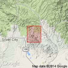
Age modified from Miocene? to Oligocene. Extrusive volcanic activity in the Mogollon-Datil volcanic province, of which the Rubio Peak Formation was a part, resumed in the Oligocene. A K-Ar age of 33.4 m.y. was obtained from the younger Kneeling Nun Tuff. Two units of Rubio Peak mapped--1) the poorly sorted conglomerate and gravel, and 2) the fine-grained porphyritic, dark latite and rhyodacite flow unit. Exposures mapped in southern part of quad (adjoins Santa Rita quad), Grant Co, NM in the Basin-and-Range province.
Source: GNU records (USGS DDS-6; Denver GNULEX).
- Usage in publication:
-
- Rubio Peak andesite, latite
- Modifications:
-
- Paleomagnetics
- AAPG geologic province:
-
- Basin-and-Range province
Summary:
In the Dwyer quad, southeast of Silver City, Grant Co, NM, Basin-and-Range province, underlying Kneeling Nun Tuff are the tuff beds of Sugarlump Formation, which interfinger with Rubio Peak andesite and latite [Rubio Peak Formation]. The upper part of the sequence is reversed and the lower part is normal. The same correlations can be made in the Lake Valley quad (Jicha, 1954) a few mi to the east. In the Bear and Magdalena Mountains, Socorro Co, NM, Orogrande basin, older andesites of the Spears Formation are found to be normally magnetized, and may correlate with lower part of Rubio Peak Formation of the southern Black Range and Dwyer quad. Magnetostratigraphic position of Rubio Peak, Kneeling Nun, Sugarlump, and Spears units within a preliminary model of the middle Tertiary paleomagnetic reversal pattern is depicted on fig. 4.
Source: GNU records (USGS DDS-6; Denver GNULEX).
- Usage in publication:
-
- Rubio Peak Formation
- Modifications:
-
- Revised
- Overview
- Age modified
- Geochronologic dating
- AAPG geologic province:
-
- Basin-and-Range province
Summary:
Rubio Peak Formation revised in report area, Massacre quadrangle, Luna Co, NM in Basin-and-Range province; includes informal Starvation Draw member (new) at base. Rubio Peak Formation in report area consists of (oldest to youngest): a) Starvation Draw member; b) tuff breccias and conglomerates, c) intrusives, d) flows, and e) undifferentiated flows and intrusives. The lithology of these rocks closely resembles the Rubio Peak mapped in Dwyer quadrangle (Elston, 1957) to northwest, Lake Valley quadrangle (Jicha, 1954) to north and northeast, Good Sight Mountains (Clemons, 1979) to east, and to some extent "the agglomerate" to south in northern Florida Mountains (Darton, 1916, 1917; Corbitt, 1971). Rubio Peak is younger than Colorado Formation (Upper Cretaceous), and older than Sugarlump Formation (Oligocene). The southern end of Cooke's Range is composed mostly of Rubio Peak Formation, forming a wide band covering about 1/4 of quadrangle. Darton (1916) mapped Starvation Draw as "Tertiary agglomerate and associated rocks". Starvation Draw is Eocene; this does not exclude possibility that some basal beds of member may be as old as Paleocene. Radiometric dates for Rubio Peak Formation indicate a middle Eocene to early Oligocene age. Geologic map.
Source: GNU records (USGS DDS-6; Denver GNULEX).
For more information, please contact Nancy Stamm, Geologic Names Committee Secretary.
Asterisk (*) indicates published by U.S. Geological Survey authors.
"No current usage" (†) implies that a name has been abandoned or has fallen into disuse. Former usage and, if known, replacement name given in parentheses ( ).
Slash (/) indicates name conflicts with nomenclatural guidelines (CSN, 1933; ACSN, 1961, 1970; NACSN, 1983, 2005, 2021). May be explained within brackets ([ ]).