

- Usage in publication:
-
- Roxana silt
- Modifications:
-
- Original reference
- Dominant lithology:
-
- Silt
- Sand
- AAPG geologic province:
-
- Illinois basin
Summary:
Pg. 2 (fig. 1), 5, 10, 12. Roxana silt. Succession of silts below Peoria loess and above a well-developed buried soil. Basal part locally contains gray noncalcareous colluvial silts with some sand and rare pebbles; gradationally above this colluvial zone (or in its absence, a basal unit) is gray noncalcareous massive silt, locally containing humus streaks in upper part. This gray silt unit is overlain by weakly calcareous pink to pinkish-tan massive silt containing sparse fauna of large snail shells. Pink silt unit grades upward into weakly calcareous massive gray silt, sparsely fossiliferous in lower part, which in turn is overlain by another pink massive silt, noncalcareous in upper part and commonly noncalcareous and nonfossiliferous throughout. Thickness at type section 47 feet. Age is Pleistocene (Wisconsinan; Altonian substage).
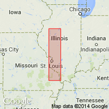
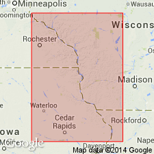
Type section [no longer exposed, ca. 1996 (see Hansel and Johnson, 1996)]: exposures at Pleasant Grove School, in center SE/4 sec. 20, T. 3 N., R. 8 W., southeast of Roxana, Madison Co., southwestern IL. Named from village of Roxana, Madison Co., southwestern IL.
Source: US geologic names lexicon (USGS Bull. 1200, p. 3351-3352).
- Usage in publication:
-
- Roxana silt
- Modifications:
-
- Not used
- AAPG geologic province:
-
- Illinois basin
Summary:
Pg. 535-536, 538, 546. Roxana silt of Frye and Willman is not single rock unit but a composite of Farmdale and Peorian. In type section of Roxana silt, Frye and Willman included in its basal part 4 feet of Farmdale loess and above it 43 feet of Peorian loess, lower part of which is undoubtably Iowan. They have 15 feet of Peorian loess at top to be designated as Peorian. Instead, this uppermost unit may possibly be correlative of Bignell loess of Doniphan County, Kansas.
Source: US geologic names lexicon (USGS Bull. 1200, p. 3351-3352).

- Usage in publication:
-
- Roxana loess
- Modifications:
-
- Areal extent
- Dominant lithology:
-
- Loam
- Loess
- AAPG geologic province:
-
- Illinois basin
Summary:
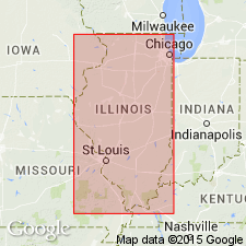
Roxana loess is not present in northeastern IL, but in western and southern IL immediately underlies the Peoria. Ranges from <15 in. to >150 in. As reported here, is a reddish brown to light brown silty loam. Older than 22,000 yr B.P., according to Willman and Frye (1970). In south-central and southern IL, where Roxana is less than 15 in. thick, a loamy zone occurs between the loess and the Sangamon soil. This mixed zone, which is neither till nor soil, is here named Casey Formation. Previously called sandy silt facies of Roxana (Johnson and others, 1972) or lower textural zone of Peoria (Olson and Ruhe, 1979). Roxana overlies Loveland loess in unglaciated areas of southern, western, and northwestern IL.
Source: GNU records (USGS DDS-6; Reston GNULEX).

- Usage in publication:
-
- Roxana Silt
- Modifications:
-
- Overview
- AAPG geologic province:
-
- Illinois basin
Summary:
In the study area, Roxana is generally a continuous unit that overlies the Oak formation (new, informal name) or the Glasford Formation in stable upland locations. Elsewhere overlies weathered bedrock or Loveland Silt. Underlies the Peoria Silt throughout the study area. Unit is 0.3 to 1.8 m thick, yellowish brown to dark yellowish brown and leached of carbonate minerals. Generally a silt loam. Contains more sand than the overlying Peoria Silt and sand content increases with depth.
Source: GNU records (USGS DDS-6; Reston GNULEX).
- Usage in publication:
-
- Roxana Silt
- Modifications:
-
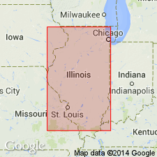
- Areal extent
- AAPG geologic province:
-
- Illinois basin
Summary:
The lower Markham Silt Member, upper Meadow Loess Member, and an informal sandy-silt facies are recognized in the Roxana Silt. The McDonough Loess Member and associated Pleasant Grove Soil are probably not valid units according to authors and are not recognized in this study. The Markham is composed of leached, pedogenically altered material. Contains a moderate amount of sand and traces of gravel. Contains more silt, vermiculite, and unweathered minerals than the underlying Glasford Formation. The Meadow Loess Member composes the uppermost 80 to 90 percent of the Roxana. It consists of calcareous and oxidized massive silt loam. The informal sandy-silt facies composes the entire Roxana in eastern IL. Though lithologically similar to the Markham, it is not temporally correlative.
Source: GNU records (USGS DDS-6; Reston GNULEX).
- Usage in publication:
-
- Roxana Silt
- Modifications:
-
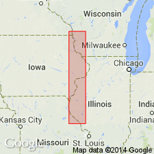
- Geochronologic dating
- AAPG geologic province:
-
- Illinois basin
- Wisconsin arch
- Iowa shelf
Summary:
In the Upper Mississippi Valley of WI and MN, loess sedimentation of the Roxana Silt occurred between about 55,000 and 27,000 yr B.P. according to radiocarbon dating. However, locally the basal age may range from 55,000 to 35,000 14-C yr B.P. Sedimentation rates in the Upper Mississippi Valley were only 4 to 8 cm/1000 yrs as compared to 40 to 70 cm/1000 yrs in the type area in IL. Thickness therefore is less than 2 m compared to 15 m in southern IL. Lithologically the Roxana of the Upper Mississippi Valley differs from the type area in that it is noncalcareous and weathered throughout. Overlies Rountree Formation or Loveland Silt; underlies Peoria Loess.
Source: GNU records (USGS DDS-6; Reston GNULEX).
- Usage in publication:
-
- Roxana Formation
- Modifications:
-
- Redescribed
- AAPG geologic province:
-
- Wisconsin arch
Summary:
Pleistocene Roxana Formation differs from the type area in west-central IL because it is much thinner (generally <1.5 m), finer textured, and noncalcareous. Lithic characteristics of the Roxana are very similar to those of middle Pleistocene Wyalusing Formation (new), differing mainly on basis of stratigraphic position. Consists of brown silt loam; upper part described as moderate medium platy parting to granular; a few specks of charcoal; diffuse boundary, while lower part has strong fine platy parting to granular; white silt caps on platy ped faces; clear boundary. Overlies Pleistocene Loveland (revised) and underlies Pleistocene Peoria Formation. Lithologic properties, stratigraphic position, and radiocarbon age of the Roxana indicate that it is the stratigraphic equivalent of Roxana Silt of Willman and Frye (1970) in IL. Report includes geochemical and mineralogic data.
Source: GNU records (USGS DDS-6; Reston GNULEX).
- Usage in publication:
-
- Roxana Silt*
- Modifications:
-
- Principal reference
- Revised
- AAPG geologic province:
-
- Illinois basin
Summary:
Pg. 4 (fig. 1), 6 (fig. 2), 14-15, 17 (fig. 9), 18, 27 (fig. 12), 30 (fig. 14), 51 (fig. 29), 52-53, 74, 81+, 92+, 102-103. Roxana Silt of Mason Group. Brownish red or gray silt with lesser amounts of sand and clay. Has massive appearance and carries abundant biospores and root traces. Commonly has the Farmdale Geosol developed in its upper part. Thickness 16 to 49 feet (5 to 15 m) along portions of the ancient Mississippi Valley. Divided into (descending) Robein Member (formerly Robein Silt), Meadow Member, McDonough Member, and Markham Member. Occurs above Sangamon Geosol and below Peoria Silt. Age is Pleistocene (Wisconsinan Age; Altonian Subage), based on radiocarbon dating.
Principal reference sections:
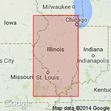
(1) Arenzville section, in borrow pit on east side of road, 5 mi (8 km) north and 2 mi (3.2 km) east of Arenzville, in NW/4 NW/4 SW/4 sec. 10, T. 17 N., R. 11 W., Arenzville East 7.5-min quadrangle, Cass Co., IL;
(2) Athens north quarry section, in north highwall of limestone quarry, 5 mi (8 km) northeast of Athens, in SW/4 SE/4 NE/4 sec. 18, T. 18 N., R. 5 W., Mason City SW 7.5-min quadrangle, Menard Co., IL;
(3) Bellefontaine quarry section, in southwest corner of large quarry, in sec. 9, T. 47 N., R. 7 E., Columbia Bottom, MO-IL 7.5-min quadrangle, St. Louis Co., MO;
(4) Cottonwood School section, roadcuts along center east line of sec. 11, T. 18 N., R. 11 W., Clear Lake 7.5-min quadrangle, Cass Co., IL;
(5) Farm Creek section, on south side of Farm Creek, in NE/4 SW/4 SE/4 sec. 30, T. 26 N., R. 3 W., Washington 7.5-min quadrangle, Tazewell Co., IL;
(6) Glendale School section, in north valley wall of a minor tributary of Farm Creek, in SE/4 SW/4 NE/4 sec. 3, T. 25 N., R. 4 W., Peoria East 7.5-min quadrangle, Tazewell Co., IL.
Source: Publication.
For more information, please contact Nancy Stamm, Geologic Names Committee Secretary.
Asterisk (*) indicates published by U.S. Geological Survey authors.
"No current usage" (†) implies that a name has been abandoned or has fallen into disuse. Former usage and, if known, replacement name given in parentheses ( ).
Slash (/) indicates name conflicts with nomenclatural guidelines (CSN, 1933; ACSN, 1961, 1970; NACSN, 1983, 2005, 2021). May be explained within brackets ([ ]).