- Usage in publication:
-
- Rountree Formation
- Modifications:
-
- Named
- Dominant lithology:
-
- Clay
- Silt
- Sand
- Gravel
- AAPG geologic province:
-
- Wisconsin arch
Summary:
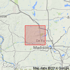
Rountree Formation is here named in Grant Co., southwestern WI. Description of the unit at its type section is given by J.C. Knox, D.S. Leigh, and T.A. Frolking. Upper part of unit (0.51 m) here consists mainly of reddish-brown clay with a strong, fine, angular blocky structure and some silt. Lower 1.55 m is dark brown to strong brown clay containing many metallic black manganese coatings on ped faces. Platey structure increases with depth. Underlies Peoria Formation and overlies Galena Formation. Elsewhere, where exposed in roadcuts and quarries commonly appears to be clay with pebbles, cobbles, and boulders. At the reference section (WGNHS Geologic Log SK-286-F), 8 km east of the village of Lime Ridge, described as predominantly clayey sand. All of the gravel and much of the sand consists of angular chert. Thickness and distribution of unit vary with type of underlying bedrock. To north, where unit found in karst depressions underlain by chert-rich Prairie du Chien Formation, thickness reaches 15 m. South of the Wisconsin River, thickness is generally 3 m or less. Age uncertain. Older than Peoria and Roxana Formations. May have been forming since the Cretaceous. The top and bottom of the Rountree probably accumulated during the last part of the Cenozoic, but the bulk of the unit most likely accumulated earlier.
Source: GNU records (USGS DDS-6; Reston GNULEX).
For more information, please contact Nancy Stamm, Geologic Names Committee Secretary.
Asterisk (*) indicates published by U.S. Geological Survey authors.
"No current usage" (†) implies that a name has been abandoned or has fallen into disuse. Former usage and, if known, replacement name given in parentheses ( ).
Slash (/) indicates name conflicts with nomenclatural guidelines (CSN, 1933; ACSN, 1961, 1970; NACSN, 1983, 2005, 2021). May be explained within brackets ([ ]).

