


- Usage in publication:
-
- Round Mountain silt
- Modifications:
-
- Named
- Dominant lithology:
-
- Siltstone
- AAPG geologic province:
-
- San Joaquin basin
Summary:
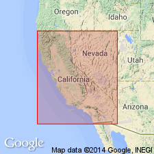
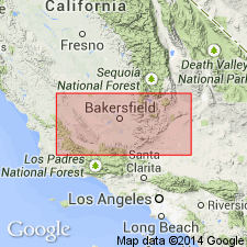
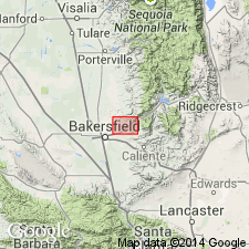
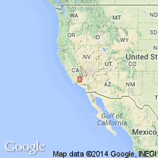
"Diepenbrock first used the name 'Upper Temblor (Round Mountain Silt)' as a paragraph heading" [Addicott, 1970]. Occurs in subsurface in Round Mountain and Mount Poso oil fields northeast of Bakersfield, Kern Co, CA. In Ohio Oil Glide No.1 well (sec.13 T27S R27E, Kern Co, CA), Mount Poso field, consists of 220 feet of gray and brown siltstone including 50-ft bed of diatomite 70 feet below top and 57 feet of gray silty sand 3 feet above base. Overlies "Middle Temblor (Olcese sand)". Is Miocene age.
Source: GNU records (USGS DDS-6; Menlo GNULEX).
- Usage in publication:
-
- Round Mountain silt member
- Modifications:
-
- Mapped
- AAPG geologic province:
-
- San Joaquin basin
Summary:
Mapped as Round Mountain silt [member] in Kern River area near Round Mountain. Considered member of Temblor [formation]. Thickness [of outcrop] is about 90 feet. Underlies "Santa Margarita" [formation]. Overlies Olcese sand member of Temblor.
[Type section]: Ohio Oil Glide No. 1 well, sec. 13, T. 27 S., R. 27 E., Kern Co., southern CA.
Source: Modified from GNU records (USGS DDS-6; Menlo GNULEX).
- Usage in publication:
-
- Round Mountain silt
- Modifications:
-
- Age modified
- AAPG geologic province:
-
- San Joaquin basin
Summary:
Is mainly brown, somewhat bedded organic siltstone. Diatomite member present about 100 ft below top in outcrop. Overlies Olcese sand; underlies Mon Bluff Formation (new). North of Poso Creek underlies Kern River formation. Is middle Miocene age.
Source: GNU records (USGS DDS-6; Menlo GNULEX).
- Usage in publication:
-
- Round Mountain Silt*
- Modifications:
-
- Adopted
- Biostratigraphic dating
- AAPG geologic province:
-
- San Joaquin basin
Summary:
Round Mountain Silt of Diepenbrock (1933) is adopted. Also referred to as Round Mountain Silt Member of Temblor Formation by Kleinpell (1938). North and west of Mount Poso field local sand beds in lowest part of Round Mountain Silt have been called McVan Sand (Beck, 1952; Sperber, 1952). Type section is cored 213-ft interval from 1229 to 1442 ft in Ohio Oil Glide No.1 well, Mount Poso oil field [sec.13 T27S R27E, Kern Co, CA]. May be divided into four lithologic units (ascending); 100 ft of light- to dark-gray clayey siltstone containing abundant fauna; 100 ft of tuffaceous diatomaceous siltstone and clay shale; 100 ft of light-gray to greenish black clayey siltstone and 20 ft of greenish-gray sandy siltstone with arenaceous foraminifers and fish remains. Sharktooth Hill area, 2 mi southwest of Round Mountain is designated as surface reference locality. Measured section included. Conformably overlies Olcese Sand. Unconformably underlies "Santa Margarita" Formation. Age is middle Miocene based on faunal assemblage of "Temblor Stage".
Source: GNU records (USGS DDS-6; Menlo GNULEX).
- Usage in publication:
-
- Round Mountain Silt*
- Modifications:
-
- Age modified
- Biostratigraphic dating
- AAPG geologic province:
-
- San Joaquin basin
Summary:
Age is early(?) and middle Miocene on basis of microfauna of "Luisian Stage", "although unsampled intervals may contain Relizian fauna."
Source: GNU records (USGS DDS-6; Menlo GNULEX).
- Usage in publication:
-
- Round Mountain Silt*
- Modifications:
-
- Age modified
- AAPG geologic province:
-
- San Joaquin basin
Summary:
Shown as middle Miocene age. [No new age information; early and middle Miocene boundary changed according to Berggren and others (1985). Relizian/Luisian microfossils now all fall within middle Miocene.]
Source: GNU records (USGS DDS-6; Menlo GNULEX).
For more information, please contact Nancy Stamm, Geologic Names Committee Secretary.
Asterisk (*) indicates published by U.S. Geological Survey authors.
"No current usage" (†) implies that a name has been abandoned or has fallen into disuse. Former usage and, if known, replacement name given in parentheses ( ).
Slash (/) indicates name conflicts with nomenclatural guidelines (CSN, 1933; ACSN, 1961, 1970; NACSN, 1983, 2005, 2021). May be explained within brackets ([ ]).