The National Geologic Map Database is migrating to a new infrastructure. We apologize for any service disruptions during this process.
|
|---|


- Usage in publication:
-
- Roughlock siltstone
- Modifications:
-
- Named
- Biostratigraphic dating
- AAPG geologic province:
-
- Williston basin
- Powder River basin
Summary:
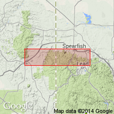
Named as formation for Roughlock Falls, along Little Spearfish Creek, sec 36, T5N, R1E, Lawrence Co, SD in Williston basin. Type locality in Spearfish Canyon, 2.4 mi above Maurice, several hundred yards up canyon wall. Measured section not given. Exposed in northern Black Hills, SD and WY, in Williston and Powder River basins. Formerly part of Whitewood formation as described by Furnish, Barragy, and Miller (1936). Consists of 25-30 ft of siltstone that gradationally overlies Icebox shale (new), and gradationally underlies Whitewood dolomite (as here redefined). Lower parts are moderately argillaceous quartzose siltstone, occasionally limonite-stained; upper portion varies from siltstone to fine-grained sandstone. The less argillaceous sections are usually porous, well sorted, crumbly, with creamy to yellow-brown coloration. Uppermost part is often slightly calcareous. Lower argillaceous beds are slightly to moderately porous, possess fair sorting, and are yellowish or pale green. Contains the thanatocoenose of sponges, annelid trails, bryozoans, conodonts, and crinoids. On basis of conodont fauna, seems to be roughly equivalent to Decorah shale of IA, which is early Trenton (Middle Ordovician) age. Disappears by non-deposition about 10 mi south of Deadwood, SD; east of Black Hills in subsurface is commonly shale with sand streaks; north of outcrop area loses its identity to Icebox shale and Whitewood dolomite.
Source: GNU records (USGS DDS-6; Denver GNULEX).
- Usage in publication:
-
- Roughlock siltstone
- Modifications:
-
- Overview
- Biostratigraphic dating
- AAPG geologic province:
-
- Williston basin
- Powder River basin
Summary:
In the Black Hills of SD and WY, siltstones, shales, and sandstones, which lie beneath the true dolomites of Whitewood as defined by Denton and Paige (1925), and above Deadwood formation, are in descending order: Roughlock siltstone, Icebox shale, and Aladdin sandstone, as proposed by McCoy (1952). Provisionally adopts this nomenclature for the Black Hills in the Williston and Powder River basins, stating that more work needs to be done before the nomenclature can be evaluated or consistently applied, even in the Black Hills. Tentatively considered Middle Ordovician; may eventually prove to be Late Ordovician in age.
Source: GNU records (USGS DDS-6; Denver GNULEX).
- Usage in publication:
-
- Roughlock siltstone
- Modifications:
-
- Overview
- Dominant lithology:
-
- Sandstone
- Siltstone
- AAPG geologic province:
-
- Williston basin
- Powder River basin
Summary:
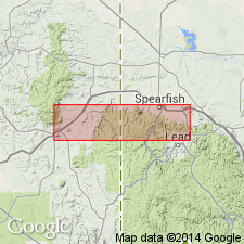
Gives detailed type section in Spearfish Canyon, 2.4 mi above Maurice, several hundred yards up canyon wall, on right side of highway (driving toward Spearfish), secs 18 and 19, T5N, R2E, Lawrence Co, SD in Williston basin. Consists of siltstone, quartzose; argillaceous in lower 19 ft, coarsening to siltstone and very fine grained, slightly calcareous sandstone in top 7 ft. Thickness 32 ft. Overlain by silty dolomite at base of overlying Whitewood dolomite. Gradational contacts with both overlying Whitewood dolomite and underlying Icebox shale. Repeats generalized description given earlier (McCoy, 1952) for nearby parts of northern Black Hills, SD and WY, in Williston and Powder River basins. Middle Ordovician (early Trenton) in age.
Source: GNU records (USGS DDS-6; Denver GNULEX).
- Usage in publication:
-
- Roughlock member
- Modifications:
-
- Revised
- AAPG geologic province:
-
- Williston basin
Summary:
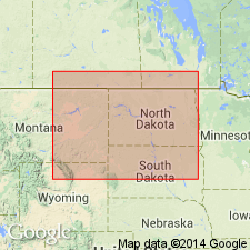
Pg. 9 (fig. 2), 10, 11, 15, 35-36 (figs. 9-10), 52 (fig. 11), 59-61; C.G. Carlson, 1958 (1959), Stratigraphy of Deadwood-Winnipeg interval in North Dakota and northwestern South Dakota, 2nd Intl. Williston Basin Symp., p. 20-26. Roughlock member of Winnipeg formation. McCoy's (1952) Roughlock formation (unit D of Whitewood formation of Butler and others, 1955) revised to member of Winnipeg formation. Consists of gray, calcareous siltstone, very fine-grained sandstone, and calcareous shale. Thickness up to 90 feet. In northwestern North Dakota, includes the "Winnipeg transition zone" interval of some petroleum geologists. Underlies Red River or Whitewood formation. Gradationally overlies Icebox member of Winnipeg (=Icebox formation of McCoy, 1952, unit C of Whitewood formation of Butler and others, 1955). Fossils (conodonts). Age is Middle Ordovician (Trentonian).
[Discussion is chiefly subsurface of North Dakota, northwestern South Dakota, and eastern Montana.]
Source: Publication.
- Usage in publication:
-
- Roughlock silt
- Modifications:
-
- Revised
- AAPG geologic province:
-
- Williston basin
- Powder River basin
Summary:
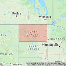
Made a formation in Winnipeg group in Williston and Powder River basins, including the outcrop area in the northern Black Hills. Overlain by Whitewood dolomite in outcrops in Black Hills, and by Red River formation in the subsurface in Williston and Powder River basins. Contact with Whitewood dolomite is placed at the top of a transitional sequence in Roughlock in Black Hills. Contact with Red River formation placed at base of a transitional sequence in Red River formation in the subsurface. Lower part grades basinward into the upper part of Winnipeg shale of basin terminology, above a readily identifiable, slightly denser, resistive horizon on electric logs identified as the Mid-Winnipeg marker (or A horizon). Middle Ordovician (Trenton) age based on correlation with upper part of Simpson shale and basal part of Viola formation in OK.
Source: GNU records (USGS DDS-6; Denver GNULEX).
- Usage in publication:
-
- Roughlock Formation
- Modifications:
-
- Overview
- AAPG geologic province:
-
- Williston basin
- Powder River basin
Summary:
Considered a member of Winnipeg Formation in the Black Hills of WY and SD, in Williston and Powder River basins, and a formation in the Winnipeg Group in the subsurface of Williston basin. Overlain by Red River Formation; underlain by Icebox Member of Winnipeg Formation in the Black Hills, and by Icebox Formation of Winnipeg Group in subsurface of the Williston and Powder River basins. Middle Ordovician (Trenton) in age.
Source: GNU records (USGS DDS-6; Denver GNULEX).
For more information, please contact Nancy Stamm, Geologic Names Committee Secretary.
Asterisk (*) indicates published by U.S. Geological Survey authors.
"No current usage" (†) implies that a name has been abandoned or has fallen into disuse. Former usage and, if known, replacement name given in parentheses ( ).
Slash (/) indicates name conflicts with nomenclatural guidelines (CSN, 1933; ACSN, 1961, 1970; NACSN, 1983, 2005, 2021). May be explained within brackets ([ ]).