

- Usage in publication:
-
- Roskruge Rhyolite*
- Modifications:
-
- Named
- Geochronologic dating
- Dominant lithology:
-
- Rhyolite
- AAPG geologic province:
-
- Basin-and-Range province
Summary:
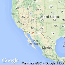
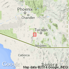
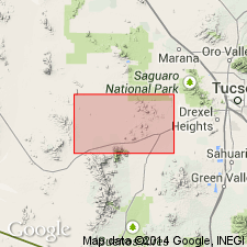
Named. Type locality is in Roskruge Mountains, Pima County, Arizona (Basin-and-Range province). Occurs in central part of Roskruge Mountains, Dobbs Buttes, and as patches in nearby hills and isolated hills. Locally divided into two newly named members, the Pescadero Member (composed mostly of flows), and Dobbs Buttes Member (composed predominantly of pyroclastic rocks). The two members intertongue and are lateral equivalents. May be as much as 4,000 feet thick. Is a variable sequence of pink to gray rhyolitic flows, tuffs, agglomerates, intercalated sedimentary lenses, dacitic or andesitic flows. Rests on tilted beds of newly named Roskruge Formation. Unconformably overlain by upper Tertiary volcanic rocks. Two samples of welded tuff in formation have been dated radiometrically as 74 and 71 Ma. Tentatively correlated with Cat Mountain Rhyolite of Brown (1939). Is Mesozoic; probably Late Cretaceous. Report includes geologic map.
Source: GNU records (USGS DDS-6; Denver GNULEX).
- Usage in publication:
-
- Roskruge volcanics
- Modifications:
-
- Redescribed
- Revised
- Geochronologic dating
- AAPG geologic province:
-
- Basin-and-Range province
Summary:
Redescribed from rhyolite to volcanics to reflect varied rock types. Primarily quartz latitic to rhyodacitic composition. Has two ash-flow sheets that are intercalated with air fall tuffs and breccias, and capped by volcanic flows and breccias. Is divided into basal Viopuli ignimbrite member and upper member (an ash-flow sheet). Biotite from Viopuli has K-Ar age of 74.1 +/-1.5 to 74.2 +/-1.5 Ma. Biotite from upper member has K-Ar age ranging from 68.7 +/-1.9 to 74.1 +/-1.5 Ma. Geologic map of the Roskruge volcanics in the Roskruge Mountains, Pima Co, AZ in the Basin-and-Range province. Overlies Cretaceous Roadside formation.
Source: GNU records (USGS DDS-6; Denver GNULEX).

- Usage in publication:
-
- Roskruge Rhyolite*
- Modifications:
-
- Overview
- Age modified
- AAPG geologic province:
-
- Basin-and-Range province
Summary:
Is youngest Cretaceous formation in Roskruge Mountains (Pima Co, AZ) in Basin-and-Range province. Overlies Roadside Formation (Campanian) conformably. Thickness as much as 4,000 ft. Roadside and Roskruge together are probably equivalent to Salero Formation in Santa Rita Mountains. Age is shown to be Campanian and Maestrichtian (Late Cretaceous) on correlation chart (fig. 5); refined from Mesozoic.
Source: GNU records (USGS DDS-6; Denver GNULEX).
- Usage in publication:
-
- Roskruge Volcanics*
- Modifications:
-
- Redescribed
- AAPG geologic province:
-
- Basin-and-Range province
Summary:
The redescription of Bikerman (1967) to Roskruge Volcanics is accepted. Formation is Upper Cretaceous. Considered correlative with Sil Nakya Formation.
Source: GNU records (USGS DDS-6; Denver GNULEX).
For more information, please contact Nancy Stamm, Geologic Names Committee Secretary.
Asterisk (*) indicates published by U.S. Geological Survey authors.
"No current usage" (†) implies that a name has been abandoned or has fallen into disuse. Former usage and, if known, replacement name given in parentheses ( ).
Slash (/) indicates name conflicts with nomenclatural guidelines (CSN, 1933; ACSN, 1961, 1970; NACSN, 1983, 2005, 2021). May be explained within brackets ([ ]).