

- Usage in publication:
-
- [Rome formation]
- Modifications:
-
- Areal extent
- AAPG geologic province:
-
- Appalachian basin
Summary:
Pg. 149. Described Weisner quartzite as "interpolated in Coosa and Montevallo shales, at no definite horizon but most commonly in their lower parts." (The Montevallo is now [ca. 1936] known to be same as Rome formation.)
Source: US geologic names lexicon (USGS Bull. 896, p. 1840).
- Usage in publication:
-
- Rome sandstone*
- Modifications:
-
- Principal reference
- Dominant lithology:
-
- Shale
- Sandstone
- AAPG geologic province:
-
- Appalachian basin
Summary:
Pg. 143-146; and 1892, Alabama Geol. Survey Bull., no. 4, p. 31, 33, 34-39. Rome sandstone and Weisner quartztie. Sandy shales, sandstones, and and quartzites, 2,000 to 3,500 feet thick, overlying Coosa [Connassauga] shales and underlying Connasauga shale. At base several hundred feet of highly indurated greenish sandy shale; succeeded upward by great thickness of purple or reddish-brown sandstones (generally thin-bedded and frequently passing into sandy shales), in which are intercalated beds of white sandstone or quartzite, from a few feet to many hundred feet thick, called Weisner quartzite. Upper part of formation consists of highly colored shales. Rome sandstone and Weisner quartzite are not regarded as distinct formations but as different lithologic types of same formation, due to local differences in condition of sedimentation. [Age is Early Cambrian.]
Source: US geologic names lexicon (USGS Bull. 896, p. 1840).
- Usage in publication:
-
- Rome formation*
- Modifications:
-
- Revised
- AAPG geologic province:
-
- Appalachian basin
Summary:
Pg. 1. Rome formation. Sandstones and shales, 3,000 to 4,000 feet thick, overlying Apison shale and underlying Connasauga shale. Basal 1,500 to 2,000 feet (consisting of alternating layers of purple, brown, and white sandstones interbedded with sandy shales) called Rome sandstone. Rest of formation consists chiefly of brown or dark olive-green shales with some thin siliceous layers. [This area adjoins, on north, Rome quadrangle, the type locality of this formation.] [Age is Early Cambrian.]
Source: US geologic names lexicon (USGS Bull. 896, p. 1840).
- Usage in publication:
-
- Rome formation
- Modifications:
-
- Revised
- AAPG geologic province:
-
- Appalachian basin
Summary:
Excluded Weisner quartzite from Montevallo shale (=Rome formation), and treated it as a distinct formation resting on crystalline rocks. [Age is Early Cambrian.]
Source: US geologic names lexicon (USGS Bull. 896, p. 1840).
- Usage in publication:
-
- Rome formation*
- Modifications:
-
- Revised
- AAPG geologic province:
-
- Appalachian basin
Summary:
Pg. 554-559. Treated Weisner quartzite as a distinct formation, in places separated from overlying Rome formation by a blue siliceous limestone, which he correlated (erroneously) with †Beaver limestone of Tennessee, and which is now known as Shady dolomite, 800 to 1,200 feet thick. (See L. LaForge, Georgia Geol. Survey Bull., no. 35, 1919, p. 43-45; also C. Butts, Alabama Geol. Survey Spec. Rpt., no. 14, 1926, p. 64.)
Source: US geologic names lexicon (USGS Bull. 896, p. 1840).
- Usage in publication:
-
- Rome formation
- Modifications:
-
- Principal reference
- AAPG geologic province:
-
- Appalachian basin
Summary:
Pg. 2. Rome formation. Brilliantly colored (various shades of red, purple, green, yellow, and white) thin-bedded fine-grained sandstones and sandy shales, 700 to 1,200 feet thick. Overlies Beaver [Shady] limestone (which rests on Weisner quartzite_, and underlies Conasauga formation. Basal part, thin-bedded red sandstones [the Rome sandstone lentil of many previous reports]; top characterized by rather heavy bed of white sandstone. Type locality is south of Rome, Georgia. [See also description of Conasauga shale in regard to drawing top boundary of Rome formation.]
Source: US geologic names lexicon (USGS Bull. 896, p. 1840).

- Usage in publication:
-
- Rome formation
- Modifications:
-
- Overview
- AAPG geologic province:
-
- Appalachian basin
Summary:
Pg. 65. The Rome formation (called "Montevallo or Choccolocco shales" by Alabama Geol. Survey) is a rather heterogeneous unit, composed of red shale, green shale, reddish or chocolate sandstone, light-gray, rusty-weathering calcareous sandstone, and local beds of fairly pure limestone and dolomite. The red shale and rusty-weathering calcareous sandstone are its most characteristic features. Thickness in Alabama 700 to possibly 4,000 feet. Underlies Conasauga formation and overlies Shady limestone.
Source: US geologic names lexicon (USGS Bull. 896, p. 1840).

- Usage in publication:
-
- Rome formation*
- Modifications:
-
- Overview
- AAPG geologic province:
-
- Appalachian basin
Summary:
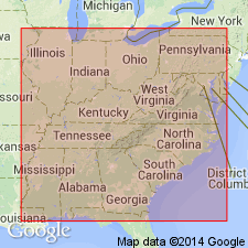
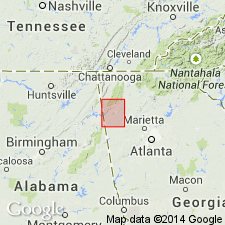
Rome formation. Recognized in northwestern Georgia, northern Alabama, western North Carolina, eastern Tennessee, and southwestern Virginia. Age is Early Cambrian.
Named from exposures south of Rome, northwestern GA.
Source: US geologic names lexicon (USGS Bull. 896, p. 1840).
- Usage in publication:
-
- Rome formation*
- Modifications:
-
- Revised
- AAPG geologic province:
-
- Appalachian basin
Summary:
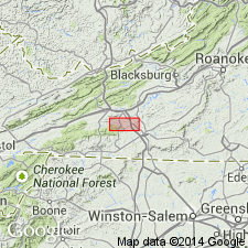
These workers take the Ivanhoe limestone member (Currier, 1935) of the Shady dolomite and include it as the lower part of the Rome formation. This well bedded, fine-grained limestone and dolomite with thin reddish sandy and argillaceous partings resembles the Rome more so than the underlying, massive Shady. The Ivanhoe limestone member is restricted to southwestern VA.
Source: GNU records (USGS DDS-6; Reston GNULEX).
- Usage in publication:
-
- Rome formation*
- Modifications:
-
- Revised
- AAPG geologic province:
-
- Appalachian basin
Summary:
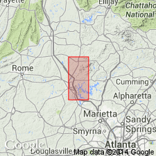
Lowered basal contact of Rome with Shady dolomite to include uppermost dolomite of Shady that lies above interbedded hematite and dolomite. In the Cartersville district, GA, the Rome overlies Shady, or where Shady is absent, the Weisner formation. In extreme western part of district, formation consists largely of crystalline dolomite and limestone whose maximum thickness is about 1800 ft. In southeastern part, consists largely of metashale whose thickness is at least 2000 ft. Carbonate rocks and metashale intergrade. Underlies Conasauga formation. Age of Rome listed as Early Cambrian.
Source: GNU records (USGS DDS-6; Reston GNULEX).
- Usage in publication:
-
- Rome formation
- Modifications:
-
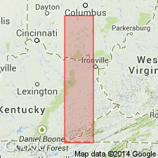
- Areal extent
- AAPG geologic province:
-
- Appalachian basin
Summary:
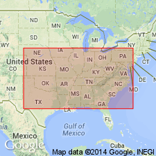
Geographically extended to subsurface of OH. Overlies Shady dolomite; underlies Conasauga Shale. Thickness of 188 ft in Fayette Co. Cross-section (fig. 1) shows transgression of Rome westward with formation as Lower and Middle Cambrian in TN and Upper Cambrian in OH.
Source: GNU records (USGS DDS-6; Reston GNULEX).
- Usage in publication:
-
- Rome Formation*
- Modifications:
-
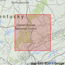
- Areal extent
- AAPG geologic province:
-
- Appalachian basin
Summary:
Geographically extended to subsurface of KY. In subsurface, Rome is mainly a glauconitic micaceous sandstone with small amounts of siltstone, shale, and limestone. The basal dolomite is recognized in several wells. Rome probably ranges in age from Early Cambrian in eastern TN to Middle Cambrian in central KY. Thickness in KY approximately 640 to 1150 feet. Underlies Pumpkin Valley Shale of Conasauga Group in eastern part and Conasauga Shale in central KY.
Source: GNU records (USGS DDS-6; Reston GNULEX).
- Usage in publication:
-
- Rome Formation*
- Modifications:
-
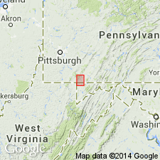
- Areal extent
- AAPG geologic province:
-
- Appalachian basin
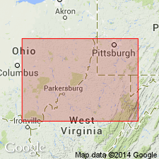
Summary:
Geographically extended to subsurface of WV. Several wells show Rome exists in the subsurface. Faulting occurs within the formation.
Source: GNU records (USGS DDS-6; Reston GNULEX).
- Usage in publication:
-
- Rome Formation*
- Modifications:
-
- Revised
- AAPG geologic province:
-
- Appalachian basin
Summary:
Reassigned the Ivanhoe Member of southwestern VA (restricted) from the Rome Formation to the Shady Dolomite as referenced to Pfeil and Read (1976: GSA Abst w/ Prog. v. 8, p 244).
Source: GNU records (USGS DDS-6; Reston GNULEX).
- Usage in publication:
-
- Rome Formation
- Modifications:
-
- Areal extent
- AAPG geologic province:
-
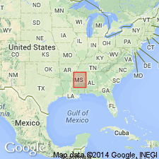
- Warrior basin
Summary:
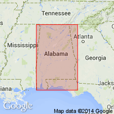
Geographically extended the Rome Formation into the subsurface of the Warrior basin in MS. Consists of dark gray to light brown and green shale and siltstone, and grayish tan, finely crystalline limestone and dolostone. Thickness is 0 to 708 ft. Overlies the Shady Dolostone and underlies the Conasauga Limestone. The Rome is of Early Cambrian age.
Source: GNU records (USGS DDS-6; Reston GNULEX).
- Usage in publication:
-
- Rome Formation*
- Modifications:
-
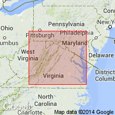
- Revised
- Age modified
- AAPG geologic province:
-
- Appalachian basin
Summary:
In cross section E-E', in the subsurface from eastern OH to western VA near Harrisburg and North Mountain, Rome Formation is used for sandstone, shale, and limestone units. Includes informal lower Rome limestone of Sutton (1981), and Rutledge Limestone and Pumpkin Valley Shale of Donaldson and others (1988). Is equivalent to approximately the lower half of Rome Formation (Limestone) of Thomas (1960), McGuire and Howell (1963), and Sutton (1981) in eastern KY. Between the central West Virginia arch to Allegheny structural front, Rome is restricted to sandstone and shale sequence; dolomite is assigned to Elbrook Dolomite. In Rome trough, Rome Formation is divided into upper unnamed limestone member and lower unnamed sandstone and shale member. In Ohio-West Virginia hinge zone, Rome climbs up section; unnamed limestone member intertongues with sandstone part of Rome. Sandstone beds become Mount Simon Sandstone in Waverly arch area of OH. Age ranges from late Early(?) to Middle Cambrian near Allegheny front, to Middle Cambrian in Rome trough, to latest Middle or earliest Late Cambrian at western margin of Ohio-West Virginia hinge zone.
Source: GNU records (USGS DDS-6; Reston GNULEX).
For more information, please contact Nancy Stamm, Geologic Names Committee Secretary.
Asterisk (*) indicates published by U.S. Geological Survey authors.
"No current usage" (†) implies that a name has been abandoned or has fallen into disuse. Former usage and, if known, replacement name given in parentheses ( ).
Slash (/) indicates name conflicts with nomenclatural guidelines (CSN, 1933; ACSN, 1961, 1970; NACSN, 1983, 2005, 2021). May be explained within brackets ([ ]).