- Usage in publication:
-
- Rockwood formation
- Modifications:
-
- Original reference
- AAPG geologic province:
-
- Appalachian basin
Summary:
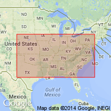
Pg. 143. Rockwood formation, 1,000 to 1,500 feet thick, is of Silurian age and = Clinton or Dyestone of Smith and Safford. Underlies Devonian Chattanooga black shale and overlies Chickamauga limestone and Rockmart slate in northwestern Georgia.
Source: US geologic names lexicon (USGS Bull. 896, p. 1834-1835).
- Usage in publication:
-
- Rockwood formation*
- Modifications:
-
- Principal reference
- Dominant lithology:
-
- Shale
- Limestone
- AAPG geologic province:
-
- Appalachian basin
Summary:
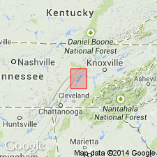
Pg. 2. Rockwood formation. Highest Silurian division in this region. Varies widely in character and thickness within limits of quadrangle. Forms narrow strip about head of Sequatchie Valley, where it is 165 feet thick and composed of calcareous shales interbedded with blue limestone. Along foot of Cumberland escarpment is about 600 feet thick and consists of calcareous and sandy shales. Still farther east, in ridge which extends from Iron Divide to Ten Mile Stand, is 850 to 1,000 feet thick, a considerable part of which is coarse sandstone interbedded with sandy shales. Toward top are sandy shales and a few calcareous beds, with which is associated iron ore that gives the formation great economic importance. Takes its name from Rockwood, [Roane County, Kingston quadrangle], eastern Tennessee, where the rocks are intermediate in character between western and eastern phases, and where the ore is extensively mined. Underlies Chattanooga black shale. To west overlies Chickamauga limestone; to east overlies Athens shale. Is = Dyestone group and White Oak Mountain sandstone of Safford.
Source: US geologic names lexicon (USGS Bull. 896, p. 1834-1835).

- Usage in publication:
-
- Rockwood formation*
- Modifications:
-
- Overview
- AAPG geologic province:
-
- Appalachian basin
Summary:
Rockwood formation. Includes rocks of Clinton and Medina ages [Silurian], according to studies of E.O. Ulrich and C. Butts. As mapped in some early reports it also included, in some areas, rocks of Richmond age and also possibly rocks of Lockport age.
Named from Rockwood, Roane Co., eastern TN, where, according to E.O. Ulrich, the rocks are all of Medina age.
Source: US geologic names lexicon (USGS Bull. 896, p. 1834-1835).
- Usage in publication:
-
- Rockwood formation*
- Modifications:
-
- Age modified
- AAPG geologic province:
-
- Appalachian basin
Summary:
At Rockwood, TN, if the Sequatchie formation is removed, Rockwood formation is entirely Silurian, but in other areas middle Silurian and perhaps even higher rocks are present. Clinch sandstone and Rockwood formation are mainly contemporaneous phases of lower and middle Silurian and, in areas intermediate between the two type localities, grade into each other, though in any one section Clinch lies chiefly below. Rockwood underlies Hancock limestone; overlies Sequatchie formation.
Source: GNU records (USGS DDS-6; Reston GNULEX).
- Usage in publication:
-
- Rockwood Formation*
- Modifications:
-
- Areal extent
- AAPG geologic province:
-
- Appalachian basin
Summary:
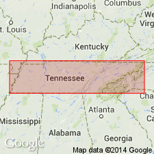
Silurian Rockwood Formation mapped in eastern TN. Consists of brown to maroon shale, thin gray siltstone and sandstone, and thin lenticular layers of oolitic and fossiliferous red hematite. Thickness is 350 to 550 ft. Also mapped undivided with underlying Clinch Sandstone.
Source: GNU records (USGS DDS-6; Reston GNULEX).
- Usage in publication:
-
- Rockwood Formation*
- Modifications:
-
- Revised
- AAPG geologic province:
-
- Appalachian basin
Summary:
Skillern Chert Member named in lower part of Rockwood Formation. Named for exposures along Skillern Creek, Bledsoe Co., south-central Tennessee. Consists of chert and sandy limestone interbedded in beds as much as 0.5 ft thick. Limestone is gray green to gray brown, chert is gray to black; bedding is uneven and contains some chert occurring as irregularly shaped nodules. Also contains gray-brown, fine-grained, calcareous sandstone at base in several massive beds. Thickness is 44 ft at type section. Age is Early Silurian. Report includes cross sections, columnar sections, and measured sections.
Source: GNU records (USGS DDS-6; Reston GNULEX).
- Usage in publication:
-
- Rockwood Formation
- Modifications:
-
- Areal extent
- AAPG geologic province:
-
- Appalachian basin
Summary:
Rockwood Formation is as much as 780 ft thick in Roane Co., eastern TN. Upper 160 ft is composed predominantly of medium-gray, yellowish-brown, reddish-brown and grayish-red, argillaceous, ferruginous shale with numerous 1- to 2-in. layers of yellow-brown to gray siltstone and thin layers of reddish-brown to red, oolitic bedded hematite with submetallic luster where fresh. Hematite layers are generally less than 2 ft thick, mostly in zone 100 to 150 ft below top of formation. Middle unit, approximately 220 ft thick, is composed predominantly of light brownish-red, light-gray, light-green, and reddish-brown, very fine to fine-grained, thin- to medium-bedded, calcareous sandstone, interbedded with very sandy siltstone and limestone. Interval may be equivalent to the Clinch Sandstone to the north and east. Lower 400 ft of the formation is composed of yellowish-gray to medium-gray with scattered reddish-brown specks, fine-grained to cryptocrystalline, silty limestone, interbedded with medium dark-gray siltstone. Overlies Upper Ordovician Sequatchie Formation and unconformably underlies Upper Devonian and Lower Mississippian Chattanooga Shale. Age is Early and Middle Silurian.
Source: GNU records (USGS DDS-6; Reston GNULEX).
For more information, please contact Nancy Stamm, Geologic Names Committee Secretary.
Asterisk (*) indicates published by U.S. Geological Survey authors.
"No current usage" (†) implies that a name has been abandoned or has fallen into disuse. Former usage and, if known, replacement name given in parentheses ( ).
Slash (/) indicates name conflicts with nomenclatural guidelines (CSN, 1933; ACSN, 1961, 1970; NACSN, 1983, 2005, 2021). May be explained within brackets ([ ]).

