The National Geologic Map Database is migrating to a new infrastructure. We apologize for any service disruptions during this process.
|
|---|


- Usage in publication:
-
- Rockhouse shale*
- Modifications:
-
- Named
- Dominant lithology:
-
- Shale
- Limestone
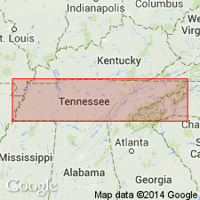
- AAPG geologic province:
-
- Cincinnati arch
Summary:
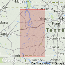
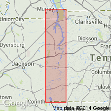
Rockhouse shale, introduced in this report, is a bluish-green or greenish-gray calcareous glade-forming shale interbedded with occasional thin bands of light-gray crystalline limestone. Fauna is very early Devonian--near Silurian-Devonian boundary. Treated as basal formation of Helderbergian or Linden group. Occurs in southern part of Hardin Co. Unconformably underlies Ross limestone (basal member of Olive Hill formation) and disconformably overlies Decatur limestone. Maximum thickness 26 ft at Rockhouse, a hunter's clubhouse on Horse Creek, 5 mi northwest of Lowryville, for which it is named.
Source: GNU records (USGS DDS-6; Reston GNULEX).
- Usage in publication:
-
- /Rockhouse shale member
- /Rockhouse limestone member
- Modifications:
-
- Revised
- AAPG geologic province:
-
- Cincinnati arch
Summary:
Pg. 280 (fig. 83), 283-287, 292. [/]Rockhouse shale member and [/]Rockhouse limestone member comprise the basal unit of newly defined [/]Ross formation through its known outcrop belt and unconformably overlie Decatur limestone. Shale member is restricted to south-central Hardin County where its average thickness is about 25 feet. Conformably underlies [/]Ross limestone member. [Rockhouse] limestone member is widely distributed in northern Hardin and Wayne Counties where its average thickness is about 12 feet; conformably underlies Birdsong shale member; includes basal 8 to 10 feet of Birdsong shale as described by Dunbar, 1919 (Tennessee Div. Geol. Bull., no. 21). Cooper and others (1942) place Rockhouse shale in Silurian. If Rockhouse shale is Silurian, then entire Ross formation including Ross limestone member and Birdsong shale member are likewise Silurian because they bear a close relationship to the Rockhouse shale member and Rockhouse limestone member.
[Name Ross preempted by Ross Limestone of Foerste (1903), which = Ross limestone member of author. The application of an identical geographic name to a stratigraphic unit and its parts (Ross limestone member of Ross formation) conflicts with nomenclature guidelines (CSN, 1933; ACSN, 1961, 1970; NACSN, 1983, 2005, 2021). Precise duplication of geographic names of sedimentary units shall not be allowed, except as a most urgent necessity because of scarcity of available names or other conditions, and then only if geographic and stratigraphic separation is such as to preclude any possible chance of confusion (CSN, 1933).]
Source: Modified from GNU records (USGS DDS-6; Reston GNULEX).
- Usage in publication:
-
- Rockhouse Shale Member
- Rockhouse Limestone Member
- Modifications:
-
- Overview
- AAPG geologic province:
-
- Cincinnati arch
Summary:
Rockhouse Shale and Limestone Members of Ross Formation are lateral equivalents. Rockhouse Shale Member occurs to the south and underlies Ross Limestone Member of Ross Formation. It interfingers with Rockhouse Limestone Member to the north. Rockhouse Limestone Member gradationally underlies Birdsong Shale Member. Thickness averages 3 to 4 m. Age of the Limestone Member is Early Devonian, while the Shale Member is Late Silurian and Early Devonian.
Source: GNU records (USGS DDS-6; Reston GNULEX).
- Usage in publication:
-
- Rockhouse Formation
- "Rockhouse" Limestone
- Modifications:
-
- Revised
- AAPG geologic province:
-
- Cincinnati arch
Summary:
As used in this report, the Rockhouse Formation is the same as Wilson's (1949) Rockhouse shale member of his Ross formation and Dunbar's (1919) Rockhouse shale. Formation is the preferred term as there is no true shale in the unit. It consistently overlies the Decatur Limestone and underlies the Ross Limestone. On the other hand, the same term should not be used for the limestone unit and therefore "Rockhouse" is placed in quotation marks. Authors state it is not within the scope of this paper to propose a new name for this unit. This is the same unit referred to as Rockhouse limestone member of Ross formation by Wilson (1949). Field investigations and analysis of ostracode fauna indicate that the Birdsong Formation, the Rockhouse Formation, the "Rockhouse" Limestone, and the Ross Limestone represent facies of a single depositional episode.
Source: GNU records (USGS DDS-6; Reston GNULEX).
- Usage in publication:
-
- Rockhouse Limestone Member*
- Modifications:
-
- Biostratigraphic dating
- AAPG geologic province:
-
- Cincinnati arch
Summary:
The conodont ICRIODUS WOSCHMIDTI? occurs in three samples (507.5 to 518.8 ft) from uppermost Decatur and overlying Rockhouse Limestone Member of Ross Formation in the du Pont Geohydrological Survey well near Waverly, Humphreys Co., central TN. I. WOSCHMIDTI is an auxiliary guide to base of Devonian. Authors believe, but cannot prove, that the specimens in the well are I. WOSCHMIDTI because collections made by Harris from upper part of Decatur near Parson's quarry, Decatur Co., TN, about 35 mi south-southwest of du Pont well produced abundant I. WOSCHMIDTI 5 ft below top of Decatur.
Source: GNU records (USGS DDS-6; Reston GNULEX).
For more information, please contact Nancy Stamm, Geologic Names Committee Secretary.
Asterisk (*) indicates published by U.S. Geological Survey authors.
"No current usage" (†) implies that a name has been abandoned or has fallen into disuse. Former usage and, if known, replacement name given in parentheses ( ).
Slash (/) indicates name conflicts with nomenclatural guidelines (CSN, 1933; ACSN, 1961, 1970; NACSN, 1983, 2005, 2021). May be explained within brackets ([ ]).