- Usage in publication:
-
- Rochester shales
- Modifications:
-
- First used
- Dominant lithology:
-
- Shale
- AAPG geologic province:
-
- Appalachian basin
Summary:
Used Rochester shales for lists of fossils for that unit.
Source: GNU records (USGS DDS-6; Reston GNULEX).
- Usage in publication:
-
- Rochester shale
- Modifications:
-
- Named
- Dominant lithology:
-
- Shale
- AAPG geologic province:
-
- Appalachian basin
Summary:
Named Rochester shale for exposures at Rochester, NY. Unit is the calcareous shales underlying the Lockport limestone and overlying green shales and iron ore of the Clinton formation as used until redefined by E.O. Ulrich in 1911 (GSA Bull., v. 22, p 392).
Source: GNU records (USGS DDS-6; Reston GNULEX).
- Usage in publication:
-
- Rochester Shale
- Modifications:
-
- Revised
- Dominant lithology:
-
- Limestone
- AAPG geologic province:
-
- Appalachian basin
Summary:
The Glenmark Member of the Rochester Shale is here named in Wayne and Cayuga Cos., NY. It is a distinctive, ledge-forming unit in the middle part of the Rochester and consists of dark bluish-gray, argillaceous limestone with thin shaly partings. The base of the Member contains coarsely crystalline limestone with hematite stringers. The lower contact with the calcareous lower part of the Rochester is gradational; the upper contact with the upper Rochester is abrupt and sharp. Thickness is 9 m (30 ft) at type locality. Age is Silurian (Wenlockian).
Source: GNU records (USGS DDS-6; Reston GNULEX).
- Usage in publication:
-
- Rochester Shale
- Modifications:
-
- Revised
- AAPG geologic province:
-
- Appalachian basin
Summary:
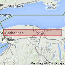
An argillaceous, resistant limestone bed herein referred to as the Glenmark Bed overlies the Rochester Shale in the Sodus area of western NY. The Glenmark occurs at the base of the DeCew Formation according to the figure, and not within the Rochester as originally defined. The Rochester is divided in this report into several distinct brachiopod and trilobite biofacies that are controlled both by depth and lithofacies. Unit comprises three members in the study area: The Lewiston and Burleigh Hill Members to the west and the Gates Member to the east.
Source: GNU records (USGS DDS-6; Reston GNULEX).
- Usage in publication:
-
- Rochester Shale*
- Modifications:
-
- Overview
- AAPG geologic province:
-
- Appalachian basin
Summary:
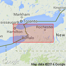
The Rochester Shale of the Clinton Group in western NY consists of medium-dark gray to black calcareous mudstone with thin interbeds of calcareous to dolomitic calcisiltite (pelletal grainstone) and calcarenite (fossil packstone and grainstone). Unit has been divided into (ascending) the Lewiston and Burleigh Hill Members with the division occurring at the top of a series of skeletal packstones to grainstones that are typically rich in bryozoans and brachiopod shell fragments. Thickness in western NY is 58 to 65 feet. Well exposed in cliffs of Niagara River Gorge near Lewiston, NY. Conformably overlies the Irondequoit Limestone and underlies the DeCew Dolomite. The Rochester is of Early Silurian (early and middle Wenlockian) age. [Report follows Early and Late Silurian time scale of Harland and others (1982). Division between Early and Late falls at the Wenlockian-Ludlovian boundary.]
Source: GNU records (USGS DDS-6; Reston GNULEX).
For more information, please contact Nancy Stamm, Geologic Names Committee Secretary.
Asterisk (*) indicates published by U.S. Geological Survey authors.
"No current usage" (†) implies that a name has been abandoned or has fallen into disuse. Former usage and, if known, replacement name given in parentheses ( ).
Slash (/) indicates name conflicts with nomenclatural guidelines (CSN, 1933; ACSN, 1961, 1970; NACSN, 1983, 2005, 2021). May be explained within brackets ([ ]).

