- Usage in publication:
-
- Rochelle conglomerate bed
- Modifications:
-
- Named
- Dominant lithology:
-
- Conglomerate
- Sandstone
- AAPG geologic province:
-
- Llano uplift
Summary:
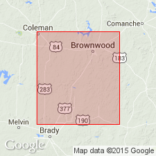
Named for its development near Rochelle, McCulloch Co, TX on Llano uplift; is a conglomerate band of variable thickness in upper portion of newly named Richland Sandstone [or division]. No type locality designated. Extends from Rochelle northeastward to the Colorado River, along Deep Creek, and just east of Milburn. At its southwestern end, it is coarsely conglomeratic, and contains pebbles often weighing a pound or two; the pebbles are almost entirely well-rounded flint of various colors, derived from the Silurian, and cemented in some places by iron and in others by silica. Near Rochelle, attains maximum thickness of 50 ft; traced northeastward, the conglomerate becomes finer grained, very much cross bedded, interbedded with layers of sandstone, and eventually becomes, near the Colorado River, a conglomeratic sandstone with thin layers of conglomerate. East of Deep Creek part of the Rochelle is buried beneath the Cretaceous, an extension of Brady Mountain Cretaceous beds, and it is in this buried portion that the change from conglomerate to conglomeratic sandstone takes place. Where it is uncovered again east of Milburn it is difficult to separate from the upper layer of Richland Sandstone. Northeast of here the conglomerate bed becomes less distinct, but traceable as a distinctly conglomeratic sandstone band across Pecan Bayou to the Cretaceous. Is barren of Coal Measures. Overlies newly named Milburn Shales. Is of Late Carboniferous age.
Source: GNU records (USGS DDS-6; Denver GNULEX).

- Usage in publication:
-
- Rochelle conglomerate
- Modifications:
-
- Revised
- AAPG geologic province:
-
- Llano uplift
Summary:
Pg. 388. Rochelle conglomerate, 20 to 50 feet thick, underlies Brownwood bed and seems to have been deposited shortly after the Coral limestone beds, 10 to 12 feet thick, which form basal bed of Canyon division. [Age is Pennsylvanian.]
Source: US geologic names lexicon (USGS Bull. 896, p. 1824-1825).

- Usage in publication:
-
- Rochelle conglomerate [member]
- Modifications:
-
- Revised
- AAPG geologic province:
-
- Llano uplift
Summary:
Rochelle revised: a) called Rochelle conglomerate [member], basal unit in Graford formation (revised) of Canyon group (revised) in Colorado River Valley, TX--Rochelle not present in Graford formation of Brazos River Valley; and b) overlies (probably unconformably) Ricker bed of Strawn group. Upper contact of Strawn group in Colorado River Valley area is marked in some places by Rochelle and in others by top of first coarse sandstone lying about 200 ft below Adams Branch limestone [member] of Graford at base of "CAMPOPHYLLUM" bed of Drake (1893). Canyon group is correlated with Milburn [Shales or division] and Brownwood [limestone or division] of Tarr (1890). Rochelle was correlated with a gravel near Milburn by Drake (1893), but this deposit is a Pleistocene terrace remnant, not part of Rochelle. True Rochelle was deposited only near Llano Mountains [southeast of Mercury, McCulloch Co, TX on Llano uplift]. Best exposure is on San Saba-Brady road, 4 mi east of Rochelle. A conglomerate closely resembling Rochelle and at same stratigraphic position is well exposed in a gravel pit near Pecan Bayou 1/2 mi north of Brownwood (Brown Co, Bend arch), and near Capps well 4 mi northeast of Brownwood. Maximum thickness about 25 ft; thins to north. Composed of well-rounded, wave-worn pebbles of chert, flint, quartzite, and scattered greenstone pebbles; white quartz sand matrix cemented with silica. CAMPOPHYLLUM TORQUIUM specimens (coral). Pennsylvanian age.
Source: GNU records (USGS DDS-6; Denver GNULEX).

- Usage in publication:
-
- Rochelle conglomerate member
- Modifications:
-
- Revised
- AAPG geologic province:
-
- Bend arch
Summary:
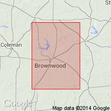
Rochelle revised--called Rochelle conglomerate member, and assigned as basal member of Brownwood formation, which is removed as a shale member of Graford formation of Canyon group, and rank raised to formation. Name Graford formation not used in this report. "The Brownwood shale has sufficient complexity in this area, together with wide mappability, to qualify as a formation with the Rochelle conglomerate as a basal member." Report area is Colorado River Valley in the vicinity of Brownwood, Brown Co, north-central TX on Bend arch. Is of Canyon [Pennsylvanian] age. Stratigraphic chart. [Author does not capitalize rank terms; however, units are considered to be formal.]
Source: GNU records (USGS DDS-6; Denver GNULEX).
For more information, please contact Nancy Stamm, Geologic Names Committee Secretary.
Asterisk (*) indicates published by U.S. Geological Survey authors.
"No current usage" (†) implies that a name has been abandoned or has fallen into disuse. Former usage and, if known, replacement name given in parentheses ( ).
Slash (/) indicates name conflicts with nomenclatural guidelines (CSN, 1933; ACSN, 1961, 1970; NACSN, 1983, 2005, 2021). May be explained within brackets ([ ]).

