

- Usage in publication:
-
- Roadside Formation*
- Modifications:
-
- Named
- Dominant lithology:
-
- Conglomerate
- Andesite
- AAPG geologic province:
-
- Basin-and-Range province
Summary:
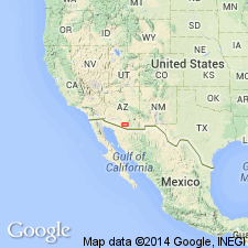
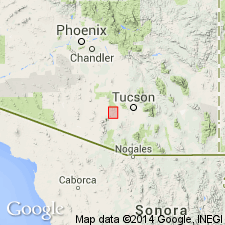
Named for Roadside Mine between the Coyote Mountains and Dobbs Buttes, Pima Co, AZ in the Basin-and-Range province. The type locality is along a line from the Roadside Mine to the base of Roskruge Rhyolite on Bell Mountain. It occurs to the north in the Roskruge Mountains and at the north end of the Sil Nakya Hills and in the north Comobabi Mountains. Geologic map. Consists mostly of volcanic conglomerate and andesitic flows and breccias; the two rock types intertongue. Forms slopes and low foothills. Commonly purple gray to olive drab. Has much angular andesitic fragments. Is several thousand ft thick. Appears to unconformably overlie the Cocoraque Formation (named) in the Roskruge Mountains. Is unconformably overlain by the Roskruge Rhyolite (named). Is equivalent to Claflin Ranch and Silver Bell Formations of Richard and Courtright (1960). Assigned a Mesozoic age.
Source: GNU records (USGS DDS-6; Denver GNULEX).
- Usage in publication:
-
- Roadside Formation
- Modifications:
-
- Geochronologic dating
- AAPG geologic province:
-
- Basin-and-Range province
Summary:
Andesite in formation has K-Ar age of 65.2 +/-2 Ma, but age is considered anomalous due to argon loss.
Source: GNU records (USGS DDS-6; Denver GNULEX).

- Usage in publication:
-
- Roadside Formation*
- Modifications:
-
- Overview
- Age modified
- AAPG geologic province:
-
- Basin-and-Range province
Summary:
Is oldest Upper Cretaceous formation in Roskruge Mountains (Pima Co, AZ) in Basin-and-Range province. Overlies Cocoraque Formation (Aptian and Albian) unconformably. Underlies Roskruge Rhyolite (Campanian and Maestrichtian) conformably. Is several-thousand-foot-thick unit, consisting of andesitic and dacitic breccias and flows and beds of pebbly mudstone to boulder conglomerate and breccia. Roadside and Roskruge together are probably equivalent to Salero Formation in Santa Rita Mountains. Age is shown to be Campanian (Late Cretaceous) on correlation chart (fig. 5); refined from Mesozoic.
Source: GNU records (USGS DDS-6; Denver GNULEX).
For more information, please contact Nancy Stamm, Geologic Names Committee Secretary.
Asterisk (*) indicates published by U.S. Geological Survey authors.
"No current usage" (†) implies that a name has been abandoned or has fallen into disuse. Former usage and, if known, replacement name given in parentheses ( ).
Slash (/) indicates name conflicts with nomenclatural guidelines (CSN, 1933; ACSN, 1961, 1970; NACSN, 1983, 2005, 2021). May be explained within brackets ([ ]).