

- Usage in publication:
-
- Ringbone shale*
- Modifications:
-
- Named
- Dominant lithology:
-
- Sandstone
- Conglomerate
- Shale
- AAPG geologic province:
-
- Pedregosa basin
Summary:
Pg. 532, figs. 2, 4; USGS Prof. Paper 208, p. 18-19, pl. 1, 1947. Ringbone shale of Bisbee group. Consists of a basal conglomerate, containing boulders as large as 2.5 feet in diameter, followed by dark shale, subordinate sandstone, and here and there a bed of black limestone. Thickness of any single bed rarely exceeds 5 feet. Upper 150 feet composed of tuffaceous sandstone and shale containing two purer volcanic members, one a basalt flow and one an andesite breccia, each approximately 50 feet thick. Maximum total thickness about 650 feet. In vicinity of Ringbone Ranch, formation is interfingered with conglomerate of the underlying Broken Jug limestone (new) of Bisbee group; thins out southward against old surface of the Broken Jug. Underlies Hidalgo volcanics (new) of Bisbee group. Age is Early Cretaceous (Trinity); freshwater shells and wood collected. Report includes geologic map.
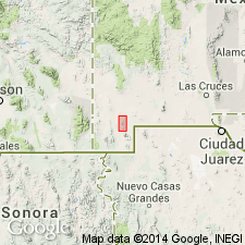
Named from Ringbone Ranch, in sec. 15, T. 27 S., R. 16 W., near which formation is best exposed, Eureka district in Little Hatchet Mountains, southwestern NM (Pedregosa basin). [According to GNU records (USGS DDS-6; Denver GNULEX, Mar. 18, 1986), type locality not designated.]
Source: US geologic names lexicon (USGS Bull. 1200, p. 3278); supplemental information from GNU records (USGS DDS-6; Denver GNULEX).

- Usage in publication:
-
- Ringbone Shale*
- Modifications:
-
- Age modified
- Overview
- Revised
- AAPG geologic province:
-
- Pedregosa basin
- Basin-and-Range province
Summary:
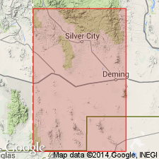
Is formation in little Hatchet Mountains, Hidalgo and Grant Cos, NM in Pedregosa basin and Basin-and-Range province. Is not considered part of Bisbee Group in this area; changed from previous work by Lasky (1947). Bisbee Group not used locally in this paper. Overlies Broken Jug Limestone (Lower Cretaceous) in northern part of range with erosional unconformity; basal conglomerate contains debris derived from Lower Cretaceous rocks. Disconformably underlies Hidalgo Volcanics (Upper Cretaceous). Thickness (following Lasky, 1947) as much as 650 ft. Shales contain fossil gastropod PHYSA, which also occurs in Fort Crittenden Formation (Upper Cretaceous). Age changed to Campanian (Late Cretaceous) on basis of lithologic similarity to Upper Cretaceous rocks in southeastern AZ (Fort Crittenden Formation) and fossils. [See fig. 5 for regional information.]
Source: GNU records (USGS DDS-6; Denver GNULEX).
- Usage in publication:
-
- Ringbone Formation
- Modifications:
-
- Redescribed
- Dominant lithology:
-
- Conglomerate
- Shale
- Basalt
- Andesite
- AAPG geologic province:
-
- Pedregosa basin
- Basin-and-Range province
Summary:
Name changed from Ringbone Shale to Ringbone Formation. Has beds and lenses of limestone cobble conglomerate derived mostly from Paleozoic limestone but some from Cretaceous limestone too at base. Middle part is black, bituminous shale and gray shale with some fossil wood. Upper third has basalt and andesite porphyry flows and basaltic volcanic breccia interbedded with black shale. Flows increase in number upwards in upper part. Locally includes part of Howells Ridge Formation and Playas Peak Formation as earlier mapped and all of Skunk Ranch Conglomerate as earlier mapped in Little Hatchet Mountains. Rests unconformably on Lower Cretaceous Mojado Formation and unconformably overlain by Hidalgo Volcanics. Maximum thickness is 7,500 ft. Assigned a Late Cretaceous or early Tertiary age on fossil palm, SABAL. Formerly assigned only to Early Cretaceous. Geologic map. Cross sections.
Source: GNU records (USGS DDS-6; Denver GNULEX).
For more information, please contact Nancy Stamm, Geologic Names Committee Secretary.
Asterisk (*) indicates published by U.S. Geological Survey authors.
"No current usage" (†) implies that a name has been abandoned or has fallen into disuse. Former usage and, if known, replacement name given in parentheses ( ).
Slash (/) indicates name conflicts with nomenclatural guidelines (CSN, 1933; ACSN, 1961, 1970; NACSN, 1983, 2005, 2021). May be explained within brackets ([ ]).