The National Geologic Map Database is migrating to a new infrastructure. We apologize for any service disruptions during this process.
|
|---|


- Usage in publication:
-
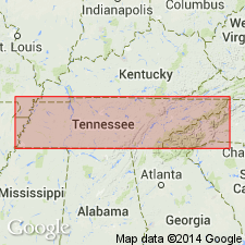
- Ridley limestone
- Modifications:
-
- Named
- Dominant lithology:
-
- Limestone
- AAPG geologic province:
-
- Appalachian basin
Safford, J.M., 1869, Geology of Tennessee: Nashville, TN, 550 p.
Summary:
Named Ridley limestone for Judge Ridley's mill, near Old Jefferson, Rutherford Co., TN. Consists of heavy-bedded light-blue or dove-colored fossiliferous limestone, 95 feet thick. It is included in Trenton or Lebanon (Stones River) group. The Ridley underlies the Glade (Lebanon) limestone and overlies the Pierce limestone. It is considered of Early Ordovician age.
Source: GNU records (USGS DDS-6; Reston GNULEX).

- Usage in publication:
-
- Ridley Limestone*
- Modifications:
-
- Revised
- AAPG geologic province:
-
- Appalachian basin
Summary:
The Ridley Limestone of the Stones River Group, as used by Milici and Smith (1969), is here used in the Chickamauga terrane in GA.
Source: GNU records (USGS DDS-6; Reston GNULEX).

- Usage in publication:
-
- Ridley Limestone*
- Modifications:
-
- Overview
- AAPG geologic province:
-
- Cincinnati arch
Summary:
The Ridley Limestone of the Stones River Group in central Tennessee consists of gray to bluish gray and tan, massive bedded, fine and medium grained limestone with dolomitized burrows and chert. Contains brachiopods and bryozoans. Thickness is 90 to 115 feet. Overlies the Pierce Limestone and underlies the Lebanon Limestone, both of the Stones River Group. The Ridley was deposited in a normal marine, subtidal environment.
Source: GNU records (USGS DDS-6; Reston GNULEX).
For more information, please contact Nancy Stamm, Geologic Names Committee Secretary.
Asterisk (*) indicates published by U.S. Geological Survey authors.
"No current usage" (†) implies that a name has been abandoned or has fallen into disuse. Former usage and, if known, replacement name given in parentheses ( ).
Slash (/) indicates name conflicts with nomenclatural guidelines (CSN, 1933; ACSN, 1961, 1970; NACSN, 1983, 2005, 2021). May be explained within brackets ([ ]).