

- Usage in publication:
-
- Richland-Gordon sandstones
- Modifications:
-
- Overview
- Dominant lithology:
-
- Sandstone
- Clay
- Sand
- AAPG geologic province:
-
- Bend arch
Summary:
Pl. 3, p. lxv. Richland-Gordon sandstones. Basal rocks of undoubted Carboniferous age on eastern border. In Colorado coal field these sandstones, with the underlying clays and sands, are given name of Richland sandstones, and in Brazos coal fields sandstones of similar position and composition have been named Gordon sandstones (probably for Gordon, Palo Pinto County, central Texas). Overlies Bend division and underlies Milburn-Strawn division. Study area in central basin, approximately from Colorado River north to Red River, north-central Texas. Age is Carboniferous (Coal Measures).
Source: US geologic names lexicon (USGS Bull. 896, p. 1809); supplemental information from GNU records (USGS DDS-6; Denver GNULEX).
- Usage in publication:
-
- Richland sandstone
- Modifications:
-
- Named
- Dominant lithology:
-
- Sandstone
- AAPG geologic province:
-
- Bend arch
- Llano uplift
Summary:
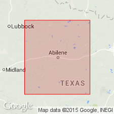
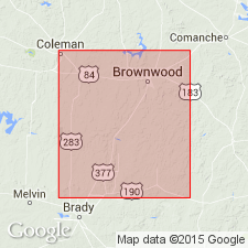
Named; called "Sandstone" and "division". No type locality designated; "characteristic development" along Richland Creek [for which probably named], San Saba Co, TX. Extends for 1,000+ sq mi, on Llano uplift and Bend arch: from 20 mi northwest of Lampasas to 5 mi south of Brownwood; east of Brownwood upper beds disappear beneath the Cretaceous; from there beds strike southwest to Rochelle; western part of Lampasas Co, all of San Saba Co, the Carboniferous corner of Mills Co, southeast corner of Brown Co, and a strip on the eastern border of McCulloch Co--all are underlain by these rocks. May be equivalent of the "millstone grit". Possibly 4,500 ft thick. Called Gordon Sandstones in Brazos coal fields (Dumble, 1890). Consists of many beds of sandstone (all grades of coarseness, from very fine to rare conglomerate), with occasional beds of shale; sandstone is generally yellow and white, containing iron, which gives weathered rocks a deep red or yellow color. All bedding grades, from fissile shaly sandstone to massive thick-bedded layers; latter weather to form immense blocks. Fossils almost exclusively coal plants washed from the land. Conglomeratic sandstone layers throughout, mostly fine grained, of breccia texture; Silurian source rock. Includes an upper conglomerate of variable thickness, here named Rochelle Conglomerate Bed. Underlies Milburn Shales (new); unconformably overlies lower Carboniferous limestone. Late Carboniferous age.
Source: GNU records (USGS DDS-6; Denver GNULEX).
- Usage in publication:
-
- Richland division*
- Modifications:
-
- Revised
- AAPG geologic province:
-
- Bend arch
- Llano uplift
- Strawn basin
Summary:
Upper contact of Richland division revised. Overlying "Milburn Shales" or "Milburn division" of Tarr (1890) is here assigned to Brownwood division. Carboniferous and Permo-Carboniferous divisions in Colorado River Valley area are (descending):
-----------------------------------------
TARR (1890)
Coleman division (Permo-Carboniferous)
Waldrip division (Carboniferous)
Brownwood division
Milburn division
Richland division
"lower limestone"
-----------------------------------------
CUMMINS (1890, 1891)
Albany division (Permo-Carboniferous)
Cisco division (Carboniferous)
Canyon division
" "
Strawn division
Bend division
-----------------------------------------
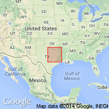
The "lower limestone" of Tarr (1890) may be the Marble Falls limestone. Divisions are present adjacent to the Colorado River in Brown and Lampasas Counties (Bend arch) and San Saba County (Llano uplift), south of Callahan Divide, central Texas. North of Callahan Divide, from northwestern Throckmorton County (Bend arch) to western Hood County (Strawn basin) the divisions continue; thickness differs, and basal portion of section is concealed by greater overlap of Cretaceous formations to the east. Relations to north cannot be stated at present.
Source: Modified from GNU records (USGS DDS-6; Denver GNULEX).
For more information, please contact Nancy Stamm, Geologic Names Committee Secretary.
Asterisk (*) indicates published by U.S. Geological Survey authors.
"No current usage" (†) implies that a name has been abandoned or has fallen into disuse. Former usage and, if known, replacement name given in parentheses ( ).
Slash (/) indicates name conflicts with nomenclatural guidelines (CSN, 1933; ACSN, 1961, 1970; NACSN, 1983, 2005, 2021). May be explained within brackets ([ ]).