


- Usage in publication:
-
- Rendham Limestone [unranked]
- Modifications:
-
- Mapped
- Dominant lithology:
-
- Limestone
- AAPG geologic province:
-
- Bend arch
- Palo Duro basin
Summary:
Rendham Limestone. Light-gray, fine-grained, thin-bedded limestone, 9 inches to 3 feet thick. Occurs in lower part of Bead Mountain Formation of Albany Group (Baylor Co.) and Waggoner Ranch Formation of Wichita Group (new; Wilbarger Co.), above the Beaverburk Limestone [unranked]. Sparsely fossiliferous. Age is Early Permian (Leonard).
Source: Publication.
- Usage in publication:
-
- Rendham Limestone (unranked)
- Modifications:
-
- Revised
- Dominant lithology:
-
- Limestone
Summary:
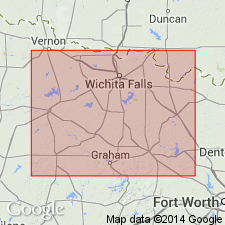
Pg. 5 (fig. 3), 9 (fig. 5), 22. Rendham Limestone is a prominent limestone marker bed that transects both the continental facies (Wichita Group) and the marine and deltaic facies (Albany Group) in north-central Texas. It is present in the lower part of the Waggoner Ranch Formation (new) of the Wichita Group (revised), and in the lower part of the Bead Mountain Formation of the Albany Group (revised) in Baylor, [Wilbarger?], and Wichita Counties, in the Wichita Falls, Lawton, and [Sherman?] 1:250,000 map sheets, north-central Texas (see fig. 5). Original reference is not known to author, but in Baylor County, the Rendham Limestone is exposed at the abandoned Rendham railroad switch, and occurs approx. 40 feet (12 m) above the Beaverburk Limestone [unranked], which is the prominent limestone marker bed separating the Waggoner Formation from the underlying Petrolia Formation (new) of the Wichita Group. Rendham Limestone is elevated to formal status in this regional stratigraphic study. It is referred to as a "component member" in fig. 5 caption (only), but impression from discussion in text, is that it is not considered a formal member. Distinguishing characteristics of this unit are not discussed in this report, nor is it present in the stratotype of the Waggoner Formation. The focus of discussion about the Rendham in this report (p. 22) is its misidentification and miscorrelation with the Beaverburk Limestone [unranked] in previous studies. In Baylor County, the Rendham was considered a local term for the Beaverburk by M.M. Garrett and others (1930, Geologic map of Baylor County, Texas, Univ. Texas, Austin, Bur. Econ. Geol. Misc. Map 8) and A.S. Romer (1974, The stratigraphy of the Permian Wichita redbeds of Texas, Breviora, no. 427, 31 p.), but the Beaverburk and Rendham are actually separate mappable entities. Both are present in Wichita and Baylor Counties. The Beaverburk forms a more prominent escarpment in Wichita County, whereas the Rendham is locally more pronounced in southern Baylor County; this probably accounts for the original miscorrelation. Age is Early Permian (Leonardian). Report includes measured sections, stratigraphic charts.
Source: Publication.
For more information, please contact Nancy Stamm, Geologic Names Committee Secretary.
Asterisk (*) indicates published by U.S. Geological Survey authors.
"No current usage" (†) implies that a name has been abandoned or has fallen into disuse. Former usage and, if known, replacement name given in parentheses ( ).
Slash (/) indicates name conflicts with nomenclatural guidelines (CSN, 1933; ACSN, 1961, 1970; NACSN, 1983, 2005, 2021). May be explained within brackets ([ ]).