


- Usage in publication:
-
- Reklaw Formation
- Modifications:
-
- Mapped 1:250k
- Dominant lithology:
-
- Sand
- Clay
- AAPG geologic province:
-
- Arkla basin
- East Texas basin
Summary:
Reklaw Formation. Quartz sand and clay. Upper part clay, silty, muscovitic, carbonaceous, laminated, brownish-black to brownish-gray; weathers light-brown to light reddish-brown, ironstone concretions common; thickness 35 feet. Lower part, quartz sand, fine- to very fine-grained, argillaceous, sparsely glauconitic, massiv, cross-bedded, grayish-green; weathers moderate brown to dark yellowish-orange with clay ironstone ledges and rubble; a few marine megafossils; thickness 10+/- feet. Lies above Carrizo Sand and below Queen City Formation. Age is Eocene.
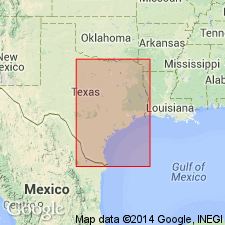
[Mapped in southern part of map sheet, in Hopkins, Franklin, Camp, Titus, Morris and Cass Cos., northeastern TX, and Miller Co., southwestern AR.]
Source: Publication.
- Usage in publication:
-
- Reklaw Formation*
- Modifications:
-
- Revised
- AAPG geologic province:
-
- Gulf Coast basin
Summary:
Pg. D4 (table 1), D7-D9. Reklaw Formation of Claiborne Group. Raised to formation rank (Mount Selman Formation abandoned). Consists of chocolate-colored shale with thin beds of glauconitic sand and of lignite. Thickness up to 400 feet. Distinguished on electric logs as zone of low resistivity (= basal Marquez Shale Member of Stenzel); contact with underlying Carrizo Sand placed at first principal break from fairly low resistivity to markedly higher resistivity [about 1,650 feet depth in Poth water well no. 3]. Underlies Queen City Sand. Equivalent to and intertongues with Bigford Formation in Rio Grande embayment south of Frio River, southern Texas. Age is middle Eocene.
Source: Publication; Changes in stratigraphic nomenclature, 1968 (USGS Bull. 1294-A, p. A15).

- Usage in publication:
-
- Reklaw Formation
- Modifications:
-
- Mapped 1:250k
- Dominant lithology:
-
- Clay
- Silt
- Sand
- AAPG geologic province:
-
- East Texas basin
Summary:
Reklaw Formation. Includes from top down Marquez and Newby Members (not separately mapped). Thickness about 80 feet, forms fairly narrow prairie. Lies above Carrizo Sand and below Queen City Sand. Age is Eocene.
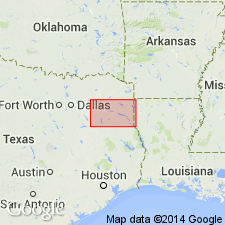
Mapped in Robertson, Leon, and Freestone Cos., eastern TX.
Source: Publication.

- Usage in publication:
-
- Reklaw Formation
- Modifications:
-
- Mapped 1:250k
- Dominant lithology:
-
- Sandstone
- Clay
- AAPG geologic province:
-
- Gulf Coast basin
Summary:
Reklaw Formation. Sandstone and clay; sandstone, fine- to medium-grained, abundant hematite, muscovite, and glauconite, friable to highly indurated, thin-bedded to massive, well developed cross-bedding, some pelecypod casts; clay, silty, lignitic, chocolate brown to light gray; weathers moderate brown and dark yellowish orange. Thickness about 50 to 80 feet. Overlies Carrizo Sand (Eocene); underlies Queen City Sand (Eocene). Age is Eocene.
Mapped in Wilson, Guadalupe, Gonzales, Caldwell, and Bastrop Cos., southeastern TX.
Source: Modified from GNU records (USGS DDS-6; Denver GNULEX).
- Usage in publication:
-
- Reklaw Formation
- Modifications:
-
- Mapped 1:250k
- Dominant lithology:
-
- Clay
- Sand
- AAPG geologic province:
-
- East Texas basin
- Arkla basin
Summary:
Reklaw Formation. Upper 100+/- feet, clay, brownish black to brownish gray, silty, muscovitic, carbonaceous, laminated, interbeds of moderate reddish-brown clay; weathers light brown, ironstone concretions common; a few marine fossils. Lower 15+/- feet, quartz sand, fine to very fine grained, grayish green, glauconitic, argillaceous, massive, locally cross-bedded; weathers moderate brown to dark yellowish orange with clay ironstone ledges and rubble; fossils, clay ironstone, and clay decrease northward. Occurs below Queen City Sand and above Carrizo Sand. Age is Eocene.
[Mapped in continuous and isolated outcrops throughout map sheet.]
Source: Publication.

- Usage in publication:
-
- Reklaw Formation
- Modifications:
-
- Mapped 1:250k
- Dominant lithology:
-
- Sandstone
- Clay
- AAPG geologic province:
-
- Gulf Coast basin
- Ouachita folded belt
Summary:
Pamphlet [p. 3]. Reklaw Formation. Sandstone and clay; sandstone, fine- to medium-grained, abundant hematite, muscovite, and glauconite, friable to highly indurated, thin-bedded to massive, well developed cross-bedding, some pelecypod casts; clay, silty, lignitic, chocolate brown to light gray, weathers moderate brown and dark yellowish orange; thickness 50+/- feet. Correlative with Bigford Formation (mapped west of Frio River). Overlies Carrizo Sand; underlies Queen City Sand. Age is Eocene.
[Mapped in narrow east-west trending belt east of Frio River, in Frio, Atascosa, Wilson, and Bexar Cos., southern TX.]
Source: Publication
For more information, please contact Nancy Stamm, Geologic Names Committee Secretary.
Asterisk (*) indicates published by U.S. Geological Survey authors.
"No current usage" (†) implies that a name has been abandoned or has fallen into disuse. Former usage and, if known, replacement name given in parentheses ( ).
Slash (/) indicates name conflicts with nomenclatural guidelines (CSN, 1933; ACSN, 1961, 1970; NACSN, 1983, 2005, 2021). May be explained within brackets ([ ]).