The National Geologic Map Database is migrating to a new infrastructure. We apologize for any service disruptions during this process.
|
|---|


- Usage in publication:
-
- Reeve meta-andesite
- Modifications:
-
- Named
- Dominant lithology:
-
- Andesite
- AAPG geologic province:
-
- Sierra Nevada province
Summary:
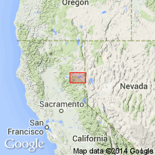
[Named for unidentified locality near Genesee, east of Taylorsville.] Composed of volcanic, tuffaceous, porphyritic meta-andesite, about 200 ft thick. Occurs as definite flow and tuff. Is intimately associated with Robinson formation into which it grades. Also occurs south of Genesee Valley east of Ward Creek and north of Indian Valley. Shown on geologic maps of Indian Valley and southern half of Honey Lake quad. Appears to be younger than Kettle meta-andesite which it intrudes. Association with Robinson formation and fossils contained in tuff fix age as late Carboniferous.
Source: GNU records (USGS DDS-6; Menlo GNULEX).
- Usage in publication:
-
- Reeve Formation*
- Modifications:
-
- Redescribed
- Areal extent
- Age modified
- AAPG geologic province:
-
- Sierra Nevada province
Summary:
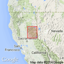
Diller's (1908) Reeve Meta-andesite redescribed as Reeve Formation because of variety of metavolcanic and metasedimentary rocks as included by McMath (1958, 1966). [McMath included other volcaniclastic rocks associated with plagioclase-rich tuff formerly of Robinson Formation of Diller (1908)]. Shown on geologic sketch map of Big Valley area (Cisco Grove and Duncan Peak 7.5' quads, CA). Age is Early Permian on basis of fossils of Roadian or Wordian Stage.
Source: GNU records (USGS DDS-6; Menlo GNULEX).
- Usage in publication:
-
- Reeve Formation*
- Modifications:
-
- Areal extent
- Revised
- Overview
- AAPG geologic province:
-
- Sierra Nevada province
Summary:
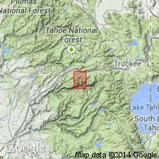
Unit geographically extended to Dyer Mountain, Keddie Ridge (near Homer Lake) in Little Grizzly Creek area (about 10 km south of Genesee) and Fir Hill. Age stated herein as Early Permian (late Wolfcampian or early Leonardian fusulinids). Chert conglomerate mapped by Harwood (1983) as part of Peale Formation in area south of HWY 80 is restricted from Peale Formation and reassigned to overlying Reeve Formation. Type locality of McMath (1950) is adopted as exposures in Hosselkus Creek drainage, sec.4 T25N R11E, Genesee Valley 7.5' quad [Plumas Co, CA] and also outcrops north of road, NE/4 sec.10 T25N R11E, Genesee Valley 7.5' quad.
Source: GNU records (USGS DDS-6; Menlo GNULEX).
For more information, please contact Nancy Stamm, Geologic Names Committee Secretary.
Asterisk (*) indicates published by U.S. Geological Survey authors.
"No current usage" (†) implies that a name has been abandoned or has fallen into disuse. Former usage and, if known, replacement name given in parentheses ( ).
Slash (/) indicates name conflicts with nomenclatural guidelines (CSN, 1933; ACSN, 1961, 1970; NACSN, 1983, 2005, 2021). May be explained within brackets ([ ]).