

- Usage in publication:
-
- Redwall limestone group
- Modifications:
-
- Original reference
- Dominant lithology:
-
- Limestone
- Sandstone
- Shale
- AAPG geologic province:
-
- Plateau sedimentary province
Summary:
Pg. 162, 177-186, 197, figs. 81, 82. Redwall limestone group. In descending order: (1) alternating sandstones and compact limestones, 200 to 500 feet; (2) Redwall limestone (sheer escarpment), 800 feet; (3) limestones in lesser escarpments and calcareous shales, 800 to 1,365 feet. Underlies Aubrey group and overlies Tonto group [Cambrian]. May include some Devonian.
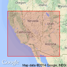
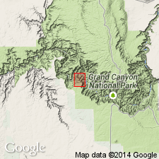
Named from red appearance of its escarpment on either side of Grand Canyon, northern AZ.
Source: US geologic names lexicon (USGS Bull. 896, p. 1790).
- Usage in publication:
-
- Redwall limestone*
- Modifications:
-
- Contact revised
- AAPG geologic province:
-
- Plateau sedimentary province
Summary:
Pg. 50. Redwall limestone. Reported beneath Redwall limestone in Grand Canyon 94 feet of Devonian limestone, which he named Temple Butte limestone.
Source: US geologic names lexicon (USGS Bull. 896, p. 1790).
- Usage in publication:
-
- Redwall limestone*
- Modifications:
-
- Principal reference
- Revised
- Dominant lithology:
-
- Limestone
- AAPG geologic province:
-
- Plateau sedimentary province
Summary:
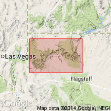
Pg. 21+. Redwall limestone. The name Redwall was given by Gilbert on account of red color of the cliffs, but the rock itself is light gray. A type locality recently selected is Redwall Canyon, in Shinumo drainage basin, on north side of Grand Canyon, [Coconino County], northern Arizona, where it consists mostly of the usual heavily bedded massive limestone and is 800+/- feet thick. At other places in Grand Canyon region thickness varies from 550 to 992+/- feet. Gilbert gave thicknes of 2,165 feet at mouth of Grand Canyon, but this includes at top 510 feet of alternating limestone and sandstone which I believe belong to Supai formation. Fossils of Redwall limestone are Pennsylvanian and Mississippian, according to G.H. Girty. Report includes geologic map.
Source: US geologic names lexicon (USGS Bull. 896, p. 1790).
- Usage in publication:
-
- Redwall limestone*
- Modifications:
-
- Contact revised
- AAPG geologic province:
-
- Plateau sedimentary province
Summary:
Redwall limestone. In Shinumo quadrangle, Coconino County, northern Arizona, unconformably overlies newly named Muav limestone, top formation of Tonto group. Contact placed at base of a 110-foot thick unit of alternating layers of calcareous sandstone and dense blue-gray limestone of the Redwall. Overlying part of Redwall consists of pure dense, blue-gray crystalline limestone that forms a single cliff, the highest in the Grand Canyon. Thickness 600 to 700 feet. Underlies Supai formation of Aubrey group. Fossiliferous. Age is Mississippian and Pennsylvanian. Report includes geologic map, fossil list.
Source: Modified from GNU records (USGS DDS-6; Denver GNULEX).
- Usage in publication:
-
- Redwall limestone*
- Modifications:
-
- Revised
- AAPG geologic province:
-
- Plateau sedimentary province
Summary:
Pg. 26+, 54+. Redwall limestone. Restricted to Mississippian part of original Redwall limestone, which consists almost wholly of bluish-gray crystalline limestone whose distinctive features are massive appearance, hardness, and relatively great thickness. Thickness in Grand Canyon 500 to 700 feet. There is probably an unconformity at top of Redwall limestone as here restricted. The upper 250+/- feet of red sandy shale, purplish and gray limestone with red chert, and reddish to buff calcareous sandstone of Pennsylvanian age, which have heretofore been included in Redwall limestone, are here transferred to overlying Supai formation. [This is present (ca. 1938) adopted definition of Redwall limestone.]
[Misprint (USGS Bull. 896, p. 1790): publication date; Noble published USGS Prof. Paper 131-B Aug. 19, 1922.]
Source: US geologic names lexicon (USGS Bull. 896, p. 1790).
- Usage in publication:
-
- Redwall limestone
- Modifications:
-
- Contact revised
- Areal extent
- AAPG geologic province:
-
- Great Basin province
Summary:
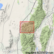
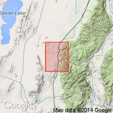
Lower contact revised. Redwall disconformably overlies the newly named Late Devonian Cove Fort Quartzite. Disconformably underlies the Pennsylvanian Oquirrh Formation. Mapped (geologic map) east of the Cove Fort on the southeast side of White Sage Flat, Millard Co, UT in the Great Basin province. Consists of thick, massive coarse crystalline oolitic limestone. Is 273 ft thick on east side of Sage Flat. Yielded Osagean age (corals, brachiopods, bryozoans, gastropod, forams) in the Pavant Range. Name Redwall extended into this area in preference to other Mississippian unit names because of the age of its fauna.
Source: GNU records (USGS DDS-6; Denver GNULEX).
- Usage in publication:
-
- Redwall Limestone
- Modifications:
-
- Areal extent
- AAPG geologic province:
-
- Great Basin province
Summary:
Areally extended to southwest UT. Rocks formerly assigned (Butler, 1913) to the lower part of Topache Limestone in the report area are reassigned to the Redwall Limestone in this report. Mapped (geologic map) on west side of range, Beaver Co, UT, Great Basin province. Stratigraphic diagram. Contrasts with the overlying and underlying formations. The Redwall is a dark-gray to black, thick-bedded to massive limestone and dolomite with bedded and nodular chert and case-hardened limestone nodules. The underlying Pilot Shale is thinner bedded. The overlying Callville Limestone (the upper part of the Topache Limestone of Butler (1913)) is brown to red brown. Is 1,240 ft thick. Very fossiliferous--corals, brachiopods, ammonites, crinoids, bryozoans. Of Mississippian age.
Source: GNU records (USGS DDS-6; Denver GNULEX).
- Usage in publication:
-
- Redwall Limestone*
- Modifications:
-
- Areal extent
- AAPG geologic province:
-
- Plateau sedimentary province
Summary:
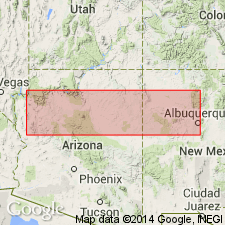
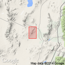
The name Redwall Limestone of Early and Late Mississippian age is extended northward from AZ into Kane Co, UT in the Plateau sedimentary province. Redwall unconformably overlies the Upper Devonian and Lower Mississippian Ouray? Limestone and unconformably underlies the Lower Pennsylvanian Molas Formation. The formation is divided in three parts (ascending): 1) Whitmore Wash and Thunder Springs Members, 232 ft thick; 2) Mooney Falls Member, 289 ft thick; and 3) Horseshoe Mesa Member, 160 ft thick. The Whitmore Wash and Thunder Springs are white, fossiliferous dolomite with white tripolitic chert. The Mooney Falls is a white to brown, crinoidal, cherty dolomite with a few thin brown limestone beds. The Horseshoe Mesa is a brown to white limestone with chert, and algal structures. The Early-Late Mississippian boundary lies within Mooney Falls Member. A marine deposit.
Source: GNU records (USGS DDS-6; Denver GNULEX).
- Usage in publication:
-
- Redwall Limestone*
- Modifications:
-
- Revised
- AAPG geologic province:
-
- Plateau sedimentary province
Summary:
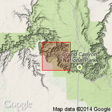
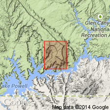
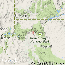
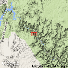
Horseshoe Mesa Member of the [Mississippian] Redwall Limestone unconformably underlies the Watahomigi Formation (new) of the Supai Group (raised in rank from formation) at Watahomigi Point, Havasu Creek, Grand Canyon region, northern AZ in the Plateau sedimentary province. Upper surface is channeled with 5 ft of relief in 100 ft horizontal distance.
Source: GNU records (USGS DDS-6; Denver GNULEX).
- Usage in publication:
-
- Redwall Marble*
- Modifications:
-
- Redescribed
- Revised
- Areal extent
- Dominant lithology:
-
- Marble
- AAPG geologic province:
-
- Salton basin
Summary:
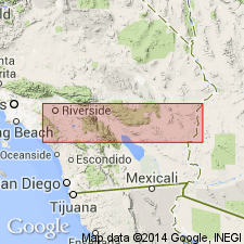
Names applied in Grand Canyon area extended geographically to sequence in Big Maria Mountains of southeast CA in the Salton basin with change of lithic designation. Mississippian Redwall Limestone redescribed as Redwall Marble. Redwall consists of coarse-grained, massive, pure calcite marble, usually gleaming white. Is 0.2 to 50 m thick. Overlies Cambrian and Devonian unnamed dolomite marble; underlies Supai Formation. Equivalent to Escabrosa Limestone of southern AZ. This part of CA was part of stable craton of North America in Paleozoic and early Mesozoic time. Rocks were intruded by Middle Jurassic granodiorite and metamorphosed in Cretaceous time.
Source: GNU records (USGS DDS-6; Denver GNULEX).
- Usage in publication:
-
- Redwall Limestone*
- Modifications:
-
- Areal extent
- AAPG geologic province:
-
- Great Basin province
Summary:
Areally extended to northwest side of Dog Valley Mountain in northern part of quad in the Great Basin province, where it overlies the Upper Devonian Cove Fort Quartzite and underlies the Lower Pennsylvanian to Lower Permian Oquirrh Formation. Contains abundant, well-preserved brachiopods and corals. Assigned to the Early and Late Mississippian.
Source: GNU records (USGS DDS-6; Denver GNULEX).
- Usage in publication:
-
- Redwall Limestone*
- Modifications:
-
- Revised
- AAPG geologic province:
-
- Plateau sedimentary province
Summary:
New name Surprise Canyon Formation applied to rocks previously assigned to the Redwall Limestone and to Watahomigi Formation in the Grand Canyon area, AZ in the Plateau sedimentary province. Surprise Canyon is lithologically distinct from both the Redwall and the Watahomigi. Contact with the Redwall is unconformable and is placed at base of a cobble and pebble conglomerate above the limestone. Contact with Watahomigi is unconformable and is placed at the top of a thin gray ledge-forming limestone. Redwall is of Mississippian age.
Source: GNU records (USGS DDS-6; Denver GNULEX).
- Usage in publication:
-
- Redwall Limestone*
- Modifications:
-
- Areal extent
- Overview
- AAPG geologic province:
-
- Black Mesa basin
Summary:
Redwall Limestone identified in subsurface of Black Mesa basin of northeast AZ where it can be divided into (ascending): Whitmore Wash Member (Kinderhookian and Osagean), Thunder Springs Member (Osagean), Mooney Falls Member (Osagean), and an upper or limestone unit (Meramecian). The Whitmore Wash unconformably overlies Devonian Martin Formation. The Mooney Falls is separated from the upper limestone unit by an unconformity. The end of Osagean is marked by a regional hiatus. The Meramecian-age limestone unit may be part of or equivalent to part of the Mooney Falls Member to the west or to the younger Horseshoe Member of the Redwall. The Redwall is overlain unconformably by unnamed redbeds and residuum. Correlation chart. The Whitmore Wash to Mooney Falls Members shown as equivalent to the lower part of the Leadville Limestone, and the Meramecian undesignated part of the Redwall is shown as equivalent to the upper part of the Leadville of the San Juan basin subsurface of northwest NM.
Source: GNU records (USGS DDS-6; Denver GNULEX).
For more information, please contact Nancy Stamm, Geologic Names Committee Secretary.
Asterisk (*) indicates published by U.S. Geological Survey authors.
"No current usage" (†) implies that a name has been abandoned or has fallen into disuse. Former usage and, if known, replacement name given in parentheses ( ).
Slash (/) indicates name conflicts with nomenclatural guidelines (CSN, 1933; ACSN, 1961, 1970; NACSN, 1983, 2005, 2021). May be explained within brackets ([ ]).