The National Geologic Map Database is migrating to a new infrastructure. We apologize for any service disruptions during this process.
|
|---|


- Usage in publication:
-
- Red Lick Member
- Modifications:
-
- Named
- Dominant lithology:
-
- Sandstone
- Siltstone
- Redbeds
- AAPG geologic province:
-
- Appalachian basin
Summary:
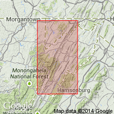
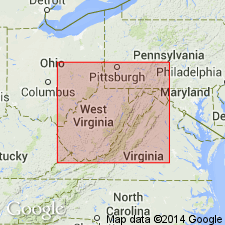
Red Lick Member here named for Red Lick Run, 5.8 km southwest of the type section at Briery Gap Run and assigned as uppermost member of the Foreknobs Formation (Greenland Gap Group). Consists of light olive gray sandstones and siltstones with some brownish gray "redbeds," and a small amount of light olive gray, silty shale and rare layers of conglomerate. Unit was deposited in a lagoonal environment. Member is 543 ft (165.6 m) thick at the type section and ranges from 0 to 700 ft (213 m) along the 92 mi study area (Allegany Co., MD, to Highland Co., VA). Gradationally underlies Hampshire Formation; overlies Pound Sandstone Member (Foreknobs Formation). Age is Late Devonian.
Source: GNU records (USGS DDS-6; Reston GNULEX).
- Usage in publication:
-
- Red Lick Member
- Modifications:
-
- Revised
- AAPG geologic province:
-
- Appalachian basin
Summary:
Uppermost members of Foreknobs Formation, Pound and Red Lick, are retained as members of the Greenland Gap Formation in the subsurface of WV, west of the Allegheny Front. Foreknobs and Scherr Formations are not recognized in study area, hence Greenland Gap is extended to this area at formation rank and replaces use of term "Chemung."
Source: GNU records (USGS DDS-6; Reston GNULEX).
- Usage in publication:
-
- Red Lick Member
- Modifications:
-
- Areal extent
- AAPG geologic province:
-
- Appalachian basin
Summary:
In south-central PA, the Minnehaha Springs Member of the Scherr Formation and the Mallow, Briery Gap, Blizzard, Pound, and Red Lick Members of the Foreknobs Formation of the Greenland Gap Group are recognized. Red Lick Member is composed of brown and gray sandstone, siltstone, and shale with local conglomerate. In the study area, the Red Lick underlies the Irish Valley Member of the Catskill Formation. Commonly contains "CAMAROTOECHIA" sp., CYRTOSPIRIFER CHEMUNGENSIS, CYRTOSPIRIFER INERMIS, LEPTODESMA sp., TYLOTHYRIS MESACOSTALIS, and SCHUCHERTELLA CHEMUNGENSIS. Fossils indicate shallow nearshore to intertidal environments.
Source: GNU records (USGS DDS-6; Reston GNULEX).
- Usage in publication:
-
- Red Lick Member
- Modifications:
-
- Areal extent
- AAPG geologic province:
-
- Appalachian basin
Summary:
The term Foreknobs Formation is not used in the stratigraphic cross section south of Gap Mills, WV. Arbitrary cutoffs are drawn where diagnostic characteristics are lost by facies change. The Mallow Member coarsens upward and also becomes finer grained toward the southwest. Cutoffs of the base of the Mallow Member are drawn between Alleghany and White Sulphur Springs. All sandstone in the Mallow, Briery Gap, Blizzard, and Pound Members is lost southwest of White Sulphur Springs resulting in an arbitrary cutoff of the base of the Foreknobs, which jumps up to the base of the Red Lick Member near Gap Mills. The Red Lick then loses all of its sandstone between Gap Mills and Bluefield.
Source: GNU records (USGS DDS-6; Reston GNULEX).
For more information, please contact Nancy Stamm, Geologic Names Committee Secretary.
Asterisk (*) indicates published by U.S. Geological Survey authors.
"No current usage" (†) implies that a name has been abandoned or has fallen into disuse. Former usage and, if known, replacement name given in parentheses ( ).
Slash (/) indicates name conflicts with nomenclatural guidelines (CSN, 1933; ACSN, 1961, 1970; NACSN, 1983, 2005, 2021). May be explained within brackets ([ ]).