- Usage in publication:
-
- Red Eagle Limestone
- Modifications:
-
- Principal reference
Summary:
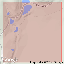
The Red Eagle Limestone is being considered for the placement of the Pennsylvanian-Permian boundary, therefore such an important formation should have a well-documented type locality. K.C. Heald (1916, USGS Bull. 641, p. 24) named the Red Eagle Limestone for excellent exposures near the Red Eagle School southwest of Foraker. The only measured section of Heald (1916) is on a tributary of Hay Creek, a quarter of a mile east of the common corner of secs. 1, 2, 11, and 12, T. 26 N., R. 5 E. The section is described as completely limestone, which is varied in color, fossil content, and lithology, and measures 16.5 feet (5.03 m) in thickness. Numerous attempts by authors of this report to locate and sample the original type locality failed. Therefore, a new principal reference section for the Red Eagle Limestone is proposed. It is located in a quarry adjacent to town of Burbank, Osage County, Oklahoma, in SE/4 sec. 25, T. 26 N., R. 5 E., Burbank 7.5-min quadrangle. The new locality provides easily located and measured sections of the Red Eagle (see fig. 1, table 1). The interval measured is (in ascending order) Johnson Shale, Red Eagle Limestone, Roca Shale, and [basal part? of] Sallyards Limestone. The bounding paleosols (Johnson and Roca Shales) are exposed in the quarry allowing for a complete and accurate measurement of the Red Eagle Limestone. In addition, two cores have been made available by the Oklahoma Geological Survey to serve as references. [No other information about these reference cores are provided, such as: well names and/or numbers, depth intervals, lithologic descriptions, where the cores were taken from, and where the cores are being stored.] The section consists of (in ascending order): (1) Johnson Shale, 17.3 feet (5.19 m) of a predominantly reddish to greenish, blocky mudstone capped by a 4 inch (0.10 m) thick chonetid lag deposit and 15 inches (0.38 m) of gray shale; (2) Red Eagle Limestone, basal 10 inches (0.25 m) is tightly interbedded gray shale and thin limestones; overlain by 38 inches (0.96 m) of algal (phylloidal) limestone and 25 inches (0.63 m) of predominantly limestone, with 4 thin, gray-shale partings; upper 24.3 feet (7.33 m) of formation is mostly a medium-gray wackestone, although 2 small gray-shale partings exist; (3) Roca Shale, 16.3 feet (5 m) of red, blocky mudstone, to red fissile shale; (4) Sallyards Limestone, 26 inches of light grayish-green limestone. Section is quite fossiliferous throughout (algae, bivalves, brachiopods, bryozoans, conodonts, corals, crinoids, echinoderms, foraminifera, ostracodes, trilobites). Location of Pennsylvanian-Permian boundary within section not indicated. Report includes stratigraphic column, detailed measured section.
Source: Publication.
For more information, please contact Nancy Stamm, Geologic Names Committee Secretary.
Asterisk (*) indicates published by U.S. Geological Survey authors.
"No current usage" (†) implies that a name has been abandoned or has fallen into disuse. Former usage and, if known, replacement name given in parentheses ( ).
Slash (/) indicates name conflicts with nomenclatural guidelines (CSN, 1933; ACSN, 1961, 1970; NACSN, 1983, 2005, 2021). May be explained within brackets ([ ]).

