The National Geologic Map Database is migrating to a new infrastructure. We apologize for any service disruptions during this process.
|
|---|


- Usage in publication:
-
- Rebecca Shoal Dolomite
- Modifications:
-
- Named
- Dominant lithology:
-
- Dolomite
- AAPG geologic province:
-
- Florida platform
Summary:
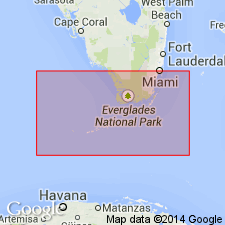
Rebecca Shoal Dolomite here named in the subsurface of southeastern FL. Includes two newly named tongues: Plantation and Tavernier. Unit is a subsurface, barrier-reef complex, finely crystalline with numerous vugs, cavities, and caverns. Consists of gray, tan, and white anhedral dolomite. Thickness is 606 m in type well. Equivalent to and interfingers with Pine Key and Cedar Keys Formations. Age is Late Cretaceous and Paleocene.
Source: GNU records (USGS DDS-6; Reston GNULEX).
- Usage in publication:
-
- Rebecca Shoal Dolomite
- Modifications:
-
- Revised
- Areal extent
- Overview
- AAPG geologic province:
-
- Florida platform
Summary:
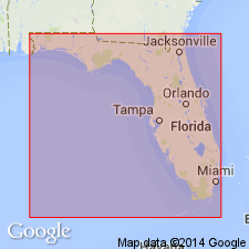
Unit is a completely dolomitized reef complex, generally 15 to 20 mi wide and 1,000 mi long, its late stages completely enclosing the FL peninsula, resembling a giant atoll. Caverns up to 50 ft high have been encountered near the base of the reef. Expands to 50 mi wide on the western Sarasota arch. Unit has been penetrated by 44 wells in FL (on and offshore) and in southeastern GA. Maximum thickness of the Rebecca Shoal is 2970 ft in Well 4950 on the Sarasota arch. Thins to 600 ft in southeastern GA. Dolomite consists of three varieties: anhedral, cryptocrystalline, and fine to coarse crystalline euhedral. Three tongues of the main reef extend into the lagoonal facies (Cedar Keys and Pine Key facies). The basal Card Sound Tongue (assigned by Winston (1989) and in this report to the Rebecca Shoal) has been penetrated in only two wells in the FL Keys and three wells on the Sarasota arch, but there is no evidence to connect the two locales. Seismic investigation is prohibited seaward of the Keys and is the only method that might confirm the presence of the Card Sound between the two areas. In one well, the younger Plantation Tongue has coalesced with the Card Sound and in several other wells the still younger Tavernier Tongue has coalesced with the Plantation. The Tavernier Tongue extends into the lagoon farther than the other two. Rebecca Shoal underlies the Delray Dolomite (name credited to Winston, in prep) and overlies the Grassy Point [limestone]. No paleontologic data available to determine the age of the unit. Earliest appearance of Card Sound Tongue is 100 ft above the Lower Cretaceous. This establishes an early Late Cretaceous age for the lower reef section and through correlation of the Tavernier Tongue with the Cedar Keys Formation, a Paleocene age is suggested for the upper reef section. A late Late Cretaceous age is suggested for the Plantation Tongue through correlation. Reef building extended over a period of approximately 40 million years.
Source: GNU records (USGS DDS-6; Reston GNULEX).
For more information, please contact Nancy Stamm, Geologic Names Committee Secretary.
Asterisk (*) indicates published by U.S. Geological Survey authors.
"No current usage" (†) implies that a name has been abandoned or has fallen into disuse. Former usage and, if known, replacement name given in parentheses ( ).
Slash (/) indicates name conflicts with nomenclatural guidelines (CSN, 1933; ACSN, 1961, 1970; NACSN, 1983, 2005, 2021). May be explained within brackets ([ ]).