

- Usage in publication:
-
- Ravalli series*
- Modifications:
-
- Named[?] or First used[?]
- Dominant lithology:
-
- Sandstone
- AAPG geologic province:
-
- Northern Rocky Mountain region
- Idaho Mountains province
Summary:
MenloGNU: Unit is named the Ravalli series. Consists of purplish gray and gray fine grained quartzitic sandstones, bedded gray sandstones, and greenish gray, fine grained, compact quartzitic sandstones. Thickness is 8,255 ft in the Mission Range section. Age is Algonkian.
DenverGNU: First published use as a name for part of Belt terrane. Intent to name not stated. Source of name not stated. No type locality designated. Town of Ravalli shown on map on Jocko Creek northwest of Missoula and south of Flathead Lake, in Lake Co. Shown (correlation chart) as basal unit in Mission Range, Lake and Missoula Cos, MT, Northern Rocky Mountain region. Section measured along Camp Creek. [Sequence order in measured section not clear. Unit 1 could be the basal or the upper unit.] Lower contact concealed. Upper contact is with Blackfoot series. Composed of purplish-gray and gray to greenish-gray fine-grained sandstone 8,255 ft thick. Of Algonkian age.
Source: GNU records (USGS DDS-6; Menlo GNULEX, Denver GNULEX).
- Usage in publication:
-
- Ravalli group*
- Modifications:
-
- Revised
- Redescribed
- Dominant lithology:
-
- Quartzite
- Shale
- AAPG geologic province:
-
- Idaho Mountains province
Summary:
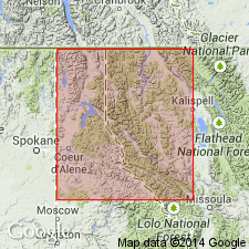
Ravalli series of Walcott (1906) is revised as the Ravalli group, consisting of (ascending) the Burke formation, Revett quartzite, and St. Regis formation in the Coeur d'Alene district. Consists of light-colored siliceous rocks varying from very pure white quartzite to siliceous shale, much of it in subdued tones of gray, green, purple, and red. Thickness in Coeur d'Alene district is about 4,200 ft; unit thickness increases to the north. Overlies the Prichard formation; underlies the Newland formation. Age is Algonkian.
Source: GNU records (USGS DDS-6; Menlo GNULEX).

- Usage in publication:
-
- Ravalli group
- Modifications:
-
- Revised
- AAPG geologic province:
-
- Northern Rocky Mountain region
Summary:
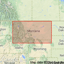
Is a dominantly clastic sequence 7,800 to 15,000 ft thick in the Belt series above the Prichard formation and below the Piegan group (new). Type locality stated as along Jocko River, near Ravalli, MT, Lake Co, MT in the Northern Rocky Mountain region. Extends into Sweetgrass arch. Divided into Altyn (base), Appekunny, and Grinnell formations. Altyn can be separated into (ascending): Waterton (reduced from formation), Hell Roaring (new), and Carthew (new) members. Appekunny can be separated into (ascending): Singleshot, Appistoki, and Scenic Point (new) members. Grinnell can be separated into (ascending): Rising Wolf, Red Gap, and Rising Bull members. Is the oldest unit discussed. Underlies Piegan group (new). Correlation chart. Of pre-Cambrian age.
Source: GNU records (USGS DDS-6; Denver GNULEX).

- Usage in publication:
-
- Ravalli Group*
- Modifications:
-
- Revised
- Overview
- AAPG geologic province:
-
- Northern Rocky Mountain region
Summary:
Revised in that Grinnell Formation abandoned in favor of Spokane Formation. Altyn Limestone removed from group and now unassigned to a group in the lower Belt part of the Precambrian Belt Supergroup. Appekunny Argillite changed to Appekunny Formation. Empire Formation thought to be equivalent to Werner Peak Formation of the International Border area. Problems remain as to proper placement of upper contact because of a facies change across the Belt basin--from carbonate to red to green strata. Some geologists place all the green strata in the Empire or all in Helena, and some place them partly in both. Overlies Prichard Formation of the lower Belt in the Northern Rocky Mountain region; overlies Altyn in Northern Rocky Mountain region; overlies Newland Limestone in Northern Rocky Mountain region. Burke and Revett Formations recognized in group in western part of Belt basin. See figures 4 and 5 for correlations with other formations of the Purcell Supergroup in Alberta and British Columbia, Canada.
Source: GNU records (USGS DDS-6; Denver GNULEX).
- Usage in publication:
-
- Ravalli Group*
- Modifications:
-
- Revised
- AAPG geologic province:
-
- Northern Rocky Mountain region
Summary:
Appekunny Argillite (or Formation) [of Ravalli Group of Belt Supergroup] and Greyson Formation [of Missoula Group of Belt Supergroup] are names applied to the same rocks in Glacier National Park, Glacier Co, MT in the Northern Rocky Mountain region. Greyson is older name and is used in preference to Appekunny. Name Appekunny abandoned. Of Precambrian Y age.
Source: GNU records (USGS DDS-6; Denver GNULEX).
- Usage in publication:
-
- Ravalli Group*
- Modifications:
-
- Age modified
- AAPG geologic province:
-
- Idaho Mountains province
Summary:
Age of the Ravalli Group is revised [everywhere] from Proterozoic Y to: Middle Proterozoic [based on ages for its St. Regis, Revett, and Burke Formations mapped here].
Source: GNU records (USGS DDS-6; Menlo GNULEX).
For more information, please contact Nancy Stamm, Geologic Names Committee Secretary.
Asterisk (*) indicates published by U.S. Geological Survey authors.
"No current usage" (†) implies that a name has been abandoned or has fallen into disuse. Former usage and, if known, replacement name given in parentheses ( ).
Slash (/) indicates name conflicts with nomenclatural guidelines (CSN, 1933; ACSN, 1961, 1970; NACSN, 1983, 2005, 2021). May be explained within brackets ([ ]).