

- Usage in publication:
-
- Rancheria formation
- Modifications:
-
- Original reference
- Dominant lithology:
-
- Limestone
- Chert
- AAPG geologic province:
-
- Orogrande basin
Summary:
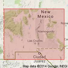
Pg. 9, 11, 17-19, 22, 34, 38. Rancheria formation. Sequence of cherty black bituminous argillaceous limestone beds that unconformably overlies Las Cruces formation (new) and unconformably underlies Helms formation (restricted) in Franklin Mountains, [Dona Ana County], New Mexico. At type locality, section comprises (ascending) few inches of black, detrital, sandy shale; black, detrital quartz sandstone containing numerous plant fossils and considerable carbonaceous material; 8 feet of soft yellow to brown sandy siltstone; massive black bituminous detrital limestone made up largely of minute fragments of crinoidal material; and the remaining 235 feet of typical medium-bedded dense black silty limestone beds that weather brown and contain large amounts of brown-weathering porous chert. Thickness approximately 255 feet in type area; 215 feet at Rancheria Peak; thins by progressive overlap from south toward north in Sacramento Monntains and missing in northern part of range. Age is Mississippian (Meramec); [siltstones contain abundant brachiopods (LEIORHYNCHUS CARBONIFERUM)].
Type locality: on southwest side of small fork of shallow canyon that leaves west slope of Franklin Mountains, almost directly east of Vinton, SW/4 sec. 67, S. Blk. 82, El Paso Co., TX. Named from Rancheria Peak in Hueco Mountains, Otero Co., NM and El Paso Co., TX.
Source: US geologic names lexicon (USGS Bull. 1200, p. 3196); supplemental information from GNU records (USGS DDS-6; Denver GNULEX).
- Usage in publication:
-
- Rancheria formation
- Modifications:
-
- Age modified
- AAPG geologic province:
-
- Permian basin
Summary:
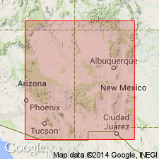
Pg. 10. Rancheria formation. Moorefield faunule present mostly in lower part, which was Laudon and Bowsher's evidence of Meramec age, but which would place it in upper Osage also, if section in Llano region were used for comparison. Probably upper part of Rancheria in Hueco and Franklin Mountains is of Meramec age.
Source: US geologic names lexicon (USGS Bull. 1200, p. 3196).
- Usage in publication:
-
- Rancheria Formation*
- Modifications:
-
- Areal extent
- AAPG geologic province:
-
- Orogrande basin
Summary:
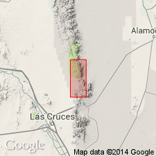
Rancheria Formation. Geographically extended into southern San Andres Mountains, Dona Ana County, New Mexico. Thickness 0 to 180 feet. Overlies Lake Valley Limestone. Unconformably underlies newly named Lead Camp Limestone. Age is Mississippian.
Source: Modified from GNU records (USGS DDS-6; Denver GNULEX).
- Usage in publication:
-
- Rancheria Formation*
- Modifications:
-
- Biostratigraphic dating
- AAPG geologic province:
-
- Pedregosa basin
- Orogrande basin
Summary:
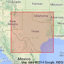
Is formation in west TX and southwest NM. Columnar sections at Vinton Canyon, Franklin Mountains, El Paso Co, TX in Orogrande basin and southeastern Florida Mountains, Luna Co, NM in Pedregosa basin. Unconformably overlies Las Cruces Formation (upper Osagean and lower Meramecian) at Vinton Canyon; unconformably overlies Percha Shale (Devonian) in Florida Mountains. Conformably underlies Helms Formation (upper Chesterian) at Vinton Canyon; unconformably underlies Heuco Limestone (Permian) in Florida Mountains. Biostratigraphic dating with foraminifers indicates zones 14-15 (Meramecian) and 16i-16s (Chesterian) for Vinton Canyon section and zones 14-15 (Meramecian) for upper part of Florida Mountains section; lower part of Florida Mountains section yields both Osagean and Meramecian conodonts respectively below and above an unconformity. Regional correlations on fig. 2; is correlated with Hachita Formation of Escabrosa Group and lower part of Paradise Formation in Pedregosa basin. [Is interpreted to represent basin-margin deep-water marine environment.] Age is Osagean (Early Mississippian) and Meramecian to Chesterian (Late Mississippian).
Source: GNU records (USGS DDS-6; Denver GNULEX).
For more information, please contact Nancy Stamm, Geologic Names Committee Secretary.
Asterisk (*) indicates published by U.S. Geological Survey authors.
"No current usage" (†) implies that a name has been abandoned or has fallen into disuse. Former usage and, if known, replacement name given in parentheses ( ).
Slash (/) indicates name conflicts with nomenclatural guidelines (CSN, 1933; ACSN, 1961, 1970; NACSN, 1983, 2005, 2021). May be explained within brackets ([ ]).