- Usage in publication:
-
- Raccoon Mountain formation
- Modifications:
-
- Named
- Dominant lithology:
-
- Shale
- Sandstone
- Coal
- AAPG geologic province:
-
- Appalachian basin
Summary:
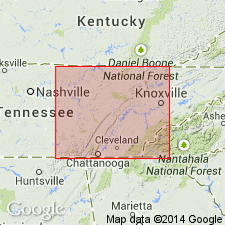
Named as basal formation in Gizzard group. Name derivation not stated, but probably named for Raccoon Mountain, located south of Tennessee River and Walden Ridge in Marion and Hamilton Cos, eastern TN. Type section is on a mine road beginning 0.4 mi northwest of Whiteside, Marion Co., and leading to strip mines at head of Scratch Ankle Hollow, Shellmound quad. Consists of alternating shales and sandstone with several coals. Includes all beds from base of Warren Point sandstone to base of Pennsylvanian. Includes Sale Creek, White Oak, and Bon Air coals. Thickness at type is 353 ft; elsewhere, thickness varies but generally thins east to west. In northwest part of Cumberland Plateau, Warren Point sandstone thins, and Raccoon Mountain formation, which cannot be differentiated, is included in lower part of Fentress formation. Underlies Crab Orchard Mountains group (new); basal contact is marked by lithologic contrast between underlying Mississippian limestone and variegated (red, maroon, and green) shale and Pennsylvanian coals and plant-bearing shales (locally on east side of Cumberland Plateau, this contact is difficult to establish). Age is Pennsylvanian (Pottsville series). Report includes geologic maps, cross sections, stratigraphic sections, and correlation charts.
Source: GNU records (USGS DDS-6; Reston GNULEX).

- Usage in publication:
-
- Raccoon Mountain Member*
- Modifications:
-
- Revised
- Areal extent
- AAPG geologic province:
-
- Appalachian basin
Summary:
Unit geographically extended into northwestern GA and reduced to member status in Gizzard Formation. Raccoon Mountain is a sequence of gray shale, fine-grained sandstone, and lenticular coal beds. Thickness about 70 ft on west side of Lookout Mountain, GA. Basal member of Gizzard. Overlies Pennington Shale; underlies Warren Point Member.
Source: GNU records (USGS DDS-6; Reston GNULEX).

- Usage in publication:
-
- Raccoon Mountain Formation
- Modifications:
-
- Areal extent
- AAPG geologic province:
-
- Appalachian basin
Summary:
(East-central sheet; not separately mapped.) Raccoon Mountain Formation of Gizzard Group. Shale, siltstone, and sandstone. Bon Air coal near top; White Oak and Sale Creek coals near base. Thickness 0 to 260 feet. Is basal formation of Gizzard Group; lies below Warren Point Sandstone. Age is Pennsylvanian.
Source: Publication.

- Usage in publication:
-
- Raccoon Mountain Formation*
- Modifications:
-
- Areal extent
- AAPG geologic province:
-
- Appalachian basin
Summary:
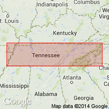
Raccoon Mountain Formation of Gizzard Group is present only in eastern TN. Includes all shale, sandstone, and coal beds between base of Pennsylvanian System to base of Warren Point Sandstone.
Source: GNU records (USGS DDS-6; Reston GNULEX).
For more information, please contact Nancy Stamm, Geologic Names Committee Secretary.
Asterisk (*) indicates published by U.S. Geological Survey authors.
"No current usage" (†) implies that a name has been abandoned or has fallen into disuse. Former usage and, if known, replacement name given in parentheses ( ).
Slash (/) indicates name conflicts with nomenclatural guidelines (CSN, 1933; ACSN, 1961, 1970; NACSN, 1983, 2005, 2021). May be explained within brackets ([ ]).

