The National Geologic Map Database is migrating to a new infrastructure. We apologize for any service disruptions during this process.
|
|---|


- Usage in publication:
-
- Rabbit Flat Member*
- Modifications:
-
- Named
- Dominant lithology:
-
- Greenstone
- Breccia
- AAPG geologic province:
-
- Sierra Nevada province
Summary:
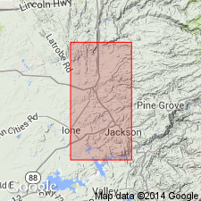
[Named for Rabbit Flat.] Type locality: N bank of Mokelumne River sec 17 T5N R11E about 3 km S of Rabbit Flat, Amador Co, CA. W-SW of Martell was called unit 29 of Brower Creek Member of Mariposa Formation by Clark (1964, pl 7). Adopted as lowermost member of Logtown Ridge Formation. Consists of greenstone flows and breccia; structurally truncated at Drytown. Is recognized S to Mokelumne River and perhaps into Calaveras Co. Is 640 to 2000 m thick. Overlies melange with fault contact. Conformably underlies Goat Hill Member (new). Age is considered to be Late Jurassic (Callovian) based on a specimen of ammonite and stratigraphic relation to Goat Hill Member.
Source: GNU records (USGS DDS-6; Menlo GNULEX).
- Usage in publication:
-
- Rabbit Flat Member*
- Modifications:
-
- Age modified
- AAPG geologic province:
-
- Sierra Nevada province
Summary:
Age changed based on Middle-Upper Jurassic boundary change based on top of Callovian-bottom of Oxfordian. Thus Rabbit Flat Member is Middle Jurassic age.
Source: GNU records (USGS DDS-6; Menlo GNULEX).
For more information, please contact Nancy Stamm, Geologic Names Committee Secretary.
Asterisk (*) indicates published by U.S. Geological Survey authors.
"No current usage" (†) implies that a name has been abandoned or has fallen into disuse. Former usage and, if known, replacement name given in parentheses ( ).
Slash (/) indicates name conflicts with nomenclatural guidelines (CSN, 1933; ACSN, 1961, 1970; NACSN, 1983, 2005, 2021). May be explained within brackets ([ ]).