

- Usage in publication:
-
- Queen City beds
- Modifications:
-
- Original reference
- Dominant lithology:
-
- Sand
- Clay
- AAPG geologic province:
-
- East Texas basin
Summary:
Pg. 50-52. Queen City beds. Uppermost member of Lignitic beds. Appears to be a series of laminated or thinly stratified white and red sands and sandy clays, frequently merging into one another and forming a mottled sandy clay or clayey sand. Best developed in neighborhood of Queen City, Cass County, eastern Texas, where it has known thickness of 65 feet. In Marion County, near Jefferson, and in Harrison County, the beds appear at various places immediately underlying a yellowish-brown sandstone or altered glauconite containing occasional casts of fossils and belonging to Mount Selman or lower member of the Marine beds. They occur also near Tyler, Smith County, and as far south as withing 2 miles of Troupe. To north they occur at Gladewater, Gregg County, and from Wilkins' mill, Upshur County, westward to within short distance of Big Sandy. They rest on a series of black, blue, and gray micaceous sands, blue, brown, and gray clays with thin strata of sandstones and limestones, and also contain many small seams and several heavy deposits of lignites. [Age is middle Eocene.]
[See also additional entries under Mount Selman (Dumble, 1893, 1898, 1902, 1911).]
Source: US geologic names lexicon (USGS Bull. 896, p. 1755-1756).
- Usage in publication:
-
- Queen City sand member*
- Modifications:
-
- Revised
- AAPG geologic province:
-
- Gulf Coast basin
Summary:
Queen City sand member of Wilcox formation. Littoral deposits comprising top member of Wilcox formation. Consists of 50 to 200 feet of white porous, loose water-bearing sands, with some interstratified clays. [Age is middle Eocene.]
Source: US geologic names lexicon (USGS Bull. 896, p. 1755-1756).
- Usage in publication:
-
- Queen City-Carrizo
- Modifications:
-
- Areal extent
- AAPG geologic province:
-
- East Texas basin
- Gulf Coast basin
Summary:
Pg. 83-84. Queen City-Carrizo. Oldest formation of Claiborne group. In east Texas is known as Queen City, and consists of 50 to 200 feet of laminated or thinly stratified white or red sands and sandy clays. In western [southern] Texas is known as Carrizo, and consists of at least 150 feet of sandstones of varying color, texture, and thickness, prevailingly grayish yellow, weathering light brown, some beds white when freshly broken; the beds ranging from fairly hard sandstone 2 to 4 or more feet thick, to beds thin, slabby, fairly soft, and almost shaly. Regarded by Vaughan as lower Wilcox, but in Rio Grande country the Carrizo overlaps the Wilcox and Midway. [Age is middle Eocene.]
Source: US geologic names lexicon (USGS Bull. 896, p. 1755-1756).
- Usage in publication:
-
- Queen City member
- Modifications:
-
- Areal extent
- AAPG geologic province:
-
- Gulf Coast basin
Summary:
Pg. 1342, 1345, pl. 14. Queen City member of Claiborne formation. First described by Wm. Kennedy (Geol. Survey Texas 3rd Ann. Rpt.). Stratigraphic position is below Weches member of Claiborne and above Reklaw member of Claiborne. According to present knowledge is limited to Texas side of Sabine uplift. As a well-defined massive sand extends from Queen City, Cass County, south through Smith and Cherokee Counties, attaining thickness of 400 feet. In Houston County it thins to 110 feet and in western Angelina County to 90 feet. From San Augustine east it is only a few feet thick, finally disappearing. [Age is middle Eocene.]
Source: US geologic names lexicon (USGS Bull. 896, p. 1755-1756).

- Usage in publication:
-
- Queen City sand member*
- Modifications:
-
- Overview
- AAPG geologic province:
-
- Gulf Coast basin
Summary:
According to recent work of Texas geologists and Julia Gardner the Queen City sand contains Claiborne fossils, underlies Weches greensand member of Mount Selman formation and overlies Reklaw member of Mount Selman. (See USGS 1932 [1937] geol. map of Texas.)
Source: US geologic names lexicon (USGS Bull. 896, p. 1755-1756).

- Usage in publication:
-
- Queen City formation
- Modifications:
-
- Revised
- AAPG geologic province:
-
- East Texas basin
Summary:
Pg. 630. Queen City formation of eastern Texas divided into (descending): (1) upper member, 200 to 230 feet of thin-bedded, cross-bedded sand, containing 2 layers of bentonite in upper 100 feet and 2 layers of brown lignite in lower 100 feet; (2) Omen greensand member, dark-green and black, partly cross-bedded, friable, sandy, unfossiliferous glauconite, 10 to 15 feet thick; (3) lower member, 140 to 150 feet of gray and brown sand and gray sandy shale with irregularly shaped lentils of sand. [Age is middle Eocene.]
Source: US geologic names lexicon (USGS Bull. 896, p. 1755-1756).
- Usage in publication:
-
- Queen City sand
- Modifications:
-
- Areal extent
- AAPG geologic province:
-
- East Texas basin
Summary:
Pg. 20 (table), 78-93 [1938]. Queen City sand described in Leon County, eastern Texas, where it is about 440 feet thick. Includes Omen glaucontic sand member at top and lower unit referred to as glauconitic sand at Venetia. Overlies Marquez shale member (new) of Reklaw formation; underlies Tyus marl member (new) of Weches formation. [Age is middle Eocene.]
Source: US geologic names lexicon (USGS Bull. 1200, p. 3174).
- Usage in publication:
-
- Queen City formation
- Modifications:
-
- Areal extent
- AAPG geologic province:
-
- Gulf Coast basin
Summary:
Pg. 10 (fig. 3), 83-100. Queen City formation. Described in Henrys Chapel quadrangle, eastern Texas, where it is youngest of Eocene formations present and is only incompletely preserved. Thickness 105 to 131 feet. Includes (ascending) Arp member, Omen glauconitic sandstone member, and unnamed upper sand member. Overlies Reklaw formation; underlies Pleistocene gravels. [Age is middle Eocene.]
Source: US geologic names lexicon (USGS Bull. 1200, p. 3174).
- Usage in publication:
-
- Queen City formation
- Modifications:
-
- Revised
- AAPG geologic province:
-
- Arkla basin
Summary:
Pg. 2517-2522. Queen City formation. Three-fold division of Queen City as recognized on surface in Texas is also present in surface in Caddo Parish, northwestern Louisiana. Lower sand unit is correlative with Arp member; middle glauconitic member is correlative with Omen member; upper sand member is herein named Myrtis sand member. Underlies Weches formation. Present study shows that sand at type locality of Sparta sand. The sand occupying stratigraphic position between Reklaw and Weches formations, "Queen City" by name, has incorrect type locality and alternate type locality is herein suggested. [Age is middle Eocene.]
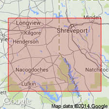
Alternate type locality: exposures extending from town of Vivian north and west along old Vivian-Atlanta Road for 4 mi through secs. 23, 15, 10, and 4 to Myrtis Mill Creek, Caddo Parish, northwestern LA.
Source: US geologic names lexicon (USGS Bull. 1200, p. 3174).

- Usage in publication:
-
- Queen City Formation
- Modifications:
-
- Mapped 1:250k
- Dominant lithology:
-
- Sand
- Clay
- AAPG geologic province:
-
- Arkla basin
- East Texas basin
Summary:
Queen City Formation. Quartz sand, thin beds of clay and sandy clay, and ironstone concretions. Quartz sand, fine-grained, locally medium-grained, massive, cross-bedded, light-gray; weathers grayish-orange-pink. Clay and sandy clay, thin-bedded, locally carbonaceous; weathers very light-gray to white. Thickness 100 to 300 feet, thins eastward. Lies above Reklaw Formation and below Weches Formation. Age is Eocene.
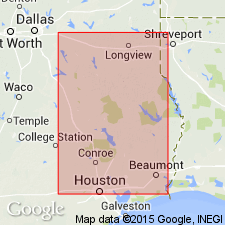
[Mapped in southern part of map sheet, south and east of Mount Vernon, TX, in Franklin, Camp, Titus, Morris and Cass Cos., northeastern TX, Miller Co., southwestern AR, and Caddo Parish, southwestern LA.]
Source: Publication.
- Usage in publication:
-
- Queen City Sand*
- Modifications:
-
- Revised
- AAPG geologic province:
-
- Gulf Coast basin
Summary:
Pg. D4 (table 1), D10-D11. Queen City Sand of Claiborne Group. Raised to formation rank (Mount Selman Formation abandoned). Recognized from eastern Texas southwestward to eastern part of Rio Grande embayment north of Frio River. In eastern Texas, consists of quartz sand, sandy clay and greensand, and lignite and bentonitic clay. In northeastern Texas, includes distinct and traceable bed of glauconite and glauconitic clay called Omen Member by Wendlandt and Knebel. Thickness 750+ feet. Equivalent to lower part of El Pico Clay (new) south of Frio River. Age is middle Eocene.
South of Sabine uplift is indistinguishable from overlying Weches and underlying Reklaw; this undivided section is equivalent to Cane River Formation in Louisiana.
Source: Publication; Changes in stratigraphic nomenclature, 1968 (USGS Bull. 1294-A, p. A15).

- Usage in publication:
-
- Queen City Sand
- Modifications:
-
- Mapped 1:250k
- Dominant lithology:
-
- Sand
- Clay
- Greensand
- AAPG geologic province:
-
- East Texas basin
Summary:
Queen City Sand. Sand, fine-grained quartz, locally carbonaceous, light gray to brown; thin interbeds of clay, sandy, silty, brownish gray; a few lentils of glauconitic quartz greensand; weathers red and white mottled; characterized by low ridges heavily forested. Thickness up to 400 feet, thins southwestward. Lies above Reklaw Formation and below Weches Formation. Age is Eocene.
Mapped in Robertson and Freestone Cos., eastern TX.
Source: Publication.

- Usage in publication:
-
- Queen City Sand
- Modifications:
-
- Mapped 1:250k
- Dominant lithology:
-
- Sandstone
- AAPG geologic province:
-
- Gulf Coast basin
Summary:
Queen City Sand. Sandstone, fine- to medium-grained quartz, well sorted, near-friable, noncalcareous, commonly massive, may be finely laminated, cross-bedded, light gray to yellow-orange, thin interbeds of clay, sandy, silty, light gray to olive green; weathers red and white mottled. Thickness 200 to 250 feet. Overlies Reklaw Formation (Eocene); underlies Weches Formation (Eocene). Age is Eocene.
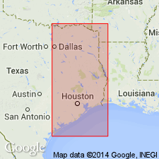
Mapped in Wilson, Guadalupe, Gonzales, Caldwell, and Bastrop Cos., southeastern TX.
Source: Modified from GNU records (USGS DDS-6; Denver GNULEX).
- Usage in publication:
-
- Queen City Sand
- Modifications:
-
- Mapped 1:250k
- Dominant lithology:
-
- Sand
- Clay
- Greensand
- AAPG geologic province:
-
- East Texas basin
- Arkla basin
Summary:
Queen City Sand. Quartz sand, fine-grained to locally medium-grained, light gray to brownish gray, locally carbonaceous, and clay, gray to brown, silty, slightly lignitic, sand most abundant to west; weathers red and white mottled; ironstone concretions and ledges common; local beds of glauconite-quartz greensand, cross-bedded, weathers to ferruginous ledges and rubble. Thickness 100-400 feet, thins southeastward. Occurs below Weches Formation and above Reklaw Formation. Age is Eocene.
[Mapped in continuous and isolated outcrops throughout map sheet.]
Source: Publication.

- Usage in publication:
-
- Queen City Sand
- Modifications:
-
- Mapped 1:250k
- Dominant lithology:
-
- Sandstone
- Siltstone
- AAPG geologic province:
-
- Gulf Coast basin
Summary:
Queen City Sand. Sandstone and siltstone; sandstone, fine- to medium-grained, well sorted, noncalcareous, friable to indurated, commonly massive, may be finely laminated, cross-bedded, light gray to yellow-orange; siltstone, light gray, friable, thin interbeds of clay, sandy, silty, light gray to olive green; weathers red and white mottled. Thickness 500 to 650 feet. [Correlative with lower part of El Pico Clay mapped southwest of Frio River. Overlies Reklaw Formation northwest of map boundary (San Antonio Sheet); underlies Weches Formation.] Age is Eocene.
[Mapped northeast of Frio River, in Frio and Atascosa Cos., southern TX.]
Source: Publication.

- Usage in publication:
-
- Queen City Sand
- Modifications:
-
- Mapped 1:250k
- Dominant lithology:
-
- Sandstone
- Siltstone
- AAPG geologic province:
-
- Gulf Coast basin
- Ouachita folded belt
Summary:
Pamphlet [p. 3]. Queen City Sand. Sandstone and siltstone; sandstone fine- to medium-grained, well sorted, noncalcareous, friable to indurated, commonly massive, may be finely laminated, cross-bedded, light-gray to yellow-orange; siltstone, light-gray, friable, thin interbeds of clay, sandy, silty, light-gray to olive green; weathers mottled red and white; thickness 250 to 500 feet. Underlies Weches Formation; overlies Reklaw Formation. Correlative with lower part of El Pico Clay. Age is Eocene.
[Mapped in southeastern part of map sheet east of Frio River, in Wilson, Bexar, Atascosa, and Frio Cos., southern TX.]
Source: GNU records (USGS DDS-6; Denver GNULEX).
For more information, please contact Nancy Stamm, Geologic Names Committee Secretary.
Asterisk (*) indicates published by U.S. Geological Survey authors.
"No current usage" (†) implies that a name has been abandoned or has fallen into disuse. Former usage and, if known, replacement name given in parentheses ( ).
Slash (/) indicates name conflicts with nomenclatural guidelines (CSN, 1933; ACSN, 1961, 1970; NACSN, 1983, 2005, 2021). May be explained within brackets ([ ]).