The National Geologic Map Database is migrating to a new infrastructure. We apologize for any service disruptions during this process.
|
|---|


- Usage in publication:
-
- Quarry Peak rhyolite complex
- Modifications:
-
- Named
- Dominant lithology:
-
- Breccia
- Rhyolite
- AAPG geologic province:
-
- Pedregosa basin
Summary:
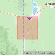
Named for an abandoned quarry operated by the SPRR at the base of a steep south-facing cliff. The peak is west of Steins and north of SPRR and State Hwy 14. Geographic name has no status and does not appear on a map. No type locality designated. Is a series of flows, breccias, and tuffs of rhyolitic composition. Forms the peak west of Steins (sec 9, T24S, R21W), Hidalgo Co, NM in Pedregosa basin. Geologic map included. Most of sequence consists of holocrystalline equigranular aphanitic white or light-gray rhyolite. Breccia interbedded with the rhyolite consists of angular fragments of rhyolite and andesite in a matrix of clay. Probably deposited in a lacustrine environment and detritus derived from a rhyolitic terrain, or were result of violent volcanic eruptions. Is about 1,000 ft thick. Rests unconformably on andesite. Is intruded by latite porphyry dikes. Assigned a Tertiary age on the geologic map.
Source: GNU records (USGS DDS-6; Denver GNULEX).
For more information, please contact Nancy Stamm, Geologic Names Committee Secretary.
Asterisk (*) indicates published by U.S. Geological Survey authors.
"No current usage" (†) implies that a name has been abandoned or has fallen into disuse. Former usage and, if known, replacement name given in parentheses ( ).
Slash (/) indicates name conflicts with nomenclatural guidelines (CSN, 1933; ACSN, 1961, 1970; NACSN, 1983, 2005, 2021). May be explained within brackets ([ ]).