The National Geologic Map Database is migrating to a new infrastructure. We apologize for any service disruptions during this process.
|
|---|


- Usage in publication:
-
- Puye gravel
- Modifications:
-
- Mapped
- Dominant lithology:
-
- Gravel
- AAPG geologic province:
-
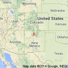
- San Juan basin
Summary:
Pg. 937 (fig. 4), 959; see also 1937 [abs.], GSA Proc. 1936, p. 103. Quaternary formations in Abiquiu quadrangle comprise Canjillon till, Canones andesite, Vallecito basalt (all new), and Black Mesa basalt, which were poured out on high-level erosion surfaces, and Puye gravel (new); which overlies an erosion surface of intermediate level and is overlain, locally, by Bandelier rhyolite and Santa Clara basalt (all new).
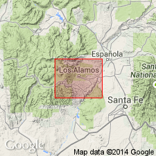
[Mapped in valley of Chama River, Rio Arriba Co., north-central NM.]
Source: US geologic names lexicon (USGS Bull. 1200, p. 3164-3165).
- Usage in publication:
-
- Puye Conglomerate*
- Modifications:
-
- Overview
- AAPG geologic province:
-
- San Juan basin
Summary:
A thick unit of conglomerate, cropping out in Guaje Canyon and along Puye Escarpment in the Los Alamos area, (here designated the type locality) was traced northward into Abiquiu quad, and is equivalent to Puye Gravel as mapped by Smith (1938). Name Puye Conglomerate used for these rocks in this report because the formation is sufficiently consolidated to stand in vertical cliffs. Type section measured in NW1/4 NE1/4 SW1/4 sec 11, T19N, R7E, Jemez Mountains, Santa Fe Co, NM in San Juan basin. Lower part of unit--consisting of gravel composed of well-rounded pebbles cobbles, and small boulders of quartzite, quartz, granite, and some volcanic debris in a matrix of fine- to coarse-grained arkosic sand--is here named Totavi Lentil; upper part of unit is here informally called the fanglomerate member, and consists of fragments of volcanic rock of latitic composition. Puye is present only on the east side of Sierra de los Valles where it lies adjacent to latitic rocks of Tschicoma Formation (name changed from Chicoma). Is probably present in the subsurface. Is of late Pliocene? age based on stratigraphic position.
Source: GNU records (USGS DDS-6; Denver GNULEX).
- Usage in publication:
-
- Puye Formation*
- Modifications:
-
- Redescribed
- Age modified
- Dominant lithology:
-
- Fanglomerate
- Mudflow
- AAPG geologic province:
-
- San Juan basin
Summary:
Redescribed from Conglomerate (Griggs, 1964) to Formation because most of the constituent materials of the formation are of ultimate pyroclastic origin, and many of the component beds, especially those close to the source areas (in Jemez Mountains, Abiquiu quad, Rio Arriba Co, NM in San Juan basin) are pumiceous tuffs and lithic lapilli tuffs that show only slight alluvial reworking. Mudflow (lahar) deposits also constitute a large part of the formation; their greater coherence largely accounts for the cliff-like outcrops. Is essentially a broad alluvial and pyroclastic fan flanking the east side of the northern Jemez Mountains. Is interbedded with basalts of Chino Mesa (Cerros del Rio) (Griggs, 1964); also interbedded in Santa Clara Canyon with thick massive dacite and quartz latite flows of Tschicoma Formation, with which it is largely penecontemporaneous. Some Tschicoma flows dated radiometrically as 6.7 to 3.7 m.y. old (written communication to author, Dalrymple, 1967). Unconformably overlies arkosic sands of Santa Fe Formation and is conformably overlain by Otowi Member of Bandelier Tuff (both new names). Age refined from late Pliocene? to middle to late Pliocene in age.
Source: GNU records (USGS DDS-6; Denver GNULEX).
- Usage in publication:
-
- Puye Formation*
- Modifications:
-
- Geochronologic dating
- AAPG geologic province:
-
- San Juan basin
- Estancia basin
Summary:
As classified in previous USGS reports, Santa Fe Group in its type region (Espanola basin, north-central NM in San Juan and Estancia basins) is middle? Miocene to Pleistocene? in age. Tesuque Formation is Miocene to Pliocene, and is unconformably overlain by Ancha Formation near the southeastern margin of the Espanola basin and by Puye Formation to west. In this report, new radiometric ages provide more precise dating for the Tesuque, Puye, and Ancha Formations of Santa Fe Group. Ancha has been assigned a Pliocene or Pleistocene age--fission-track age of 2.7 +/-0.4 m.y. was obtained from zircons in pumice 15 m from top of Ancha type locality. Puye is Pliocene--zircon fission-track age of 2.9 +/-0.5 m.y. was obtained from a pumice bed directly overlying Totavi Lentil of Puye, 8 km north of type locality of the Ancha (Santa Fe Co, NM in Estancia basin). These ages support the correlation of the Puye and Ancha Formations and establish a minimum age for the Rio Grande [River] (Totavi Lentil of Puye) in the Espanola basin.
Source: GNU records (USGS DDS-6; Denver GNULEX).
- Usage in publication:
-
- Puye Formation*
- Modifications:
-
- Geochronologic dating
- AAPG geologic province:
-
- San Juan basin
Summary:
Puye Formation of Santa Fe Group. Sample from a pumice bed immediately overlying basal 4.6m of gravels of ancestral Rio Grande, in Rio Arriba County, north-central New Mexico, yielded a fission-track age of 2.9 +/-0.5 Ma (zircon), a slightly older age than previously reported by Manley (1976). Contemporaneous with Ancha and Servilleta Formations.
Source: Modified from GNU records (USGS DDS-6; Denver GNULEX).
For more information, please contact Nancy Stamm, Geologic Names Committee Secretary.
Asterisk (*) indicates published by U.S. Geological Survey authors.
"No current usage" (†) implies that a name has been abandoned or has fallen into disuse. Former usage and, if known, replacement name given in parentheses ( ).
Slash (/) indicates name conflicts with nomenclatural guidelines (CSN, 1933; ACSN, 1961, 1970; NACSN, 1983, 2005, 2021). May be explained within brackets ([ ]).