- Usage in publication:
-
- Puget group
- Modifications:
-
- Named
- Dominant lithology:
-
- Sandstone
- Shale
- Coal
- AAPG geologic province:
-
- Puget Sound province
Summary:
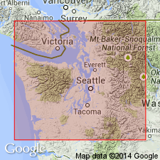
Unit is named the Puget group [probably named for Puget Sound]. "Formation is known to occupy a large part of Puget Sound basin and to extend upon the western flank of the Cascade range." p.443. Consists of "alternating beds of yellow and fine-grained sandstone and very fine arenaceous shales interstratified with many beds of carbonaceous shale and coal" [Willis, 1886], p.445. Section measured near town of Wilkeson give minimum thickness of 13,200 ft and maximum of 14,500 ft [Willis, 1888]. Overlies rocks of Late Cretaceous age. Twelve species of brackish-water mollusks, collected by Prof. J.S. Newberry from coal-bearing formation [Puget Group] in Puget Sound basin are listed [but no age is assigned].
Source: GNU records (USGS DDS-6; Menlo GNULEX).
- Usage in publication:
-
- Puget [group] formation*
- Modifications:
-
- Age modified
- Biostratigraphic dating
- Revised
- AAPG geologic province:
-
- Puget Sound province
Summary:
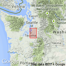
Consists of interbedded sandstones, shales and coal beds, 10,000 ft or more thick. Sandstone dominates and ranges from typical arkose to siliceous clay. Coal beds occur in lower 3000 ft. Detailed measured section for Carbon River near Carbonado divides [group] into (ascending); Carbonado (1255 ft thick), Wilkeson (1227 ft thick), and Burnett (2471 ft thick) formations; detailed measured section along South Prairie Creek shows Burnett as 7392 ft thick and Wilkeson as 879 ft thick. [Burnett was called Pittsburg formation by Willis (1898, opposite p.425)]. These units considered local divisions of Puget. Puget contains fresh or brackish water invertebrate fauna. F.H. Knowlton states number of flora species is 100. Puget shown on map as of Eocene age.
Source: GNU records (USGS DDS-6; Menlo GNULEX).
- Usage in publication:
-
- Puget Group*
- Modifications:
-
- Revised
- AAPG geologic province:
-
- Puget Sound province
Summary:
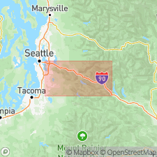
Group subdivided into three formations based on relative proportion of volcanic and nonvolcanic material. As thus defined in Tiger Mountain-Taylor Mountain upland, group includes (ascending) Tiger Mountain (new), Tukwila, and Renton Formations. Overlies Raging River Formation (new).
Source: GNU records (USGS DDS-6; Menlo GNULEX).
- Usage in publication:
-
- Puget Group*
- Modifications:
-
- Revised
- Overview
- Age modified
- Biostratigraphic dating
- AAPG geologic province:
-
- Puget Sound province
Summary:
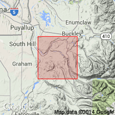
Puget Group is divided into (ascending): Carbonado, Northcraft, and Spiketon (new) Formations in Lake Tapps 15' quad. Historical overview of previous studies given. Puget Group of White (1888) and Willis (1898) is retained but extended to include thick wedge of volcanic rocks here correlated with Northcraft Formation of Snavely and others (1958). Carbonado Formation of Willis (1898) is redefined to include coal-bearing rocks underlying Northcraft. Spiketon includes upper 3600 ft of Willis' Burnett Formation. Wilkeson, Pittsburg, South Prairie, and Burnett Formations of Willis are abandoned. Fossil leaves collected during present investigation indicate that part of Puget in Lake Tapps 15' quad is middle Eocene to possibly Oligocene(?) age. [In his reference section of Kummerian Stage (Oligocene age), Wolfe (1968, p.8) includes uppermost 300 ft of Puget Group as exposed on Coal Creek, immediately north of Lake Tapps 15' quad.]
Source: GNU records (USGS DDS-6; Menlo GNULEX).
- Usage in publication:
-
- Puget Group*
- Modifications:
-
- Age modified
- Biostratigraphic dating
- Overview
- AAPG geologic province:
-
- Puget Sound province
Summary:
Puget Group, undivided in Green River area and as divided in Tiger Mountain-Taylor Mountain upland area into (ascending): Tiger Mountain, Tukwila, and Renton Formations, is described in detail. Lithology, clay-mineral constituents of samples, fossils, stratigraphic sections, and mapping included in this overview paper. Age of group is early Eocene to early Oligocene based on biostratigraphic dating.
Source: GNU records (USGS DDS-6; Menlo GNULEX).
- Usage in publication:
-
- Puget Group*
- Modifications:
-
- Geochronologic dating
- AAPG geologic province:
-
- Puget Sound province
Summary:
New K-Ar and fission-track ages from volcanic ash partings in coal beds of Eocene Puget Group of western WA indicate time span of about 45.0 +/-2.1 to 41.2 +/-1.8 Ma for 1890-m-section in Green River area. Report includes discussion of data inconsistencies for the type section of four paleobotanical stages within Green River area with same stages outside the area.
Source: GNU records (USGS DDS-6; Menlo GNULEX).
- Usage in publication:
-
- Puget Group*
Summary:
Not compiled to date. Publication available online: http://ngmdb.usgs.gov/Prodesc/proddesc_10042.htm
Puget Group. In this area includes (descending): Tukwila Formation and Tiger Mountain Formation. Age is Eocene.
Source: Publication.
- Usage in publication:
-
- Puget Group*
- Modifications:
-
- Age modified
- Areal extent
- AAPG geologic province:
-
- Puget Sound province
Summary:
Puget Group is extended into the Snoqualmie Pass 30' x 60' quad, WA. Age is revised everywhere from early, middle, and late Eocene to: middle and late Eocene [based on age revision of age of its Tiger Mountain Formation].
Source: GNU records (USGS DDS-6; Menlo GNULEX).
For more information, please contact Nancy Stamm, Geologic Names Committee Secretary.
Asterisk (*) indicates published by U.S. Geological Survey authors.
"No current usage" (†) implies that a name has been abandoned or has fallen into disuse. Former usage and, if known, replacement name given in parentheses ( ).
Slash (/) indicates name conflicts with nomenclatural guidelines (CSN, 1933; ACSN, 1961, 1970; NACSN, 1983, 2005, 2021). May be explained within brackets ([ ]).

