The National Geologic Map Database is migrating to a new infrastructure. We apologize for any service disruptions during this process.
|
|---|


- Usage in publication:
-
- Puente formation*
- Modifications:
-
- Original reference
- Dominant lithology:
-
- Shale
- Sandstone
- AAPG geologic province:
-
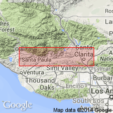
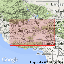
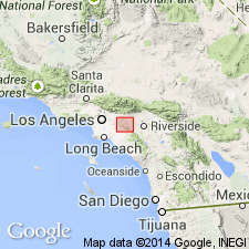
- Los Angeles basin
Summary:
Puente formation. Miocene deposits unconformably underlying Fernando formation in Puente Hills [southern part of Los Angeles County] and Los Angeles district, southern California. Consists of (descending):
Upper Puente shale, 800 to 2,000 feet. (Earthy chalk-like shale with a few beds of fine yellow ferruginous sandstone and quartzose calcareous concretions.) Resembles Monterey shale.
Puente sandstone, 300 to 2,000 feet. (Moderately coarse gray and yellow heavy-bedded sandstone separated by minor bands of organic siliceous shale.)
Lower Puente shale, 2,000 feet. (Chiefly earthy shale, but with minor members of siliceous nature, the whole gray or brown, from presence of iron and bitumen. Thin fine-grained sandstones interbedded from top to base, and lentils of gray limestone. This lowest rock exposed in Puente Hills.)
Is unconformably underlain by Fernando formation, and overlies, unconformably, pre-Cretaceous granite and schist. [Age is middle and late Miocene.]
Recognized in Puente Hills and Los Angeles district, southern CA.
Source: US geologic names lexicon (USGS Bull. 896, p. 1740-1741).
- Usage in publication:
-
- Puente formation*
- Modifications:
-
- Not used
- AAPG geologic province:
-
- Los Angeles basin
Summary:
Pl. 3. [According to W.S.W. Kew the Puente formation of Puente Hills corresponds to Modelo formation of USGS Bull. 753, and Puente formation of Los Angeles district corresponds to Modelo and underlying Topanga formation of Bull. 753.]
Source: US geologic names lexicon (USGS Bull. 896, p. 1740-1741).
- Usage in publication:
-
- Puente formation
- Modifications:
-
- Areal extent
- AAPG geologic province:
-
- Los Angeles basin
Summary:
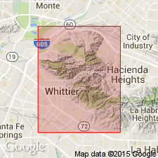
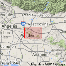
In Whittier Hills, [Los Angeles County], southern California, underlies Sycamore Canyon formation (new).
Source: US geologic names lexicon (USGS Bull. 1200, p. 3150-3151).
- Usage in publication:
-
- Puente(?) shale
- Modifications:
-
- Areal extent
- AAPG geologic province:
-
- Mojave basin
Summary:
Pg. 363 (fig. 150). A few small inliers of platy, siliceous, and finely laminated shale are exposed along southwest side of Chino fault in San Bernadino County, southern California; these are probable equivalents of [Eldridge and Arnold's] upper Puente shale and are divided into (ascending) Papel Blanco shale, Blanco sandstone, Cubierto shale, Hunter sandstone and conglomerate, Peculiar shale, and Mahala sandstone and conglomerate (all new). Age is late Miocene.
Source: Publication; US geologic names lexicon (USGS Bull. 1200, p. 3150-3151).
- Usage in publication:
-
- Puente formation
- Modifications:
-
- Revised
- AAPG geologic province:
-
- Los Angeles basin
- Mojave basin
Summary:
Pg. 515, 516-517 (fig. 2), 519-523. Puento formation. Described in Puente and San Jose Hills where it is divided into three unnamed members: lower of shale and sandstone, middle of sandstone, and upper of shale, conglomerate, and sandstone. Delimination of middle sandstone is key to threefold division. Thickness possibly 9,000 feet in Puente Hills; thinner in San Jose Hills. Krueger's (1943) subdivisions of upper Puente recognized in Slaughter Canyon in southeastern Puente Hills, between Chino and the Santa Ana River, San Bernardino County, southern California, and thicknesses measured. Overlain by sediments assigned to Repetto formation. In some areas, overlies Buzzard Peak conglomerate member (new) of Topanga formation. Age is late Miocene.
Source: US geologic names lexicon (USGS Bull. 1200, p. 3150-3151).
- Usage in publication:
-
- Puente formation*
- Modifications:
-
- Revised
- AAPG geologic province:
-
- Los Angeles basin
Summary:
Puente formation. In this report [northwestern Puente Hills, Los Angeles County, southern California], four divisions of Puente are recognized: lower siltstone member made up chiefly of interbedded siltstone and sandstone; sandstone member; upper siltstone member; and conglomeratic unit, Sycamore Canyon member. Krueger called this conglomeratic part of upper Puente the Sycamore Canyon formation. For purposes of this report, the unit is treated as local member of Puente because lower beds of conglomerate lens out within map area and in places interfinger with beds of upper siltstone member. Maximum thickness 8,500 feet or more. Underlies Repetto formation. Suggested that different plan of nomenclature for rocks herein assigned to the Puente may be desirable. [Age is late Miocene.]
Source: US geologic names lexicon (USGS Bull. 1200, p. 3150-3151).
- Usage in publication:
-
- Puente formation*
- Modifications:
-
- Revised
- AAPG geologic province:
-
- Los Angeles basin
- Salton basin
Summary:
Puente formation. Subdivided into (ascending) La Vida, Soquel, and Yorba (all new), and Sycamore Canyon members. Overlies El Modeno volcanics (new). On Burruel Ridge, Sycamore Canyon member is unconformably overlain by Repetto(?) formation. Late Miocene; correlative with Modelo formation of Santa Monica Mountains and with parts of Monterey formation.
Source: US geologic names lexicon (USGS Bull. 1200, p. 3150-3151).
- Usage in publication:
-
- Puente formation*
- Modifications:
-
- Areal extent
- AAPG geologic province:
-
- Los Angeles basin
Summary:
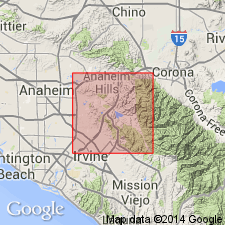
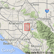
Pg. 326, pl. 46. In El Modeno area, strata of Puente formation rest with apparent conformity upon El Modeno volcanics. North of Santiago Creek and elsewhere strata overlap El Modeno volcanics, and Topanga, Vaqueros, and Sespe formations. Average thickness about 1,800 feet. In type area in Puente Hills, to northwest of El Modeno, formation reaches thickness of about 11,000 feet. Age is late Miocene.
Source: Publication; US geologic names lexicon (USGS Bull. 1200, p. 3150-3151).
For more information, please contact Nancy Stamm, Geologic Names Committee Secretary.
Asterisk (*) indicates published by U.S. Geological Survey authors.
"No current usage" (†) implies that a name has been abandoned or has fallen into disuse. Former usage and, if known, replacement name given in parentheses ( ).
Slash (/) indicates name conflicts with nomenclatural guidelines (CSN, 1933; ACSN, 1961, 1970; NACSN, 1983, 2005, 2021). May be explained within brackets ([ ]).