

- Usage in publication:
-
- Price River formation*
- Modifications:
-
- Original reference
- Dominant lithology:
-
- Sandstone
- AAPG geologic province:
-
- Uinta basin
- Paradox basin
Summary:
Pg. 445+. Price River formation of Mesaverde group. A succession of sandstones, grits, and conglomerates with a minor amount of shale. Thickness 900 to 1,000 feet. Includes Castlegate sandstone member (150 to 400 feet thick) at base. Is top formation of Mesaverde group in Wasatch Plateau and Book Cliffs. Unconformably underlies Wasatch formation and overlies (unconformably?) Blackhawk formation, of Mesaverde group. Age is Late Cretaceous.
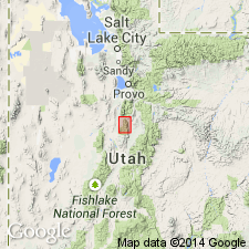
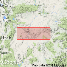
[Named from exposures in Price River Canyon, northwest of town of Castlegate (Castle Gate formerly at mouth of Willow Creek, Castle Gate 15-min quadrangle, 1916 ed., Carbon Co.), central eastern UT.]
[Additional locality information from USGS historical topographic map collection TopoView, accessed March 15, 2016.]
Source: US geologic names lexicon (USGS Bull. 1200, p. 1729).
- Usage in publication:
-
- Price River formation*
- Modifications:
-
- Revised
- AAPG geologic province:
-
- Paradox basin
Summary:
Is the upper formation of the Mesaverde group in report area which extends from Emery Co, UT in the Paradox basin to west border of Garfield Co, CO. Includes strata above the Blackhawk formation and beneath the Tuscher formation (new). Divided into (ascending): Castlegate sandstone, Sego sandstone (new), Neslen coal-bearing (new) and Farrer non-coal-bearing (new) members. The Castlegate and Sego are separated by the Buck tongue (new) of the Mancos shale. Five measured sections of Price River described (except for Farrer which was neither measured nor described in detail) that include information on the Neslen, Sego, and Castlegate. Is about 1,100 ft thick. Of Late Cretaceous age. Geologic maps.
Source: GNU records (USGS DDS-6; Denver GNULEX).
- Usage in publication:
-
- Price River formation*
- Modifications:
-
- Revised
- AAPG geologic province:
-
- Wasatch uplift
Summary:
As originally defined Price River included strata above Castlegate sandstone between Blackhawk formation and the lower member of the Wasatch formation. The former lower member of Wasatch is removed from the Wasatch and is renamed North Horn formation in this report. Is uniform in lithology. Partial measured section described. Crops out throughout Wasatch Plateau, Sanpete Co, UT on Wasatch uplift and adjoining areas. Divisible into Castlegate sandstone and upper members. Unconformably overlies Sixmile Canyon formation (new) of Indianola group (new). Underlies North Horn formation gradationally, a change from coarse-grained gray sandstone (Price River) to variegated beds (North Horn). Has a Montana or Late Cretaceous age. Contains freshwater mollusks and vertebrates (dinosaurs, crocodiles, etc). Fossils listed. Stratigraphic table.
Source: GNU records (USGS DDS-6; Denver GNULEX).
- Usage in publication:
-
- Price River formation*
- Modifications:
-
- Revised
- Areal extent
- AAPG geologic province:
-
- Wasatch uplift
- Paradox basin
Summary:
Occurs as a formation in the Mesaverde group in the Salina-Manti and Cedar Hills areas, Sanpete Co, UT on the Wasatch uplift, and on the eastern part of the Wasatch Plateau and western Book Cliffs, UT in the Paradox basin. Overlies Blackhawk formation and underlies North Horn formation on the Wasatch Plateau and Book Cliffs. Castlegate recognized as the basal member, Castlegate sandstone member, in both of the eastern areas. Farther eastward, however, in the central Book Cliffs, name Price River not used. Castlegate, Sego, Neslen, and Farrer, formerly assigned as members of Price River, are raised to formations of Mesaverde group. Of late Campanian and early Maestrichtian, Late Cretaceous age. Correlation chart.
Source: GNU records (USGS DDS-6; Denver GNULEX).
- Usage in publication:
-
- Price River formation
- Modifications:
-
- Areal extent
- AAPG geologic province:
-
- Great Basin province
Summary:
Pg. 120. Price River formation. Overlies South Flat formation (new) in northern part of Gunnison Plateau. Thins and disappears westward in Chicken Creek Canyon and North Maple Canyon
Source: GNU records (USGS DDS-6; Denver GNULEX).
- Usage in publication:
-
- Price River formation
- Modifications:
-
- Revised
- AAPG geologic province:
-
- Piceance basin
- Uinta basin
- Paradox basin
Summary:
Tongues eastward into tongues of Mancos shale. In the western Book Cliffs, Carbon Co, UT in the Uinta basin, Price River formation is divided into the basal Castlegate member (formerly Castlegate sandstone member) and overlying unnamed shale, sandy shale, and lenses of sandstone. Castlegate thins east to 0 at West Salt Creek, Garfield Co, CO in the Piceance basin. East of Thompsons, Grand Co, UT near the CO border and eastward to Cameo on the Colorado River, Mesa Co, CO, the Price River is divided (ascending) into the Castlegate member, Sego member (formerly Sego sandstone member), Corcoran (new), Cozzette (new), and Cameo (new) members. The western Price River--generally between Castlegate and Thompsons--is in the non-coal-bearing or Farrer facies (formerly Farrer member of Price River). The eastern Price River--generally between Thompsons and Cameo--is in the coal-bearing or Neslen facies (formerly Neslen member of Price River). Price River used as a formation name regionally replacing use of "Mt. Garfield and Hunter Canyon formations" in CO. Is 1000 to 2000 ft thick in western Book Cliffs and 1000 to 2500 ft thick in eastern Book Cliffs, CO. Is Late Cretaceous age--Maestrichtian, or Campanian and Maestrichtian. Cross sections.
Source: GNU records (USGS DDS-6; Denver GNULEX).
- Usage in publication:
-
- Price River formation*
- Modifications:
-
- Revised
- AAPG geologic province:
-
- Paradox basin
Summary:
Sego sandstone member removed as basal member of Price River and raised to formation rank as a unit above the Buck tongue of the Mancos shale and beneath the Neslen formation in the central Book Cliffs, east of the Green River, UT in the Paradox basin, and as a unit above the Anchor Mine tongue of the Mancos shale and beneath the Mount Garfield in eastern Book Cliffs, Garfield and Mesa Cos, CO in the Piceance basin. Price River used with Bluecastle sandstone member at top west of Green River in western Book Cliffs, and as equivalent to Neslen and Mount Garfield. Fresh-water fossils listed. Of Late Cretaceous age. Two measured sections described. Composed of gray and buff sandstone, and gray shale up to 530 ft thick. Sandstone beds are locally thick and cliff-forming. Columnar sections.
Source: GNU records (USGS DDS-6; Denver GNULEX).
- Usage in publication:
-
- Price River Formation*
- Modifications:
-
- Age modified
- AAPG geologic province:
-
- Uinta basin
Summary:
Age changed from Late Cretaceous to Late Cretaceous to Paleocene? in Uinta basin. Late Cretaceous designation based on dinosaur fossils. Paleocene age based on mammalian fauna. [Author included a "conglomeratic facies" or conglomerate beds in his map unit that are not part of the Price River according to many authors. The age of the Price River is only Late Cretaceous.]
Source: GNU records (USGS DDS-6; Denver GNULEX).
- Usage in publication:
-
- Price River Formation
- Modifications:
-
- Areal extent
- AAPG geologic province:
-
- Wasatch uplift
Summary:
The conglomerate exposed in Red Narrows Canyon which was mapped as Red Narrows facies of North Horn Formation by Merrill (1972) and as part of Price River Formation by Spieker (1946) is named Red Narrows Conglomerate. The newly named conglomerate extends at least 10 mi south and 5 mi east of quad. Lower member of Red Narrows intertongues with upper part of Price River. Geologic map. Cross section. Price River is an Upper Cretaceous unit.
Source: GNU records (USGS DDS-6; Denver GNULEX).

- Usage in publication:
-
- Price River Formation*
- Modifications:
-
- Revised
- Age modified
- Overview
- AAPG geologic province:
-
- Wasatch uplift
- Paradox basin
Summary:
Is a unit of late Campanian age. Palynomorphs identified in NW1/4 NW1/4 sec 32, T18S, R3E, Sanpete Co on the Wasatch uplift; in NW1/4 sec 32, T17S, R6E, Emery Co in the Paradox basin; and sec 22, T12S, R9E, Carbon Co in the Uinta basin. Bluecastle Sandstone Member removed from Price River and placed in the Castlegate Sandstone as the Bluecastle Tongue.
Source: GNU records (USGS DDS-6; Denver GNULEX).
- Usage in publication:
-
- Price River Formation*
- Modifications:
-
- Overview
- AAPG geologic province:
-
- Paradox basin
Summary:
Tertiary-Cretaceous boundary placed above a bleached zone, a distinctive, well-developed, easily recognized, and readily traceable zone of kaolinite-rich beds. Rocks west of Desolation Canyon above the bleached zone assigned to the Paleocene North Horn Formation and Flagstaff Member of Green River Formation undivided. This zone is recognized also in Piceance basin, CO, between the Upper Cretaceous Ohio Creek Member of Mesaverde Formation, or Ohio Creek Member of Hunter Canyon Formation of Mesaverde Group, and the overlying Paleocene and Eocene Wasatch Formation. Underlying Upper Cretaceous rocks belong to Price River Formation of Mesaverde Group. Bluecastle Sandstone Member assigned to Price River. Bluecastle mapped undivided with mudstone member of Price River west of Desolation Canyon, Emery Co, UT, Paradox basin. Price River divided into upper part, Bluecastle, and mudstone member in lower part. Flagstaff and Price River mapped in northeast corner of map area south of the Roan Cliffs, Emery Co, UT in Paradox basin. Rocks east of Desolation Canyon above the bleached zone assigned to Paleocene North Horn Formation and Flagstaff Member of Green River Formation. Underlying rocks assigned to Upper Cretaceous Tuscher Formation of Mesaverde Group. Tuscher mapped along east-central edge of map.
Source: GNU records (USGS DDS-6; Denver GNULEX).
- Usage in publication:
-
- Price River Formation*
- Modifications:
-
- Not used
Summary:
Name not applied to conglomerate units at the base of the section in the San Pitch Mountains, UT on the Wasatch uplift. The conglomerates formerly included in Price River are reassigned to the basal North Horn. The reason for reassignment are: 1.) the lithology of the conglomerates in the San Pitch Mountains is different from conglomerates at the type exposures of Price River in the northeast Wasatch Plateau; 2.) the outcrops in the San Pitch Mountains are not continuous with and therefore not traceable into those at the type Price River; and 3.) conglomerates in the southwest San Pitch Mountains that have been assigned to the Price River are not continuous with the basal conglomerates of the North Horn along the eastern range front.
Source: GNU records (USGS DDS-6; Denver GNULEX).
For more information, please contact Nancy Stamm, Geologic Names Committee Secretary.
Asterisk (*) indicates published by U.S. Geological Survey authors.
"No current usage" (†) implies that a name has been abandoned or has fallen into disuse. Former usage and, if known, replacement name given in parentheses ( ).
Slash (/) indicates name conflicts with nomenclatural guidelines (CSN, 1933; ACSN, 1961, 1970; NACSN, 1983, 2005, 2021). May be explained within brackets ([ ]).