


- Usage in publication:
-
- Presumpscot formation
- Modifications:
-
- Named
- Dominant lithology:
-
- Clay
- Silt
- AAPG geologic province:
-
- New England province
Summary:
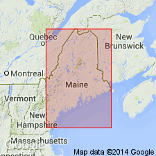
Named Presumpscot formation for the valley of the Presumpscot River in cities of Portland and Westbrook, ME. Consists of marine silty clay. Thickness is 0 to 110 ft and changes rapidly within short distances as formation was deposited on surface of considerable relief. Unit overlies bedrock, till, or stratified drift. The Presumpscot is of late Pleistocene age.
Source: GNU records (USGS DDS-6; Reston GNULEX).
- Usage in publication:
-
- Presumpscot Formation*
- Modifications:
-
- Overview
- Age modified
- AAPG geologic province:
-
- New England province
Summary:
Presumpscot Formation is term used for glaciomarine mud in coastal ME. Correlates with Emerald Silt in the eastern Gulf of Maine and an unnamed unit in western Gulf of Maine. Deposition began 18 ka and continued until 12 ka. This disagrees with the 38 ka age assigned by King and Fader (1986: G. S. CAN Bull. 363). Presumpscot is clearly shallow-water, nearshore glaciomarine mud deposited close to source.
Source: GNU records (USGS DDS-6; Reston GNULEX).

- Usage in publication:
-
- Presumpscot Formation*
- Modifications:
-
- Overview
- AAPG geologic province:
-
- New England province
Summary:
The Presumpscot Formation in NH consists of two facies. The lower facies is a clayey silt to silty clay, locally with silt and fine sand beds; thickness is not well known, but may be as much as 20 feet. The upper facies is a fine to coarse sand, locally containing small pebbles and may contain thin beds of silt and clayey silt; thickness is as much as 60 ft. The upper facies generally intertongues seaward, and in places downward, with the lower facies. Unit is of Pleistocene age.
Source: GNU records (USGS DDS-6; Reston GNULEX).
For more information, please contact Nancy Stamm, Geologic Names Committee Secretary.
Asterisk (*) indicates published by U.S. Geological Survey authors.
"No current usage" (†) implies that a name has been abandoned or has fallen into disuse. Former usage and, if known, replacement name given in parentheses ( ).
Slash (/) indicates name conflicts with nomenclatural guidelines (CSN, 1933; ACSN, 1961, 1970; NACSN, 1983, 2005, 2021). May be explained within brackets ([ ]).