- Usage in publication:
-
- Preston limestone member
- Modifications:
-
- Original reference
- Dominant lithology:
-
- Limestone
- AAPG geologic province:
-
- Forest City basin
Summary:
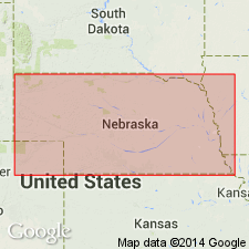
Pg. 16, 26, 28. Preston limestone member of Nemaha formation. In Missouri River section between La Platte, Nebraska, and Charleston Creek, Kansas, Preston limestone is hard, massive, bluish, breaks into box-like blocks, and is 2.5 to 3 feet thick. In Big Nemaha Valley section, Nebraska, it consists of several limestones separated by shale; is light-colored, also bluish, brownish; includes hard and massive beds; thickness 4 to 11 feet. Separated from overlying Tarkio limestone by 50 feet of shale with thin limestones, and from underlying Fargo limestone [Wakarusa limestone] by 14 to 34 feet of shale.
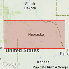
Type locality: near level of railroad at bridge west of Preston, Richardson Co., southeastern NE.
Source: US geologic names lexicon (USGS Bull. 896, p. 1728-1729); GNC KS-NE Pennsylvanian Corr. Chart, sheet 1, Oct. 1936.
- Usage in publication:
-
- Preston limestone†
- Modifications:
-
- Abandoned
Summary:
Pg. 60, 63. "Preston" limestone is now known to be Emporia limestone; the latter name has priority.
Source: US geologic names lexicon (USGS Bull. 896, p. 1728-1729).
- Usage in publication:
-
- Preston limestone†
- Modifications:
-
- Abandoned
Summary:
Pg. 96. Abandoned Preston limestone. Used Emporia limestone, as did Condra and Moore in their Oct. 1932 revised chart of Permian and Pennsylvanian rocks of Kansas and Nebraska. But Condra (1935, Nebraska Geol. Survey Paper, no. 8, p. 10) discarded Emporia for Preston. (Emporia limestone in medial part of Wabaunsee group in upper part of Virgil series.)
Source: US geologic names lexicon (USGS Bull. 896, p. 1728-1729); GNC KS-NE Pennsylvanian Corr. Chart, sheet 2, Oct. 1936.
- Usage in publication:
-
- Preston ("Emporia") limestone formation
- Modifications:
-
- Reinstated
- AAPG geologic province:
-
- Forest City basin
- Nemaha anticline
Summary:
Preston ("Emporia") limestone formation of Nemaha subgroup [informal] of Wabaunsee group. Thickness 9 to 11 feet. Includes the following members (descending): Elmont limestone, 2 to 5 feet; Harveyville shale, 3 to 7 feet; Reading limestone, 3+/- feet. Age is Late Pennsylvanian (Virgil).
["Subgroup" not recognized as a formal stratigraphic rank term (CSN, 1933; ACSN, 1961, 1970; NACSN, 1983, 2005, 2021). Considered informal and should not be capitalized.]
Source: GNC KS-NE Pennsylvanian Corr. Chart, sheet 2, Oct. 1936.

- Usage in publication:
-
- Preston limestone†
- Modifications:
-
- Abandoned
Summary:
Pg. 224-226. Discarded both Emporia and Preston and treated their named subdivisions (Reading limestone, Harveyville shale, and Elmont limestone) as formations [of Wabaunsee group].
Source: US geologic names lexicon (USGS Bull. 896, p. 1729); GNC KS-NE Pennsylvanian Corr. Chart, sheet 2, Oct. 1936.
- Usage in publication:
-
- Preston limestone†
- Modifications:
-
- Abandoned
Summary:
Pg. 45. Preston limestone formation was named to include 2 limestones separated by a shale. This formation lies between the Willard and Auburn shales. When it was found that these beds represent the "Emporia" of older Kansas surveys, the Nebraska State Geol. Survey accepted and used name Emporia for a few years, that is, until it was discarded by Moore (1936, Kansas Geol. Survey Bull. 22), when he revived names Elmont and Reading, gave the name Harveyville to shale located between these limestones, and ranked the 3 divisions each as formations. Although the authors [Condra and Reed] believe that these units represent only members of the Preston limestone their formational rank is accepted, and name Preston limestone is dropped.
Source: US geologic names lexicon (USGS Bull. 1200, p. 3131-3132).
For more information, please contact Nancy Stamm, Geologic Names Committee Secretary.
Asterisk (*) indicates published by U.S. Geological Survey authors.
"No current usage" (†) implies that a name has been abandoned or has fallen into disuse. Former usage and, if known, replacement name given in parentheses ( ).
Slash (/) indicates name conflicts with nomenclatural guidelines (CSN, 1933; ACSN, 1961, 1970; NACSN, 1983, 2005, 2021). May be explained within brackets ([ ]).

