

- Usage in publication:
-
- Potterchitto member
- Modifications:
-
- Named
- Dominant lithology:
-
- Greensand
- Sand
- AAPG geologic province:
-
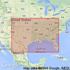
- Mid-Gulf Coast basin
Thomas, E.P., 1942, The Claiborne: Mississippi Geological Survey Bulletin, no. 48, 96 p.
Summary:
Potterchitto defined as middle member of Wautubbee formation in eastern MS. Lithology varies. Contains all gradations from greensand to nonglauconitic sand. Sands range from calcareous and marly to noncalcareous and from highly fossiliferous to nonfossiliferous. Contains pellets, partings, interbeds, and lenses of carbonaceous clay and shale. Bentonite and bentonic clay are present locally. Earthy siderite is common. Thickness 36 ft at type section. Overlies Archusa member (new) with conformable and gradational contact; underlies Gordon Creek shale member (new) with conformable and sharply defined contact. Age is Eocene.
Source: GNU records (USGS DDS-6; Reston GNULEX).
- Usage in publication:
-
- Potterchitto member*
- Modifications:
-
- Revised
- AAPG geologic province:
-
- Mid-Gulf Coast basin
Summary:
Potterchitto member assigned to Cook Mountain formation. [Age is Eocene.]
Source: US geologic names lexicon (USGS Bull. 1200, p. 3117).
- Usage in publication:
-
- Potterchitto Member
- Modifications:
-
- Overview
- AAPG geologic province:
-
- Mid-Gulf Coast basin
Summary:
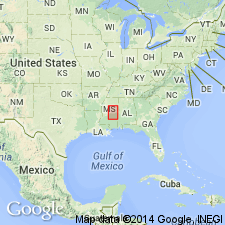
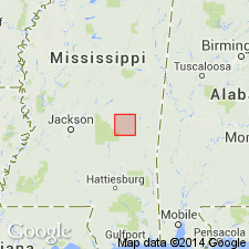
Cook Mountain Formation of Claiborne Group in Newton Co., MS, is mapped as a single unit, but two of its members are discussed in the text. The Archusa Marl Member is not recognized either at the surface or in the subsurface. The Potterchitto is well exposed at NE1/4NW1/4NE1/4 sec. 26, T6N, R11E. Unit is characteristically light- to brownish-gray, silty, clayey, glauconitic, calcareous, fossiliferous, bioturbated sand, with discontinuous sandstone and siltstone ledges as well as ironstone concretions. Burrows are well preserved in lithified zones. Flabellum, Turritella, C. Sellaeformis, and various bivalves abundant in lower portion. In the subsurface, Member is composed of light-gray to pale yellowish-brown, very fine- to very coarse-grained, silty, clayey, calcareous, glauconitic, fossiliferous sand, with appreciable amounts of carbonaceous clay. Thickness varies from 35 ft to 78 ft. Potterchitto disconformably overlies the Kosciusko Formation and conformably underlies the Gordon Creek Shale Member of the Cook Mountain. Unit is interpreted as marine shelf sediments. Age is Eocene. Geologic map. Measured section. Stratigraphic column.
Source: GNU records (USGS DDS-6; Reston GNULEX).
For more information, please contact Nancy Stamm, Geologic Names Committee Secretary.
Asterisk (*) indicates published by U.S. Geological Survey authors.
"No current usage" (†) implies that a name has been abandoned or has fallen into disuse. Former usage and, if known, replacement name given in parentheses ( ).
Slash (/) indicates name conflicts with nomenclatural guidelines (CSN, 1933; ACSN, 1961, 1970; NACSN, 1983, 2005, 2021). May be explained within brackets ([ ]).