

- Usage in publication:
-
- Potosi limestone
- Modifications:
-
- Original reference
- Dominant lithology:
-
- Limestone
- AAPG geologic province:
-
- Ozark uplift
Summary:
Pg. 331, 351, 355. Potosi limestone. Limestone containing chert and drusy quartz, constituting country rock about Potosi, Missouri. Underlies Crystal City [St. Peter] sandstone and overlies St. Joseph limestone. Is upper part of St. Francois limestone. [This definition was followed by Winslow, 1895 (Amer. Geol., v. 15, p. 81-89). In 1896 (USGS Bull. 132) he gave thickness of his Potosi limestone as 270 feet. This is a broad use of Potosi, corresponding to Potosi group of Bain and Ulrich, 1905.]
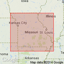
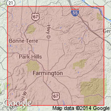
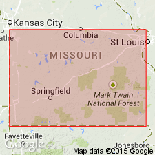
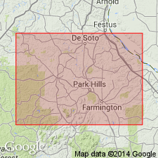
[Named from Potosi, Potosi 7.5-min quadrangle, Washington Co., eastern MO.]
Source: US geologic names lexicon (USGS Bull. 896, p. 1714-1715).
- Usage in publication:
-
- Potosi limestones
- Modifications:
-
- Revised
- AAPG geologic province:
-
- Ozark uplift
Summary:
Pg. 358. Divided the rocks unconformably above Bonneterre limestone in St. Francois County, Missouri, as follows (descending): (1) Potosi Residuary, 100 feet; (2) Potosi limestones, 350 feet, consisting of cherty limestone at top, drusy quartz in middle, and shaly limestone at base; (3) Potosi slates and conglomerates, 106 feet. [Age is Late Cambrian.]
Source: US geologic names lexicon (USGS Bull. 896, p. 1714-1715).

- Usage in publication:
-
- Potosi [formation]
- Modifications:
-
- Incidental mention
- AAPG geologic province:
-
- Ozark uplift
Summary:
Potosi underlies Proctor and overlies Doe Run. [Age is Late Cambrian.]
Source: Publication; US geologic names lexicon (USGS Bull. 896, p. 1714-1715).
- Usage in publication:
-
- Potosi formation
- Modifications:
-
- Areal extent
- AAPG geologic province:
-
- Ozark uplift
Summary:
Pg. 286. Potosi underlies Eminence and unconformably overlies Doe Run (top division of Elvins). [Age is Late Cambrian.]
Source: US geologic names lexicon (USGS Bull. 896, p. 1714-1715).
- Usage in publication:
-
- Potosi formation
- Modifications:
-
- Revised
- AAPG geologic province:
-
- Ozark uplift
Summary:
Potosi formation. Restricted to the siliceous cherty and drusy dolomite, 300 feet thick, underlying Eminence formation and unconformably(?) overlying Doerun formation (upper part of Elvins formation of Ulrich). Consists of massive dolomite and thick chert alternating. [This is accepted definition of Potosi limestone in subsequent reports of Missouri geologists, and is the one followed by the USGS, which now [ca. 1936] classifies the formation as Upper Cambrian.]
Source: US geologic names lexicon (USGS Bull. 896, p. 1714-1715).

- Usage in publication:
-
- Potosi Dolomite
- Modifications:
-
- Overview
- AAPG geologic province:
-
- Illinois basin
Summary:
Potosi Dolomite of Knox Dolomite Megagroup underlies essentially all of IL except in parts of northern IL where it was truncated by sub-Tippecanoe unconformity. Exposed in Oregon and Ashton areas in Ogle and Lee Cos. where it is generally overlain by St. Peter Sandstone. One exposure in Lee Co., 4 mi south of Rochelle, Ogle Co., shows Potosi overlain by Oneota Dolomite. Consists of brown to pinkish-gray, finely crystalline, pure to slightly argillaceous dolomite that is very slightly glauconitic at the top and glauconitic and sandy at base. Drusy quartz covers surfaces of small cavities in most areas and characterizes Potosi in both outcrop and well samples. Ranges from 100 ft thick in northern IL to more than 300 ft thick in southern IL. In southern two-thirds of IL, conformably overlies Franconia Formation and underlies Eminence Formation above, but in wide areas of northern IL, is unconformably overlain by St. Peter Sandstone. Locally over Ashton Arch, Eminence is absent and Oneota overlies Potosi. Contains algal domes and rare trilobite and gastropod remains. Equivalent to St. Lawrence Dolomite in MI,MN, and WI, and to Trempealeau Dolomite in Indiana. Age is Late Cambrian (Trempealeauan).
Source: GNU records (USGS DDS-6; Reston GNULEX).

- Usage in publication:
-
- Potosi Formation*
- Modifications:
-
- Areal extent
- AAPG geologic province:
-
- Illinois basin
- Ozark uplift
Summary:
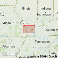
Potosi Formation of Late Cambrian (Croixan) age is found in subsurface of MO and IL in St. Louis area.
Source: GNU records (USGS DDS-6; Reston GNULEX).
- Usage in publication:
-
- Potosi Dolomite*
- AAPG geologic province:
-
- Ozark uplift
Summary:
Cambrian (Croixan) Potosi Dolomite is found in outcrop on Ozark dome in MO and in subsurface of IL and KY. Assigned to Knox Group in IL and KY. Difficult to differentiate it from Derby and Doe Run Formations below and Eminence Formation above.
Source: GNU records (USGS DDS-6; Reston GNULEX).
For more information, please contact Nancy Stamm, Geologic Names Committee Secretary.
Asterisk (*) indicates published by U.S. Geological Survey authors.
"No current usage" (†) implies that a name has been abandoned or has fallen into disuse. Former usage and, if known, replacement name given in parentheses ( ).
Slash (/) indicates name conflicts with nomenclatural guidelines (CSN, 1933; ACSN, 1961, 1970; NACSN, 1983, 2005, 2021). May be explained within brackets ([ ]).