

- Usage in publication:
-
- Pope Megagroup
- Modifications:
-
- Named
- Dominant lithology:
-
- Sandstone
- Shale
- Limestone
Summary:
Pg. 471-483. Pope Megagroup. Name proposed for sequence of alternating sandstone-and-shale and limestone-and-shale formations of later Meramecian and Chesterian age that lie above Mammoth Cave Megagroup (new) and that are overlain by Pennsylvanian and younger rocks. In general, includes those rocks which in early reports were assigned to Kaskaskia, Huron, or Chester Groups in different areas. Kaskaskia and Huron have been abandoned in this sense, and both are used in current stratigraphic literature for entirely different units. Chester is now used almost entirely in a time-stratigraphic sense. Base of megagroup has been described as upper surface of Mammoth Cave Megagroup. The Pope is truncated by sub-Absaroka or "pre-Pennsylvanian" unconformity, though there may be no unconformity at places in southern Midcontinent basins, Black Warrior basin, and southern Appalachians. Has discontinuous distribution. In Illinois basin thickens from featheredge at north to about 1,300 feet at south. Megagroup may be useful in Black Warrior basin where its base is younger toward east and in Appalachian basin where its base is younger toward south. In Appalachians carbonate components pinch out northeastward, and megagroup is replaced by nonmarine red beds of Mauch Chunk. Term "megagroup" is proposed as formal designation for rock-stratigraphic unit larger than group. Although comparable in size with series and systems, megagroups are defined in terms of lithology and transect boundaries of units that are based on time of deposition. ["Megagroup" not recognized as a formal stratigraphic rank term (ACSN, 1961, 1970; NACSN, 1983, 2005, 2021). Considered informal. The rank or lithologic term should not be capitalized.]
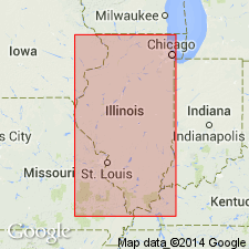
Named for Pope Co., southern IL.
Source: US geologic names lexicon (USGS Bull. 1350, p. 591).
- Usage in publication:
-
- Pope Megagroup
- Modifications:
-
- Overview
- AAPG geologic province:
-
- Illinois basin
Summary:
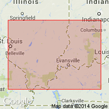
Described as sequence of alternating clastic and limestone units of late Valmeyeran and Chesterian age overlying the Mammoth Cave Limestone Megagroup and underlying the Pennsylvanian in the central United States. The base of the megagroup is placed at the base of the lowest well-developed clastic unit in any area. It is at the base of the Fredonia, Spar Mountain, Aux Vases, Sample or Cypress, and Big Clifty in different parts of the Illinois basin, and at older or younger horizons elsewhere. The megagroup is the rock-stratigraphic, as opposed to the time-stratigraphic, component of the early concept of the Chester Group.
Source: GNU records (USGS DDS-6; Reston GNULEX).
- Usage in publication:
-
- Pope Group
- Modifications:
-
- Revised
- Reinstated
- AAPG geologic province:
-
- Illinois basin
Summary:
Pg. 7; Weibel and others, 1991, Illinois Geol. Survey Geol. Quad. Ser. IGQ-8. Pope Group (revised). Fine-grained clastics and limestones. Rank reduced from megagroup; includes Chesterian strata from base of Aux Vases Sandstone to top of Kinkaid Formation. Upper part of group, from Haney Limestone Member of Golconda Formation through Kinkaid, exposed in Waltersburg quadrangle, Pope County, southeastern Illinois (Weibel and others, 1991), thickness about 1,425 feet. Lower part of group, 384 feet, recognized in subsurface, in the C.E. Williams Company Austin Roberts No. 1 well, in [NE/4 NW/4 NE/4 SE/4] sec. 10, T. 13 S., R. 6 E., in southeastern part of quadrangle. Occurs above Ste. Genevieve(?) Limestone (basal Chesterian) and below Caseyville Formation (Lower Pennsyvlanian, Morrowan). Age is Late Mississippian (Chesterian).
Source: Publication.
For more information, please contact Nancy Stamm, Geologic Names Committee Secretary.
Asterisk (*) indicates published by U.S. Geological Survey authors.
"No current usage" (†) implies that a name has been abandoned or has fallen into disuse. Former usage and, if known, replacement name given in parentheses ( ).
Slash (/) indicates name conflicts with nomenclatural guidelines (CSN, 1933; ACSN, 1961, 1970; NACSN, 1983, 2005, 2021). May be explained within brackets ([ ]).