

- Usage in publication:
-
- Pony Express limestone
- Modifications:
-
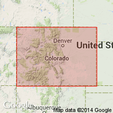
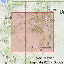
- Areal extent
- Dominant lithology:
-
- Limestone
- AAPG geologic province:
-
- San Juan Mountains province
Summary:
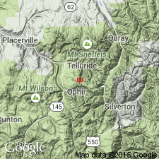
Pg. 56. [Black Girl and Pony Express limestone is shown as basal bed of McElmo formation in section of Gold Hill, Ouray district, southwestern Colorado. Age is Late Jurassic.]
Source: US geologic names lexicon (USGS Bull. 896, p. 1699).
- Usage in publication:
-
- Pony Express beds*
- Modifications:
-
- Principal reference
- Dominant lithology:
-
- Shale
- Limestone
- Gypsum
- AAPG geologic province:
-
- San Juan Mountains province
Summary:
Pg. 151-232. "Pony Express beds." An important ore-bearing horizon forming basal part of Wanakah shale member of Morrison formation in Ouray district, southwestern Colorado. Consists of shale, limestone, and breccia, 1 to 70 feet thick. Separates "Upper La Plata" of Cross from "Lower La Plata." Commonly known to miners as "Pony Express limestone" and "Pony Express contact," from its occurrence in Pony Express mine. [Age is Late Jurassic.]
[Abandoned as formal name.]
Source: US geologic names lexicon (USGS Bull. 896, p. 1699).
- Usage in publication:
-
- Pony Express limestone member*
- Modifications:
-
- Revised
- Redescribed
- Dominant lithology:
-
- Limestone
- AAPG geologic province:
-
- San Juan basin
- Paradox basin
Summary:
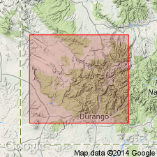
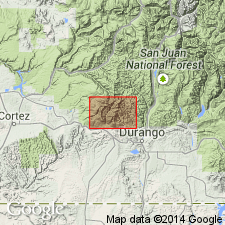
Removed from Wanakah shale member of Morrison formation, and raised in stratigraphic rank from Pony Express beds of Wanakah to Pony Express limestone member and reassigned as basal member of the Morrison. Measured sections near Animas Durango], La Plata Co, CO in the San Juan basin and on San Miguel River opposite Bilk Creek, San Miguel Co, CO in the Paradox basin. Was measured in sections along the San Miguel River, San Miguel Co, and at Uravan, Montrose Co, in the Paradox basin. Is a dark gray to black, discontinuous, bituminous limestone. The limestone is replaced locally by gypsum or limestone breccia. Has a maximum known thickness of 15 ft. Overlies Entrada sandstone; underlies Bilk Creek sandstone member (new) of Morrison. Assigned to the Late Jurassic. May be equivalent to Curtis formation.
Source: GNU records (USGS DDS-6; Denver GNULEX).
- Usage in publication:
-
- Pony Express limestone member*
- Modifications:
-
- Revised
- AAPG geologic province:
-
- San Juan basin
- Paradox basin
Summary:
Reassigned from Morrison formation to Wanakah formation as its basal member. Overlies Entrada sandstone. Underlies Bilk Creek sandstone member (formerly a member of Morrison formation) which is reassigned to Wanakah as its middle member. Nomenclature chart. Is a very distinctive, easily recognized marker and a very thin (6 in to 30 ft, averages 3 ft) dark-blue to gray to black limestone. Occurs as a single massive bed or as three or more beds. Has a fetid odor. Measured section 4 ft thick described. Wanakah mapped (geologic map) as an undivided unit along east edge, along southwest and west part of area in La Plata Co, CO in the San Juan basin and Montezuma Co, CO in the Paradox basin. Assigned to the Late Jurassic.
Source: GNU records (USGS DDS-6; Denver GNULEX).
- Usage in publication:
-
- Pony Express Limestone Member*
- Modifications:
-
- Overview
- AAPG geologic province:
-
- San Juan Mountains province
- San Juan basin
Summary:
Is a member of the Middle Jurassic Wanakah Formation in southwest CO, San Juan basin and San Juan Mountain province, that correlates with Todilto Limestone Member (reduced in rank) of the Wanakah of NM, San Juan basin and AZ, Black Mesa basin. Basal contact of Wanakah is placed consistently at the base of the same bed throughout basin. CO-NM state line is the arbitrary dividing line for the two limestone members. Deposited in Todilto-Pony Express basin in which the basal unit is a gray laminated structureless limestone that is overlain toward east (fig 5) by white gypsum (at or near surface) and anhydrite (mostly in the subsurface) that grades laterally into calcareous sandstone and siltstone of the Beclabito Member (new) of the Wanakah.
Source: GNU records (USGS DDS-6; Denver GNULEX).
- Usage in publication:
-
- Pony Express Limestone Member*
- Modifications:
-
- Areal extent
- Reference
- AAPG geologic province:
-
- Paradox basin
- San Juan Mountains province
- Piceance basin
Summary:
Recognized as basal member of Wanakah Formation of San Rafael Group in report area of southwest CO from Bilk Creek, San Miguel Co in the Paradox basin north to Ouray in Ouray Co, San Juan Mountain province, Black Canyon of the Gunnison in Montrose Co, Paradox basin to Red Canyon, Delta Co in the Piceance basin. Areal extent map shows distribution of gypsum and extent of member. Increases in thickness southward from 2-3 ft thick in Black Canyon to 11-20 ft thick near Telluride, and 59 ft thick near Ouray. Though primarily a dark-gray to black limestone, the member also includes a sedimentary breccia of bits of limestone, shale and siltstone, and locally gypsum. Breccia probably formed as a result of the dissolving gypsum. An equivalent of Pony Express is recognized north of Red Canyon. An equivalent is a tan, fine-grained, flat-bedded, water-laid sandstone deposited at the periphery of the member. Is of Callovian, Middle Jurassic age. Cross sections. Overlies Entrada Sandstone of San Rafael Group. Underlies Bilk Creek Sandstone Member of Wanakah. Nomenclature chart. Reference section 3.8 ft thick designated and measured on east-facing cliffs bordering the Gunnison River western Black Canyon, Montrose Co.
Source: GNU records (USGS DDS-6; Denver GNULEX).
For more information, please contact Nancy Stamm, Geologic Names Committee Secretary.
Asterisk (*) indicates published by U.S. Geological Survey authors.
"No current usage" (†) implies that a name has been abandoned or has fallen into disuse. Former usage and, if known, replacement name given in parentheses ( ).
Slash (/) indicates name conflicts with nomenclatural guidelines (CSN, 1933; ACSN, 1961, 1970; NACSN, 1983, 2005, 2021). May be explained within brackets ([ ]).