

- Usage in publication:
-
- Poleslide member
- Modifications:
-
- Named
- Dominant lithology:
-
- Clay
- Ash
- AAPG geologic province:
-
- Chadron arch
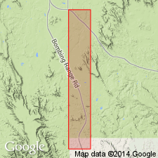
Summary:
Named as upper member of Brule formation of White River group. Source of geographic name not stated. Standard section designated and measured in NW1/4 sec 23, T43N, R44W, 8 1/2 mi south of Scenic and on rim of Sheep Table Mountain, Shannon Co, SD on the Chadron arch. [Extent into Williston basin not stated.] Formerly called PROTOCERAS OR LEPTAUCHENIA beds. Divided in measured standard section into: 1) lower zone, a 103 ft unit of gray clay; 2) middle zone, a 111 ft unit of buff and gray clay with channel sandstones at several levels in upper 40 ft, fossiliferous; and 3) upper zone of gray silty ash that has horizontal bedding and weathers into vertical walls or columns. Overlies upper nodular zone of Scenic member of Brule. Underlies Arikaree formation. Middle zone has LEPTAUCHENIA nodules. Oligocene age.
Source: GNU records (USGS DDS-6; Denver GNULEX).
- Usage in publication:
-
- Poleslide member
- Modifications:
-
- Overview
- AAPG geologic province:
-
- Williston basin
- Sioux uplift
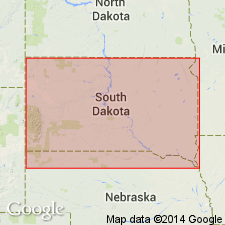
Summary:
The Oligocene Brule Formation in the Williston basin and Sioux uplift that includes Scenic Member (early late Oligocene) at base and Poleslide member (mid-late Oligocene) at top. Base of Scenic placed at top of paleosol on the prominent calcareous claystone breccia of the underlying Chadron. Scenic is a cliff-former characterized by alternating red siltstone and white sandstone and by paleosols. Poleslide has steep, runneled, orange and brown banded slopes, and paleosols studded with round, calcareous nodules. Sandstone in both members forms hoodoos. Each member has channel sandstones and numerous paleosols. Scenic is a near-stream deposit; Poleslide accumulated on a flat, featureless landscape with a savanna vegetation. The climate was semiarid in Brule time.
Source: GNU records (USGS DDS-6; Denver GNULEX).
For more information, please contact Nancy Stamm, Geologic Names Committee Secretary.
Asterisk (*) indicates published by U.S. Geological Survey authors.
"No current usage" (†) implies that a name has been abandoned or has fallen into disuse. Former usage and, if known, replacement name given in parentheses ( ).
Slash (/) indicates name conflicts with nomenclatural guidelines (CSN, 1933; ACSN, 1961, 1970; NACSN, 1983, 2005, 2021). May be explained within brackets ([ ]).