- Usage in publication:
-
- Pochnoi volcanics*
- Modifications:
-
- Named
- Dominant lithology:
-
- Tuff
- Breccia
- Volcanics
- AAPG geologic province:
-
- Alaska Southwestern region
- Aleutian Islands province
Summary:
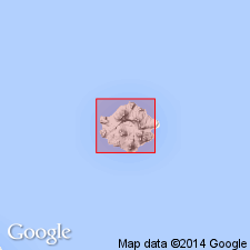
Named for exposures west and north of Pochnoi Point, Semisopochnoi Island, western Aleutian Islands, AK. Exposed chiefly in northeast, south, and southwest parts of island, outside central lowland. Apparently erupted by volcano which had approximately same dimensions as present island. Is sequence of tuff-breccia, lava, and agglomerate, and minor amounts of sandstone. Thickness in walls of caldera is 1700 ft. Underlies products of later volcanic eruption. Unit is oldest rock on island. Map legend shows age as Tertiary(?) or Quaternary which is based on relation of unit to glaciation.
Source: GNU records (USGS DDS-6; Menlo GNULEX).
For more information, please contact Nancy Stamm, Geologic Names Committee Secretary.
Asterisk (*) indicates published by U.S. Geological Survey authors.
"No current usage" (†) implies that a name has been abandoned or has fallen into disuse. Former usage and, if known, replacement name given in parentheses ( ).
Slash (/) indicates name conflicts with nomenclatural guidelines (CSN, 1933; ACSN, 1961, 1970; NACSN, 1983, 2005, 2021). May be explained within brackets ([ ]).

