

- Usage in publication:
-
- Pleasantview sandstone
- Modifications:
-
- Original reference
- Dominant lithology:
-
- Sandstone
- AAPG geologic province:
-
- Illinois basin
Summary:
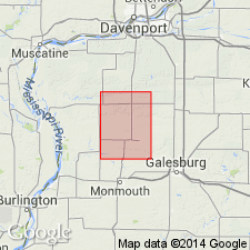
Pg. 49, 90-91, 124. Pleasantview sandstone [in Carbondale formation]. Olive-gray to blue-gray sandstone, medium-grained, very micaceous, cross-bedded. Thickness in Alexis quadrangle [Mercer County, northwestern Illinois] 0 to 50+ feet. Is here designated Pleasantview sandstone, a name proposed by Walter Searight (personal communication) for a sandstone in similar stratigraphic position along Mill Creek, near Pleasantview, Schuyler County, [Illinois]. Local distribution and marked irregularity of basal surface of this sandstone suggest it is largely a group of channel deposits. Lies 17+/- feet above Colchester (No. 2) coal or 0 to 12.5 feet above Francis Creek shale. Is probably = Vergennes sandstone of southern Illinois. [Age is Pennsylvanian.]
Source: US geologic names lexicon (USGS Bull. 896, p. 1682).
- Usage in publication:
-
- Pleasantview sandstone
- Modifications:
-
- Areal extent
- AAPG geologic province:
-
- Illinois basin
Summary:
Pleasantview sandstone [in Carbondale formation]. Overlies Purington shale and in places cuts out all underlying beds down to coal No. 2. [Age is Pennsylvanian.]
Source: US geologic names lexicon (USGS Bull. 896, p. 1682).
- Usage in publication:
-
- Pleasantview sandstone
- Modifications:
-
- Principal reference
- Dominant lithology:
-
- Sandstone
- AAPG geologic province:
-
- Illinois basin
Summary:
Pg. 50 (fig. 22), 95, 98, 190. Pleasantview sandstone of Carbondale group. Consists of two types: channel sandstone and nonchannel or sheet sandstone. Nonchannel ranges in thickness from 2 or 3 to 15 or 20 feet and is commonly very fine-grained and blue-gray or yellow-gray. Major part of channel sandstones consists of lenticular massive beds, alternating with thin shaly beds. Thickness as much as 80 feet. In some areas, channel sands rest unconformably on all beds down to Colchester (No. 2) coal. Included in Summum cyclothem, Carbondale group. Name credited to W.V. Searight (unpub. ms.). Type exposure given. [Age is Pennsylvanian.]
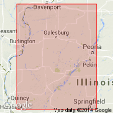
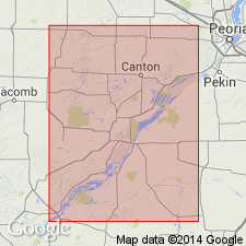
Type exposure: along Mill Creek in vicinity of Pleasantview, in sec. 36, T. 2 N., R. 1 W., and sec. 31, T. 2 N., R. 1 E., Beardstown 15-min quadrangle, Schuyler Co., central western IL.
Source: US geologic names lexicon (USGS Bull. 1200, p. 3065).

- Usage in publication:
-
- Pleasantview sandstone member
- Modifications:
-
- Revised
- AAPG geologic province:
-
- Illinois basin
Summary:
Pg. 35, 47 (table 1), 66, pl. 1. Pleasantview sandstone member of Carbondale formation. Assigned member status in Carbondale formation (redefined). Occurs above Purington shale member and below Kerton Creek coal member (new). Thickness about 18 feet. [Age is Pennsylvanian.] Presentation of new rock-stratigraphic classification of Pennsylvanian strata in Illinois. Cyclical classification is retained but is entirely independent of rock-stratigraphic classification.
Source: US geologic names lexicon (USGS Bull. 1200, p. 3065).
For more information, please contact Nancy Stamm, Geologic Names Committee Secretary.
Asterisk (*) indicates published by U.S. Geological Survey authors.
"No current usage" (†) implies that a name has been abandoned or has fallen into disuse. Former usage and, if known, replacement name given in parentheses ( ).
Slash (/) indicates name conflicts with nomenclatural guidelines (CSN, 1933; ACSN, 1961, 1970; NACSN, 1983, 2005, 2021). May be explained within brackets ([ ]).