- Usage in publication:
-
- Pleasant Mills Formation
- Modifications:
-
- Named
- Dominant lithology:
-
- Dolomite
- AAPG geologic province:
-
- Cincinnati arch
Summary:
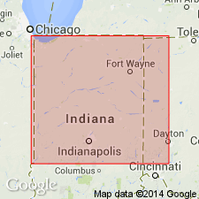
The Pleasant Mills Formation of the Salina Group, here named, includes all Silurian rocks that lie above the Salamonie Dolomite and below the Wabash Formation in central and northern IN northeast of the defined limit of the Salina Group. In the area within and south of the Fort Wayne Bank, the formation contains the Limberlost Dolomite Member, here reduced in rank, and overlying rocks formerly assigned to the Waldron and Louisville Formations, which are, in this area, interbedded and lacking typical lithologies. North of the Fort Wayne Bank the Limberlost Dolomite Member may be identified wherever an upper contact is provided by a recognizable Waldron equivalent. The formation has an arbitrary cutoff on the southeast at the Limberlost depositional limit; the Waldron and Louisville retain their formational status south of this limit. The Pleasant Mills consists of medium- to dark-brown, fine grained dolomite with nodular chert, and lighter-brown, more granular, porous dolomite. A reef facies near the Fort Wayne Bank is termed the Huntington lithofacies. Two major depositional cyclic sequences are recognized. Thickness ranges from 0 to 300 ft. Age is Middle Silurian (Niagaran).
Source: GNU records (USGS DDS-6; Reston GNULEX).

- Usage in publication:
-
- Pleasant Mills Formation
- Modifications:
-
- Revised
- AAPG geologic province:
-
- Cincinnati arch
Summary:
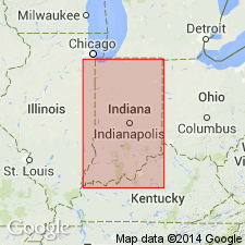
Terms Waldron and Louisville are reintroduced in this article with member status in the Pleasant Mills Formation of the Salina Group in northern IN. Therefore, the Pleasant Mills now consists of three members, including the Limberlost Dolomite Member at the base. The rocks recognized as the Louisville include the New Corydon Limestone type section of Cumings and Shrock (1928). The Pleasant Mills consists of several almost pure carbonate facies, including tan to brown micritic to fine-grained and sugary dolomite that is also color banded and faintly laminated. Oolites are common to very abundant in the lower (Limberlost) part of the unit. Approximately in the middle part of the formation is a 1- to 30-ft-thick section of gray to dark-gray fine-grained argillaceous to shaly thin-bedded dolomite (Waldron). A reef facies grades from fully mature to incipient reef rock. The Pleasant Mills extends throughout much of northern IN. Its southern and western limits coincide with the extent of the Limberlost Member. Its upper members extend beyond this limit, which is the vertical cutoff of the Pleasant Mills, and are classified as the Waldron Shale or Formation and the Louisville Limestone. The Pleasant Mills reaches a maximum thickness of 300 ft in the northeast corner of IN. The upper transitional contact with the Mississinewa Shale Member of the Wabash Formation spans up to 30 ft. Lower contact with Salamonie Dolomite is also transitional. Units corresponding generally to the Pleasant Mills include the Greenfield and Tymochtee Dolomites of western OH, and the Sugar Run and lower part of the Racine Formation in northeastern IL, among others. Brachiopods and conodonts indicate a middle Wenlockian to early Ludlovian age.
Source: GNU records (USGS DDS-6; Reston GNULEX).
For more information, please contact Nancy Stamm, Geologic Names Committee Secretary.
Asterisk (*) indicates published by U.S. Geological Survey authors.
"No current usage" (†) implies that a name has been abandoned or has fallen into disuse. Former usage and, if known, replacement name given in parentheses ( ).
Slash (/) indicates name conflicts with nomenclatural guidelines (CSN, 1933; ACSN, 1961, 1970; NACSN, 1983, 2005, 2021). May be explained within brackets ([ ]).

