- Usage in publication:
-
- Plattsmouth limestone
- Modifications:
-
- Original reference
- Dominant lithology:
-
- Limestone
Summary:
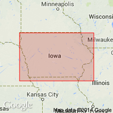
Pg. 349, 350. Limestone, 30 feet thick, underlying Platte shale and overlying Lawrence shale along Missouri River between Kansas City, Missouri, and Omaha, Nebraska.
Source: US geologic names lexicon (USGS Bull. 896, p. 1681).

- Usage in publication:
-
- Plattsmouth limestone bed
- Modifications:
-
- Revised
- AAPG geologic province:
-
- Nemaha anticline
Summary:
Plattsmouth limestone bed of Oread limestone member of Douglas formation.
For many years this limestone was believed to be same as Oread limestone, but according to G.E. Condra (Nebraska Geol. Survey Bull., 2nd ser., no. 1, p. 37, 1927) it represents only top 28 to 30 feet of Oread limestone in southeastern Nebraska, rests on Heebner shale bed of the Oread, and one of its best developments is in Weeping Water Valley, at Snyderville. Condra said: "The bed has been known by this name since the days of Meek and Hayden, but has not been closely defined, there being more or less misunderstanding regarding its relation to Oread member as a whole." Condra gave thickness in Missouri 19 to 21 feet and in Kansas 16 to 21 feet.
Source: US geologic names lexicon (USGS Bull. 896, p. 1681); GNC KS-NE Pennsylvanian Corr. Chart, sheet 1, Oct. 1936.
- Usage in publication:
-
- Plattsmouth limestone member
- Modifications:
-
- Revised
Summary:
Pg. 94, 96. Plattsmouth limestone member of Oread limestone of Shawnee group. Oread limestone divided into (descending) Kereford limestone member, Heumader shale member, Plattsmouth limestone member, Heebner shale member, Leavenworth limestone member, Snyderville shale member, and Weeping Water limestone member. Age is Late Pennsylvanian (Virgil).
Source: US geologic names lexicon (USGS Bull. 896, p. 1681); GNC KS-NE Pennsylvanian Corr. Chart, sheet 2, Oct. 1936.
- Usage in publication:
-
- Plattsmouth limestone member
- Modifications:
-
- Revised
- AAPG geologic province:
-
- Forest City basin
- Nemaha anticline
Summary:
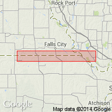
Pg. 12. Plattsmouth limestone member of Oread limestone formation of Shawnee group. Oread limestone divided into (descending) Kereford limestone, Heumader shale, Plattsmouth limestone (17 to 18 feet thick), Heebner shale, Leavenworth limestone, Snyderville shale, and Weeping Water (Toronto) limestone. Age is Late Pennsylvanian (Virgil).
Source: US geologic names lexicon (USGS Bull. 896, p. 1681); GNC KS-NE Pennsylvanian Corr. Chart, sheet 2, Oct. 1936.

- Usage in publication:
-
- Plattsmouth limestone
- Modifications:
-
- Revised
- AAPG geologic province:
-
- Nemaha anticline
Summary:
Pg. 167. Plattsmouth limestone member of Oread limestone of Shawnee group. According to my observations in July, 1934, of type Plattsmouth exposures near Plattsmouth, Nebraska, and of excellent section in Snyderville quarry, west of Nehawka, Nebraska, which is regarded by Condra as showing uppermost beds of Plattsmouth limestone that are eroded at Plattsmouth, it appears that Condra's definition of this unit includes equivalents not only of "upper" Oread limestone of Kansas, but also of Kereford limestone member of Oread, Clay Creek limestone member of Kanwaka shale, and other limestones that appear in north part of Kanwaka shale. If this is true the name Plattsmouth is not applicable to "upper" Oread limestone alone unless restricted to use in this sense. Since it was evidently Condra's intention to designate only "upper" Oread limestone member as Plattsmouth, and since the Kereford and other stratigraphic units in type Plattsmouth section can be recognized, it seems best to restrict Plattsmouth to limestone between Kereford (Heumader shale absent at Plattsmouth) and Heebner members of Oread. Age is Late Pennsylvanian (Virgil).
[See further remarks in 1936 entry under Spring Branch limestone. See also G.E. Condra and E.C. Reed, 1937, Nebraska Geol. Survey Bull. 11, 2nd ser., p. 60.]
Source: US geologic names lexicon (USGS Bull. 896, p. 1681); GNC KS-NE Pennsylvanian Corr. Chart, sheet 2, Oct. 1936.
- Usage in publication:
-
- Plattsmouth limestone member
- Modifications:
-
- Overview
Summary:
Pg. 2035. Plattsmouth limestone member of Oread formation; underlies Heumader shale member; overlies Leavenworth limestone member. This is classification agreed upon by state geological surveys of Iowa, Kansas, Missouri, Nebraska, and Oklahoma.
[See also, R.C. Moore, 1949, Kansas Geol. Survey Bull. 83, p. 126 (fig. 22), 149.]
Source: US geologic names lexicon (USGS Bull. 1200, p. 3061-3062).
- Usage in publication:
-
- Plattsmouth
- Modifications:
-
- Overview
- AAPG geologic province:
-
- Iowa shelf
Summary:
Pg. 418 (fig. 1), 419. Thickness about 5.5 feet in measured section near Winterset, Madison County; consists of blue-gray uneven beds separated by thin shales, some black chert; lower 1 foot persistent massive bed.
Source: US geologic names lexicon (USGS Bull. 1200, p. 3062).
- Usage in publication:
-
- Plattsmouth limestone member
- Modifications:
-
- Areal extent
- AAPG geologic province:
-
- Forest City basin
- Iowa shelf
Summary:
Pg. 20-21, fig. 5. Plattsmouth limestone member of Oread limestone. As exposed in quarries in Montgomery County, includes thin upper cherty limestone, thick section of shaly limestone containing abundant fusulinids, and lower unit containing less shale and fewer fusulinids. Thickness about 20 feet. In Cass County, thickness is about 13 feet and includes (descending) about 2 feet of thin-bedded limestone; 3 to 4 feet of fusulinid-bearing argillaceous limestone; 4 feet of calcareous olive shale weathering buff and containing abundant CHONETES, ECHINOCONCHUS, JURESANIA, NEOSPIRIFER, COMPOSITA, crinoid columnals, and large ramose bryozoans; and 3 feet of argillaceous to sublithographic cherty fossiliferous limestone. In Madison and Adair Counties, includes 4 feet of OSAGIA-bearing wavy-bedded sublithographic limestone, 2 to 3 feet of argillaceous shale, 3 to 4 feet of alternating dark-blue cherty limestone and platy shale, and 1.5 feet of massive limestone containing OTTONOSIA at base. Overlies Heebner shale member; underlies Heumader shale member. Age is Late Pennsylvanian (Virgilian).
Source: US geologic names lexicon (USGS Bull. 1200, p. 3062).
- Usage in publication:
-
- Plattsmouth
- Modifications:
-
- Overview
- AAPG geologic province:
-
- Forest City basin
Summary:
Pg. 41, pl. 1. Thickness about 18 feet in Douglas county where it is composed almost entirely of light-gray to nearly white wavy-bedded limestone which weathers a light gray to tan; scattered blue-gray chert nodules persistent near middle of bed.
Source: US geologic names lexicon (USGS Bull. 1200, p. 3062).
For more information, please contact Nancy Stamm, Geologic Names Committee Secretary.
Asterisk (*) indicates published by U.S. Geological Survey authors.
"No current usage" (†) implies that a name has been abandoned or has fallen into disuse. Former usage and, if known, replacement name given in parentheses ( ).
Slash (/) indicates name conflicts with nomenclatural guidelines (CSN, 1933; ACSN, 1961, 1970; NACSN, 1983, 2005, 2021). May be explained within brackets ([ ]).

