The National Geologic Map Database is migrating to a new infrastructure. We apologize for any service disruptions during this process.
|
|---|


- Usage in publication:
-
- Plainview sandstone member*
- Modifications:
-
- Named
- Dominant lithology:
-
- Sandstone
- Shale
- AAPG geologic province:
-
- Denver basin
Summary:
Named as basal member of South Platte formation of Dakota group for exposures in the cut of the Denver and Salt Lake RR through the Dakota hogback at Plainview, NE1/4 NE1/4 sec 12, T2S, R71W, Jefferson Co, CO in Denver basin. No type section designated, though a section measured at location above. Is a light gray, fine-, medium- to coarse-grained sandstone which has some cross laminated to cross-bedded units. Basal sandstone is conglomeratic. Is interbedded with dark gray to black shale which has local thin concretionary lenses of pyritic silt and gray argillaceous thin-bedded siltstone. Is 56+/-ft at measured section. Has a maximum thickness of 65 ft. Disconformably overlies Lytle formation of Dakota group. Underlies an unnamed shale and sandstone of the South Platte. Has a nonmarine phase in the south and a marine phase in the north. Correlation with other Cretaceous units in Powder River basin northeast WY, Wind River basin central WY, and Denver basin southeast WY, northeast and south-central CO shown on fig 19. Is of Early Cretaceous age.
Source: GNU records (USGS DDS-6; Denver GNULEX).
- Usage in publication:
-
- Plainview Formation
- Modifications:
-
- Revised
- AAPG geologic province:
-
- Denver basin
Summary:
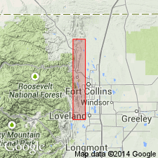
Shown on "Correlation chart" as one of four formations of Lower Cretaceous Dakota Group, as unconformably overlying Lytle Formation of Dakota and as beneath Skull Creek Shale (extended from south-central WY) into northern Front Range foothills, from Loveland to Boxelder Creek (sec 9, T10N, R69W), Larimer Co, CO in the Denver basin. [No discussion of modification of stratigraphic rank change.] Correlation chart.
Source: GNU records (USGS DDS-6; Denver GNULEX).
For more information, please contact Nancy Stamm, Geologic Names Committee Secretary.
Asterisk (*) indicates published by U.S. Geological Survey authors.
"No current usage" (†) implies that a name has been abandoned or has fallen into disuse. Former usage and, if known, replacement name given in parentheses ( ).
Slash (/) indicates name conflicts with nomenclatural guidelines (CSN, 1933; ACSN, 1961, 1970; NACSN, 1983, 2005, 2021). May be explained within brackets ([ ]).