The National Geologic Map Database is migrating to a new infrastructure. We apologize for any service disruptions during this process.
|
|---|


- Usage in publication:
-
- Pioneer shale*
- Modifications:
-
- Named
- Dominant lithology:
-
- Shale
- Quartzite
- AAPG geologic province:
-
- Southwestern Basin-and-Range region
Summary:
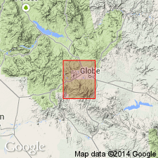
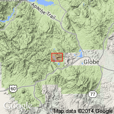
Named for old mining settlement of Pioneer just south of Globe quad, AZ in the Southwestern Basin-and-Range region. No type locality designated. Dark-reddish-brown arenaceous shales having a thickness of about 200 ft on Barnes Peak, Gila Co, AZ. Shales are more quartzose near top and occasional quartzite beds rarely more than one ft thick are intercalated with the shales. A formation of Apache group (new). Overlies Scanlan conglomerate (new) and is overlain by Barnes conglomerate (new), both of Apache group. Is assigned a Cambrian? age. Not separately distinguished on geologic map.
Source: GNU records (USGS DDS-6; Denver GNULEX).

- Usage in publication:
-
- Pioneer shale*
- Modifications:
-
- Age modified
- AAPG geologic province:
-
- Southwestern Basin-and-Range region
Summary:
Apache group [of which Pioneer is a recognized part] is accepted as of Algonkian age.
Source: GNU records (USGS DDS-6; Denver GNULEX).
- Usage in publication:
-
- Pioneer shale*
- Modifications:
-
- Areal extent
- AAPG geologic province:
-
- Southwestern Basin-and-Range region
Summary:
Extended to Little Dragoon Mountains, AZ, Southwestern Basin-and-Range region. Is Precambrian.
Source: GNU records (USGS DDS-6; Denver GNULEX).
- Usage in publication:
-
- Pioneer quartzite*
- Modifications:
-
- Redescribed
- AAPG geologic province:
-
- Southwestern Basin-and-Range region
Summary:
Shown on columnar section as Pioneer quartzite [rather than Pioneer shale] in Globe-Miami area, AZ, Southwestern Basin-and-Range region. Of Pre-Cambrian age.
Source: GNU records (USGS DDS-6; Denver GNULEX).
- Usage in publication:
-
- Pioneer formation*
- Modifications:
-
- Redescribed
- AAPG geologic province:
-
- Southwestern Basin-and-Range region
Summary:
Called Pioneer formation [rather than Pioneer shale or quartzite] in Castle Dome area, AZ, Southwestern Basin-and-Range region. Is pre-Cambrian.
Source: GNU records (USGS DDS-6; Denver GNULEX).
- Usage in publication:
-
- Pioneer formation
- Modifications:
-
- Overview
- AAPG geologic province:
-
- Southwestern Basin-and-Range region
Summary:
Rhyolite tuff and tuffaceous siltstone found in the formation at several localities indicate unknown interval of volcanic activity in Late Precambrian? of southeastern AZ, Southwestern Basin-and-Range region.
Source: GNU records (USGS DDS-6; Denver GNULEX).
- Usage in publication:
-
- Pioneer shale*
- Modifications:
-
- Areal extent
- AAPG geologic province:
-
- Southwestern Basin-and-Range region
Summary:
Extended as shale [rather than formation] to Slate and Vekol Mountains, AZ, Southwestern Basin-and-Range region. Is basal formation of Apache group. Is of late Precambrian age.
Source: GNU records (USGS DDS-6; Denver GNULEX).

- Usage in publication:
-
- Pioneer shale*
- Modifications:
-
- Overview
- AAPG geologic province:
-
- Southwestern Basin-and-Range region
Summary:
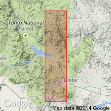
Shown in this quad, Cochise Co, AZ in Southwestern Basin-and-Range region, as co-extensive with underlying Scanlan conglomerate both of the Apache group on geologic map. Two measured sections described. At the first in SW1/4 sec 16, T15S, R22E [section is incomplete] it overlies Scanlan. At the second NE1/4 NW1/4 sec 21, T21S, R14E, it is 304 ft thick, overlies Scanlan, and underlies Barnes quartzite unconformably. Assigned to Upper Precambrian. Geologic map.
Source: GNU records (USGS DDS-6; Denver GNULEX).
- Usage in publication:
-
- Pioneer Formation*
- Modifications:
-
- Revised
- Areal extent
- AAPG geologic province:
-
- Southwestern Basin-and-Range region
Summary:
Revised to be the basal unit of the Apache Group from measured sections in the Vekol and Slate Mountains, Pinal and Pima Cos, AZ in the Southwestern Basin-and-Range region. Rank of Scanlan Conglomerate lowered to be a bed within the Pioneer Formation [1 ft thick conglomerate lens at base of Vekol Mountain section]. Unconformably overlies Precambrian granite and disconformably underlies Cambrian Bolsa? Quartzite. Is intruded by diabase sills. Absent in the Waterman Mountains. Is of younger Precambrian age.
Source: GNU records (USGS DDS-6; Denver GNULEX).
- Usage in publication:
-
- Pioneer Formation*
- Modifications:
-
- Revised
- AAPG geologic province:
-
- Southwestern Basin-and-Range region
Summary:
In the Christmas quad, AZ, Southwestern Basin-and-Range region, the basal contact is lowered to include Scanlan Conglomerate Bed [formerly considered a separate formation]. Pioneer is basal formation of Apache Group. Of Precambrian age.
Source: GNU records (USGS DDS-6; Denver GNULEX).
- Usage in publication:
-
- Pioneer Shale*
- Modifications:
-
- Overview
- AAPG geologic province:
-
- Southwestern Basin-and-Range region
Summary:
Is described as a formation of Apache Group throughout its area of occurrence. Depositional history discussed. Contains Scanlan Conglomerate Member at base, a thin unit that cannot be depicted separately even on a large-scale map. A line of lapout (fig. 4) of Pioneer Shale shown as in eastern Pinal and southwest Graham, Southwestern Basin-and-Range region. Does not extend east of these areas. Northward shown as lapping out in southern Yavapai and southwestern Navajo Cos. Detailed lithology. Is younger Precambrian.
Source: GNU records (USGS DDS-6; Denver GNULEX).
- Usage in publication:
-
- Pioneer argillite
- Modifications:
-
- Redescribed
- AAPG geologic province:
-
- Southwestern Basin-and-Range region
Summary:
Is called Pioneer argillite as well as Pioneer shale in Little Dragoon Mountains, AZ, Southwestern Basin-and-Range region.
Source: GNU records (USGS DDS-6; Denver GNULEX).
- Usage in publication:
-
- Pioneer Shale*
- Modifications:
-
- Age modified
- AAPG geologic province:
-
- Southwestern Basin-and-Range region
Summary:
Basal unit of Apache Group in Cochise Co, AZ in the Southwestern Basin-and-Range region. Age changed from late Precambrian to Precambrian Y age.
Source: GNU records (USGS DDS-6; Denver GNULEX).
For more information, please contact Nancy Stamm, Geologic Names Committee Secretary.
Asterisk (*) indicates published by U.S. Geological Survey authors.
"No current usage" (†) implies that a name has been abandoned or has fallen into disuse. Former usage and, if known, replacement name given in parentheses ( ).
Slash (/) indicates name conflicts with nomenclatural guidelines (CSN, 1933; ACSN, 1961, 1970; NACSN, 1983, 2005, 2021). May be explained within brackets ([ ]).