The National Geologic Map Database is migrating to a new infrastructure. We apologize for any service disruptions during this process.
|
|---|


- Usage in publication:
-
- Pinal schists*
- Modifications:
-
- Original reference
- Dominant lithology:
-
- Schist
- AAPG geologic province:
-
- Southwestern Basin-and-Range region
Summary:
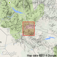
Pinal schists. Crystalline schists with occassional bands of greenish amphibolite. The oldest rocks in Globe quadrangle, Gila County, Arizona. Are broken by granite intrusions (Madera diorite and Schultze granite) into very irregular masses. Are at least in part derived from quartzose sediments. The largest single body of schistose rocks is that underlying greater part of west slope of the range. Are unconformably overlain by Apache group. Age is pre-Cambrian. Report includes geologic map.
Named from Pinal Mountains, Globe quadrangle, Gila Co., AZ. [According to GNU records (USGS DDS-6; Denver GNULEX, Sept. 12, 1986), type locality not designated.]
Source: US geologic names lexicon (USGS Bull. 896, p. 1661); supplemental information from GNU records (USGS DDS-6; Denver GNULEX).
- Usage in publication:
-
- Pinal schist*
- Modifications:
-
- Mapped 1:62.5k
- Dominant lithology:
-
- Schist
- AAPG geologic province:
-
- Southwestern Basin-and-Range region
Summary:
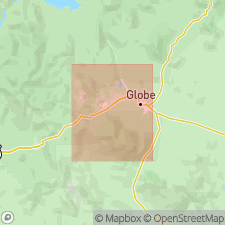
Pinal schist. Consists of quartz sericite and quartz monzonite schists. Age is pre-Cambrian.
Source: US geologic names lexicon (USGS Bull. 896, p. 1661).
- Usage in publication:
-
- Pinal schist*
- Modifications:
-
- Areal extent
- AAPG geologic province:
-
- Southwestern Basin-and-Range region
Summary:
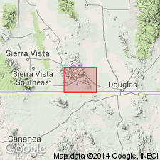
Pinal schist. Extended south of Globe area, into Mule Mountains and Escabrosa Ridge, Bisbee quadrangle, Cochise County, central Arizona. Unconformably underlies Bolsa quartzite (new, replaces Dragoon quartzite). Age is pre-Cambrian. Report includes geologic map, cross sections, columnar section.
Source: Modified from GNU records (USGS DDS-6; Denver GNULEX).

- Usage in publication:
-
- Pinal Schist*
- Modifications:
-
- Mapped 1:62.5k
- Dominant lithology:
-
- Schist
- AAPG geologic province:
-
- Southwestern Basin-and-Range region
Summary:
Pinal Schist. Light- to dark-gray or greenish schists; very fine-grained; uniform texture; imperfect cleavage; surfaces commonly have a satin-like sheen; essential constituents quartz and sericite; biotite and tourmaline rare; amphibole not observed. General character indicates the schist was at one time arkosic sands or silts. Vastly older than Cambrian. May = Vishnu schist of Grand Canyon. Thickness unknown.
Source: US geologic names lexicon (USGS Bull. 896, p. 1661).
- Usage in publication:
-
- Pinal schist*
- Modifications:
-
- Overview
- Areal extent
- AAPG geologic province:
-
- Southwestern Basin-and-Range region
Summary:
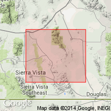
Pg. 8-9 (table), 10-11, pl. 5. Pinal schist. Described in central Cochise County, southeastern Arizona, where it is oldest formation exposed. Contains several small intrusive masses of albite granite, quartz diorite, gneissic granite, and sausuritic quartz monzonite which are also referred to the Precambrian. Base on which the Pinal was deposited not exposed in area; hence, no reliable estimate of thickness possible. Underlies Bolsa quartzite. In areas of intense metamorphism, distinguished with difficulty from metamorphosed Bisbee formation. Age is Precambrian. Report includes geologic map.
Source: US geologic names lexicon (USGS Bull. 1200, p. 3985-3986).
- Usage in publication:
-
- Pinal Schist*
- Modifications:
-
- Revised
- AAPG geologic province:
-
- Southwestern Basin-and-Range region
Summary:
Pg. 9 (chart), 10-13. Pinal Schist. Massive quartzite, and schistose graywacke, quartz-muscovite-chlorite schist, metavolcanics, and hornfels. Exposed 8.5+ sq mi in Klondyke quadrangle, Arizona; present in Santa Teresa and Turnbull Mountains, and possibly Galiuro Mountains. Intruded by Laurel Canyon Granodiorite, Santa Teresa Granite, and probably Goodwin Canyon Quartz Monzonite. Unconformably underlies Bolsa Quartzite, Buford Canyon Formation, and older alluvium. Contacts with other formations are faults. Age is possibly early Precambrian; possibly correlative with Vishnu Schist of Grand Canyon and Yavapai series of Mazatzal Mountains, Bagdad, and Jerome. Report includes petrologic description.
Source: Publication; supplemental information from GNU records (USGS DDS-6; Denver GNULEX).
- Usage in publication:
-
- Pinal Schist*
- Modifications:
-
- Age modified
- Areal extent
- AAPG geologic province:
-
- Southwestern Basin-and-Range region
Summary:
Is extended on geologic map to the Sierrita Mountains, Pima Co, AZ, Southwestern Basin-and-Range region. Age given as Precambrian X. Formerly considered early Precambrian age.
Source: GNU records (USGS DDS-6; Denver GNULEX).
- Usage in publication:
-
- Pinal Schist*
- Modifications:
-
- Revised
- AAPG geologic province:
-
- Southwestern Basin-and-Range region
Summary:
Name "Catalina gneiss" changed to Santa Catalina Group to avoid confusion with a named Precambrian unit in CA. Type area is on south side of Santa Catalina Mountains, southern outskirts of Tucson, Pima Co, AZ in Southwestern Basin-and-Range region. These rocks extend into Tortolita Mountains to northwest and Rincon Mountains to southeast. Divided into Pinal Schist of Precambrian X age, Continental Granodiorite and Wrong Mountain Quartz Monzonite of Precambrian Y age. In many areas, granitoid rocks form lit-par-lit sheets into the schist, or younger quartz monzonite into older granodiorite. Rocks have been deformed and recrystallized. Ages of foliation and lineation are unclear. May be as old as Precambrian and as young as Laramide--Late Cretaceous and Paleocene. Term therefore applied to all pre-kinematic and synkinematic rocks of the Mazatzal revolution.
Source: GNU records (USGS DDS-6; Denver GNULEX).
- Usage in publication:
-
- Pinal Schist*
- Modifications:
-
- Areal extent
- Geochronologic dating
- AAPG geologic province:
-
- Southwestern Basin-and-Range region
Summary:
Is accepted on geologic map in Chiricahua and Dos Cabezas Mountains, Cochise Co, AZ, Southwestern Basin-and-Range region. One metavolcanic rock in formation dated as 1,715 Ma old. Is Precambrian X age.
Source: GNU records (USGS DDS-6; Denver GNULEX).
- Usage in publication:
-
- Pinal Schist*
- Modifications:
-
- Revised
- Mapped 1:24k
- Dominant lithology:
-
- Phyllite
- Quartzite
- Conglomerate
- Breccia
- AAPG geologic province:
-
- Southwestern Basin-and-Range region
Summary:
Pinal Schist (restricted). Excludes Early Proterozoic amphibolite bodies previously combined with Pinal Schist; dark- to greenish-gray, amphibole-rich, foliated meta-igneous rock forming sills and irregular-shaped bodies in Pinal Schist. Divided into: phyllite facies, silver-gray phyllite, metasiltstone or metagraywacke, and some sandstone; quartzite facies, light-gray to pale-yellowish-brown metaquartzite, phyllite, hornfels, and metasiltstone; and an arkosic conglomerate and arkosic sedimentary breccia facies, brownish-gray massive rock derived from unknown older granitic terrane. Where undifferentiated, consists of mixtures of schist, phyllite, gneiss, metagraywacke, and locally some small unmapped bodies of amphibolite or other igneous rocks of intermediate composition. Age is Early Proterozoic.
Source: Publication.
For more information, please contact Nancy Stamm, Geologic Names Committee Secretary.
Asterisk (*) indicates published by U.S. Geological Survey authors.
"No current usage" (†) implies that a name has been abandoned or has fallen into disuse. Former usage and, if known, replacement name given in parentheses ( ).
Slash (/) indicates name conflicts with nomenclatural guidelines (CSN, 1933; ACSN, 1961, 1970; NACSN, 1983, 2005, 2021). May be explained within brackets ([ ]).