


- Usage in publication:
-
- Petrolia Formation
- Modifications:
-
- First used
- Dominant lithology:
-
- Mudstone
- Sandstone
- Conglomerate
- Limestone
- AAPG geologic province:
-
- Bend arch
- Palo Duro basin
- Fort Worth syncline
Summary:
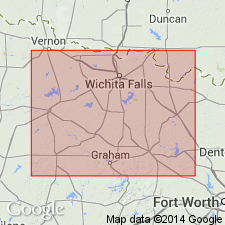
First used as a formation in middle part of Wichita Group that is mapped in vicinity of Wichita River north of Salt Fork of the Brazos River to the Red River, Baylor and Archer Cos, TX (on Bend arch) into Wichita Co, TX (in Palo Duro basin), and Clay Co, TX (on Fort Worth syncline). Areal stratigraphic cutoff of Petrolia with its equivalents--Elm Creek, Valera, and Jagger Bend Formations of Albany Group--is at the Brazos River. [Probably named for town of Petrolia in Clay Co.] No type locality designated. Overlies Nocona Formation (first used) of lower part of Wichita Group. Underlies Waggoner Ranch Formation (first used) of upper part of Wichita Group. Is 360 to 400 ft thick. Consists mostly of red-brown unstratified and crudely stratified mudstone and of: laminated and cross-bedded, fossiliferous (plants vertebrates, footprints) sandstone in lentils and channel-fill bodies; lenticular, calcareous-nodule poorly indurated, locally fossiliferous (vertebrates) conglomerate; gray, very argillaceous, locally desiccation-cracked, thin-bedded, discontinuous, sandy limestone. Assigned to Leonard Series.
Source: GNU records (USGS DDS-6; Denver GNULEX).
- Usage in publication:
-
- Petrolia Formation
- Modifications:
-
- Named
- Dominant lithology:
-
- Mudstone
- Sandstone
- Limestone
- AAPG geologic province:
-
- Bend arch
- Fort Worth syncline
- Palo Duro basin
- South Oklahoma folded belt
Summary:
Named as middle of three new formations of Wichita Group (revised); origin of name not given. Stratotype designated from base of prominent, east-facing cuesta along county road about 1.8 mi north-northwest of the intersection of Farm Rds Wichita Co, TX. Overlies Nocona Formation and underlies Waggoner Ranch Formation (both of Wichita, both named in this report). Present in eastern Baylor, northwest Archer, southern and eastern Wichita, and northern Clay Cos, Bend arch, Palo Duro basin, and Fort Worth syncline. Lower part mapped in adjacent Jefferson Co, OK in S. Oklahoma folded belt province. Comprises all continental strata that are approximately equal to Elm Creek Formation and Jagger Bend and Valera Formations (undivided) of the principally marine Albany Group. Exposure of Petrolia restricted to drainage areas of North Fork of Little Wichita, Wichita, and Red Rivers; Brazos River marks southern limit. About 360-400 ft thick. Petrolia is a transition between underlying sandstone-rich formations and overlying mudstone-dominated and limestone-bearing Waggoner Ranch. Consists of sandstones (ss1-ss10), decreasing upsection; proportionate increase in mudstone in intervening sequences. Limestone occurs only near base, in southern area. Absence of chert-pebble conglomerate and multistory sandstone configurations common to lower formations. Age is Early Permian (Wolfcampian to Leonardian). Geologic map.
Source: GNU records (USGS DDS-6; Denver GNULEX).

- Usage in publication:
-
- Petrolia Formation
- Modifications:
-
- Mapped 1:250k
- Dominant lithology:
-
- Mudstone
- Sandstone
- Conglomerate
- AAPG geologic province:
-
- Fort Worth syncline
- South Oklahoma folded belt
Summary:
Pamphlet [p. 7]. Petrolia Formation of Wichita Group. Mudstone, sandstone, and conglomerate. Mudstone, reddish-brown, locally gray and olive, massive to thick-bedded, unstratified and crudely stratified calcareous nodules common, lenses of gray and variegated claystone locally; laminated, cross-laminated, and cross-bedded sandstone in lentils and small channel-fill bodies throughout.
Sandstones (descending, ss4, ss3, ss2, and ss1, separately mapped), brown, reddish-brown, fine- to medium-grained, local chert-pebble and mud-clast conglomerate in lenses near base of units, thick-bedded to massive, soft-sediment deformation common, laminated, cross-bedded, friable to moderately well cemented by hematite, limonite, and silica, poorly exposed across a gently rolling terrain, thickness of individual members 3 to 25 feet.
Upper part of formation does not crop out within map sheet. Most of formation and underlying Pennsylvanian and Permian units (Nocona, Archer City, Markley Formations) are exposed in area depicted on adjacent Wichita Falls-Lawton sheet. Regional stratigraphic relations, lithologic characteristics, and stratotypes are discussed in Hentz (1988); a schematic illustration of the Paleozoic stratigraphy of the western Sherman sheet area is presented on the Wichita Falls-Lawton sheet [Texas Geol. Atlas, 1987]. Thickness in map area approximately 120 feet. Age is Early Permian (Leonardian).
[Mapped in northwestern corner of map sheet, in Clay Co., central northern TX, and Jefferson Co., southeastern OK. Rocks previously (1967 ed. of map) included in "Permian rocks above Graham Formation."]
Source: Publication.
For more information, please contact Nancy Stamm, Geologic Names Committee Secretary.
Asterisk (*) indicates published by U.S. Geological Survey authors.
"No current usage" (†) implies that a name has been abandoned or has fallen into disuse. Former usage and, if known, replacement name given in parentheses ( ).
Slash (/) indicates name conflicts with nomenclatural guidelines (CSN, 1933; ACSN, 1961, 1970; NACSN, 1983, 2005, 2021). May be explained within brackets ([ ]).