- Usage in publication:
-
- Perry Mountain Formation*
- Modifications:
-
- Revised
- Areal extent
- AAPG geologic province:
-
- New England province
Summary:
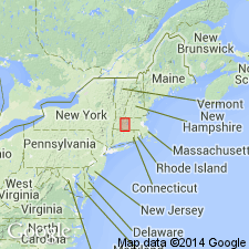
Footnotes [added just before report went to press] state that recent stratigraphic interpretations in the Monadnock and Hinsdale areas, NH, and remapping in the Mt. Grace area, MA, have shown that garnet quartzite and iron formation mapped as Littleton Formation in the Pelham-Shutesbury syncline in MA, are now assigned to the Perry Mountain Formation [here geographically extended to MA]. [This change is not reflected on MA State bedrock geologic map of Zen and others (1983).] [Papers presented as chapters in U.S. Geological Survey Professional Paper 1366 are intended as explanations and (or) revisions to MA State bedrock geologic map of Zen and others (1983) at scale of 1:250,000.]
Source: GNU records (USGS DDS-6; Reston GNULEX).
- Usage in publication:
-
- Perry Mountain Formation*
- Modifications:
-
- Age modified
- AAPG geologic province:
-
- New England province
Summary:
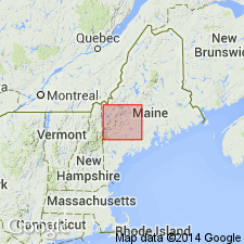
Age thought to be Wenlock. Formation unfossiliferous; gradationally overlies Rangeley Formation of Llandovery age; underlies Smalls Falls Formation of middle Wenlock to early Ludlow age. Composed of cyclically interbedded, quartz-rich sandstone or quartzite and aluminous, potassium-rich shale. About 600 m thick at type. Similar lithologically to fossiliferous Sangerville Formation.
Source: GNU records (USGS DDS-6; Reston GNULEX).
- Usage in publication:
-
- Perry Mountain Formation*
- Modifications:
-
- Revised
- Areal extent
- AAPG geologic province:
-
- New England province
Summary:
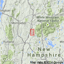
Stratigraphy differs radically from that of Hadley (1942, 1950), White and Billings (1952), in Mt. Cube and Woodsville 15-min quads, respectively, and revisions of Rumble (1942) east of Connecticut River. Fundamental difference is that Moench recognizes seven formations (plus members) that constitute Piermont allochthon. Hadley (1942) mapped all of these as Albee Formation, a name not used in this report. Rocks previously mapped as Albee are reassigned to stratigraphic equivalents of Quimby (Upper Ordovician?), Greenvale Cove (Lower Silurian), Rangeley (Lower Silurian), Perry Mountain (Silurian), Smalls Falls (Upper Silurian), Madrid (Upper Silurian?), and Littleton (Lower Devonian) Formations, whose type localities, except for Littleton, are near Rangeley, ME (Moench and Boudette, 1987). Perry Mountain Formation in Piermont allochthon, as well as in western ME, is about 600 m thick; appears to be thicker farther north in allochthon. About 60 km northeast of Piermont area, Ammonoosuc Volcanics is underlain by interbedded schist and quartzite of Upper Cambrian(?) and Lower Ordovician Dead River Formation, which is remarkably similar to Perry Mountain Formation of Piermont allochthon. Previous reports (Moench and others, 1987; Moench, 1989) incorrectly assign rocks to Dead River Formation that actually belong to Perry Mountain. Report includes geologic map and correlation chart.
Source: GNU records (USGS DDS-6; Reston GNULEX).
- Usage in publication:
-
- Perry Mountain Formation*
- Modifications:
-
- Revised
- Geochronologic dating
- Age modified
- Areal extent
- AAPG geologic province:
-
- New England province
Summary:
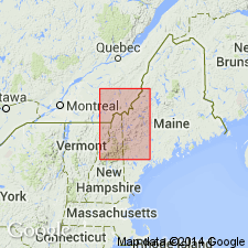
Geographically extended into VT. In Piermont-Frontenac allochthon, rocks previously mapped as part of Albee Formation in northern NH by Billings (1956) and Green (1964, 1968) and in northeastern VT by Doll and others (1961) are now assigned to Perry Mountain Formation. In Piermont sequence, divided into a quartzite and shale facies, a variably tuffaceous quartzite and shale facies, a mixed sedimentary and volcanic facies, and hematitic siltstone lenses. In western sequence of central Maine trough, consists of quartzite, schist, and slate. In eastern sequence, consists of metasandstone, phyllite, and slate in eastern part of Livermore 15-min quad. Silurian (Wenlockian and Ludlovian per time scale of Harland and others (1989)) age in Piermont sequence is based on 1) conformable position below Smalls Falls Formation, 2) field evidence that Perry Mountain Formation is a partial lateral facies of Frontenac Formation, and 3) late Ludlovian U-Pb zircon ages of 412 +/-2 Ma from metamorphosed rhyolite tuffisite, and 413 +/-4 Ma from a rhyolite bed (J.N. Aleinikoff, this report; both dates are from samples from the mixed sedimentary and volcanic facies). In central Maine trough, age is Wenlockian(?) and Ludlovian(?) based on correlation with rocks of Piermont sequence.
Source: GNU records (USGS DDS-6; Reston GNULEX).
- Usage in publication:
-
- Perry Mountain Formation*
- Modifications:
-
- Overview
- Age modified
- Geochronologic dating
- AAPG geologic province:
-
- New England province
Summary:
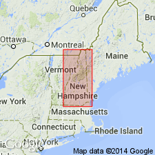
Used as Perry Mountain Formation of Early(?) and Middle(?) Silurian age. Mapped as one undivided unit and four unnamed subdivisions. Undivided part consists of sharply interbedded quartzites, light-gray nongraphitic metapelite, and "fast-graded" metaturbidites; common coticule layers. Subdivisions include a metadacite and metarhyolite unit in southern NH; a proximal bimodal volcanic facies in Piermont allochthon; a sedimentary and distal felsic and mafic volcanic facies in Piermont allochthon; and metabasalt lenses in Piermont allochthon. Mapped undivided with Rangeley Formation. Age of Early(?) and Middle(?) Silurian supported by isotope ages (sample localities shown on accompanying 1:500,000-scale map): 418 +/-4 Ma using U/Pb methods for felsic metatuff, and 418 +/-10 Ma using U/Pb methods for felsic dike from possible feeder system for the felsic metatuff (Lyons and others, 1983); and 414 +/-4 Ma for tuff bed, 412 +/-2 Ma for tuffisite sill, <430 and >410 Ma for rhyolite intrusive, all using U/Pb methods (J.N. Aleinikoff, oral commun., 1990). Report includes geologic map, cross sections, correlation chart, and four 1:500,000-scale derivative maps.
Source: GNU records (USGS DDS-6; Reston GNULEX).
For more information, please contact Nancy Stamm, Geologic Names Committee Secretary.
Asterisk (*) indicates published by U.S. Geological Survey authors.
"No current usage" (†) implies that a name has been abandoned or has fallen into disuse. Former usage and, if known, replacement name given in parentheses ( ).
Slash (/) indicates name conflicts with nomenclatural guidelines (CSN, 1933; ACSN, 1961, 1970; NACSN, 1983, 2005, 2021). May be explained within brackets ([ ]).

